- Cserhát
-
 Cserhát Mountains near the ethnographic village of Hollókő
Cserhát ([ˈtʃɛrhaːt]) is a mountain range in Hungary, part of the North Hungarian Mountains, divided between Pest and Nógrád counties. Its highest point is the Naszály with an elevation of 654 metres above sea level.
Cserhát stretches from Cserhátalja to the valley of the Ipoly (Slovak: Ipeľ) river. Its central part is mountainous, covered with forests, while its southern and northern parts are hilly.
With regard to architecture, the territory is rich in castles and Hollókő, an ethnographic village is located there.
See also
Geographical regions of Hungary 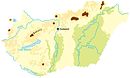 Hanság · Fertőzug · Neusiedl Basin · Rábaköz · Szigetköz · Marcali Basin · Moson Plain · Komárom-Esztergom PlainBaranya · Zala Hills · Inner Somogy · Outer Somogy · Zselic · Völgység · Szekszárd Hills · Baranya Hills · Villány Mountains
Transdanubian
MountainsKeszthely Mountains · Tapolca Basin · Balaton Uplands · Bakony · Bakonyalja · Sokoró · Vértesalja · Velence Mountains · Gerecse Mountains · Buda Mountains · Pilis Mountains · Visegrád Mountains · Vértes MountainsTransdanubian Hills North Hungarian
MountainsGreat Hungarian Plain Coordinates: 47°55′N 19°30′E / 47.917°N 19.5°E
Categories:- Mountain ranges of Hungary
- Mountain ranges of the Western Carpathians
- Hungary geography stubs

Wikimedia Foundation. 2010.