- Dunning Creek
-
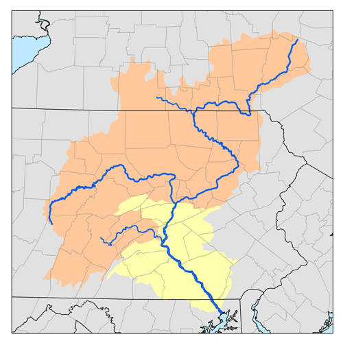
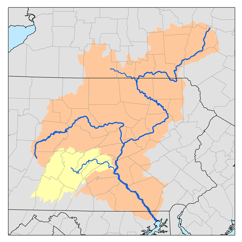
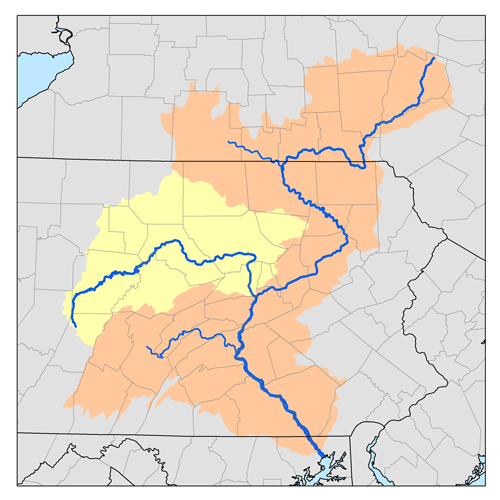
Dunning Creek is a 27.8-mile-long (44.7 km)[1] tributary of the Raystown Branch Juniata River in south west/south central Pennsylvania in the United States.
Dunning Creek joins the Raystown Branch just downstream of Bedford.
Contents
Bridges
- The Snooks Covered Bridge crosses Dunning Creek in East St. Clair Township, Pennsylvania.[2]
- The New Paris Covered Bridge crosses Dunning Creek at Napier Township, Pennsylvania.[3]
- The Dr. Knisley Covered Bridge crosses Dunning Creek at West St. Clair Township, Pennsylvania.[4]
See also
References
- ^ U.S. Geological Survey. National Hydrography Dataset high-resolution flowline data. The National Map, accessed August 8, 2011
- ^ ""National Historic Landmarks & National Register of Historic Places in Pennsylvania"" (Searchable database). CRGIS: Cultural Resources Geographic Information System. https://www.dot7.state.pa.us/ce/SelectWelcome.asp. Note: This includes Susan M. Zacher and Barbara Hufnagel (undated). "National Register of Historic Places Inventory Nomination Form: Snooks Covered Bridge" (PDF). https://www.dot7.state.pa.us/ce_imagery/phmc_scans/H050719_01H.pdf. Retrieved 2011-11-19.
- ^ ""National Historic Landmarks & National Register of Historic Places in Pennsylvania"" (Searchable database). CRGIS: Cultural Resources Geographic Information System. https://www.dot7.state.pa.us/ce/SelectWelcome.asp. Note: This includes Susan M. Zacher and Barbara Hufnagel (undated). "National Register of Historic Places Inventory Nomination Form: New Paris Covered Bridge" (PDF). https://www.dot7.state.pa.us/ce_imagery/phmc_scans/H050723_01H.pdf. Retrieved 2011-11-19.
- ^ ""National Historic Landmarks & National Register of Historic Places in Pennsylvania"" (Searchable database). CRGIS: Cultural Resources Geographic Information System. https://www.dot7.state.pa.us/ce/SelectWelcome.asp. Note: This includes Susan M. Zacher and Barbara Hufnagel (undated). "National Register of Historic Places Inventory Nomination Form: Dr. Knisley Covered Bridge" (PDF). https://www.dot7.state.pa.us/ce_imagery/phmc_scans/H050713_01H.pdf. Retrieved 2011-11-19.
- Gertler, Edward. Keystone Canoeing, Seneca Press, 2004. ISBN 0-9749692-0-6
External links
Categories:- Rivers of Pennsylvania
- Tributaries of the Susquehanna River
- Pennsylvania geography stubs


Wikimedia Foundation. 2010.