- Dourges
-
Dourges


 DourgesLocation within Nord-Pas-de-Calais region
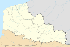 Dourges
Administration Country France Region Nord-Pas-de-Calais Department Pas-de-Calais Arrondissement Lens Canton Leforest Intercommunality Communauté d'agglomération d'Hénin-Carvin Mayor Patrick Defrancq
(2008–2014)Statistics Elevation 23–35 m (75–115 ft)
(avg. 29 m/95 ft)Land area1 10.48 km2 (4.05 sq mi) Population2 5,704 (2004) - Density 544 /km2 (1,410 /sq mi) INSEE/Postal code 62274/ 62119 1 French Land Register data, which excludes lakes, ponds, glaciers > 1 km² (0.386 sq mi or 247 acres) and river estuaries. 2 Population without double counting: residents of multiple communes (e.g., students and military personnel) only counted once. Coordinates: 50°26′13″N 2°59′15″E / 50.4369444444°N 2.9875°E
Dourges is a commune in the Pas-de-Calais department in the Nord-Pas-de-Calais region of France.
Contents
Geography
An ex-coalmining commune, now a light industrial and farming town, situated some 8 miles (12.9 km) east of Lens, at junction 17 of the A21 and the A1 autoroutes. The canalized Deule river flows through the commune.
Population
Historical population of Dourges 1962 1968 1975 1982 1990 1999 2004 5162 5746 5402 5201 5806 5676 5704 From the year 1962 on: population without double counting—residents of multiple communes (e.g. students and military personnel) are counted only once. Places of interest
- The church of St.Piat, dating from the twentieth century.
- Traces of an old castle and an ancient farm.
- The Commonwealth War Graves Commission cemetery.
See also
References
External links
- A regional website (French)
- The CWGC cemetery
- Dourges on the Quid website (French)
Categories:- Communes of Pas-de-Calais
- Pas-de-Calais geography stubs


Wikimedia Foundation. 2010.