- 9th Street (PATH station)
-
9th Street 
PlatformStation statistics Address Ninth Street and Sixth Avenue
Manhattan, New YorkCoordinates 40°44′03″N 73°59′56″W / 40.734210°N 73.998944°WCoordinates: 40°44′03″N 73°59′56″W / 40.734210°N 73.998944°W Lines PATH: HOB–33JSQ–33JSQ–33 (via HOB)Connections New York City Subway:


 at West Fourth Street – Washington Square
 New York City Bus: M5 north, M8
Platforms 1 island platform Tracks 2 Other information Opened 1908 Owned by Port Authority of New York and New Jersey Traffic Passengers (2002) 3.248 million  54%
54%Services Preceding station PATH Following station Regular service toward HobokenHOB–33 toward 33rd Streettoward Journal SquareJSQ–33 Nights and weekends toward Journal SquareJSQ–33 (via HOB) toward 33rd StreetThe 9th Street PATH station, opened on February 25, 1908, is located on Ninth Street and Sixth Avenue (Avenue of the Americas), in Manhattan's Greenwich Village neighborhood. It is served by the Journal Square-33rd Street and Hoboken-33rd Street services.
In keeping with the "style" of PATH station entrances in Manhattan, the Ninth Street entrance is in the side of a building on the east side of Sixth Avenue. Passengers travel down a number of stairwells and through a narrow curved tunnel before descending to the north end of the platform.
This underground station has two tracks and a center island platform. It is located in between the local tracks of the IND Sixth Avenue Line (which are on the opposite side of either track from the platform) and above the express tracks.
After the September 11, 2001 attacks, which resulted in the destruction of the vital World Trade Center station Ninth Street experienced serious overcrowding. While a new station near the World Trade Center has opened, the Port Authority plans to build a second entrance (pending environmental review) at this station, despite local opposition to the project.[1] Residents are concerned that the project will endanger the surrounding neighborhood's fragile historic buildings (through the vibrations that major construction would cause) and disrupt business and traffic in the Village. The effects of September 11 did not end quickly. In 2002, Ninth Street was used by an average of 8,900 people per day, about 3.248 million per annum. This was 54% higher than the 1.496 million passengers that utilized this station in 2001.
North of this station, at the curve, there are tunnel headings for a level junction with a never-built branch line that would have run to Astor Place on the IRT Lexington Avenue Line. The bellmouth for the proposed Astor Place connection north of this station runs for about 250 feet. Large portions of the ring erecting machine from the original tunnel construction is in the bellmouth for the proposed extension and the tunnel also filled with equipment.
Nearby attractions
- Jefferson Market Library
- The New School
- New York University
- Washington Square Park
References
- ^ Carucci, Lisa (December 1, 2004). "PATH plan for new Village entrance is still on track". The Villager. http://www.thevillager.com/villager_83/pahtplanfornewvillage.html. Retrieved 2009-08-16.
External links
- PATH - Ninth Street Station
- PATH's Plan For More Station Entrances in the West Village Continues from New York University's Livewire
- Ninth Street entrance from Google Maps Street View
 Street entrance
Port Authority Trans-Hudson (PATH) Services HOB–33 · HOB–WTC · JSQ–33 · JSQ–33 (via HOB) · NWK–WTC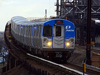
Stations 9th Street · 14th Street · 23rd Street · 33rd Street · Christopher Street · Exchange Place · Grove Street · Harrison · Hoboken · Journal Square · Newark · Newport · World Trade CenterInfrastructure Downtown Hudson Tubes · Hudson and Manhattan Railroad Powerhouse · Uptown Hudson Tubes · PATH Lift BridgeMiscellaneous Categories:- PATH stations in New York


Wikimedia Foundation. 2010.