- Cypress River, Manitoba
-
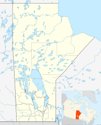
 Cypress RiverLocation of Cypress River in Manitoba
Cypress River is a community in the Rural Municipality of Victoria in the Canadian province of Manitoba. Originally, the community was known as "Littleton".
Contents
Geography
It is located along Highway 2 in south central Manitoba between Tiger Hills to the south, and the sandy hills of Spruce Woods Provincial Park to the north.
Climate
Climate data for Cypress River Month Jan Feb Mar Apr May Jun Jul Aug Sep Oct Nov Dec Year Record high °C (°F) 7.2
(45.0)12
(54)19.4
(66.9)37
(99)38
(100)40.6
(105.1)42.2
(108.0)39.4
(102.9)37.2
(99.0)33
(91)23.3
(73.9)13.3
(55.9)42.2
(108.0)Average high °C (°F) −11.6
(11.1)−7.3
(18.9)−0.4
(31.3)10.6
(51.1)19.2
(66.6)23.4
(74.1)25.8
(78.4)25.3
(77.5)18.9
(66.0)11.2
(52.2)−0.5
(31.1)−8.9
(16.0)8.8 Daily mean °C (°F) −16.9
(1.6)−12.6
(9.3)−5.6
(21.9)4.3
(39.7)12.2
(54.0)17
(63)19.2
(66.6)18.3
(64.9)12.4
(54.3)5.5
(41.9)−5
(23)−13.8
(7.2)2.9 Average low °C (°F) −22.1
(−7.8)−17.8
(0.0)−10.7
(12.7)−2.1
(28.2)5.2
(41.4)10.5
(50.9)12.6
(54.7)11.3
(52.3)6
(43)−0.2
(31.6)−9.4
(15.1)−18.7
(−1.7)−3 Record low °C (°F) −43.9
(−47.0)−43.5
(−46.3)−38.9
(−38.0)−30
(−22)−12.2
(10.0)−3.3
(26.1)−1.1
(30.0)−3.9
(25.0)−10.6
(12.9)−21.5
(−6.7)−36.7
(−34.1)−39.5
(−39.1)−43.9
(−47.0)Precipitation mm (inches) 22.7
(0.894)19.3
(0.76)21.5
(0.846)32.3
(1.272)61.5
(2.421)90.7
(3.571)83.3
(3.28)70
(2.76)49.5
(1.949)37.8
(1.488)24.7
(0.972)24.1
(0.949)537.2
(21.15)Source: Environment Canada[1] Notable People
- Scott Young, journalist, father of musician Neil Young.
- Ric Nordman, politician
References
- ^ Environment Canada - Canadian Climate Normals 1971-2000—Canadian Climate Normals 1971–2000, accessed 13 April 2011
 Subdivisions of Manitoba
Subdivisions Cities  Category:Manitoba ·
  Portal:Manitoba ·
  WikiProject:Manitoba
Coordinates: 49°33′22″N 99°27′12″W / 49.55611°N 99.45333°W
Categories:- Hamlets in Manitoba
- Victoria, Manitoba
- Manitoba geography stubs

Wikimedia Foundation. 2010.