Medway Gap

Medway Gap
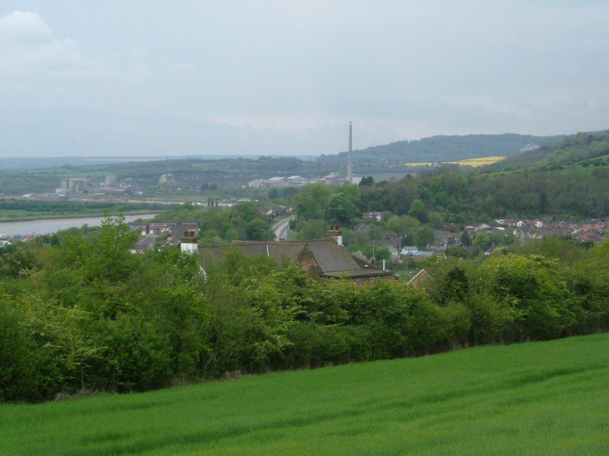
The River Medway passing through the Medway Gap. In the foreground is Cuxton with the Cement Works at Halling to the rear. The A228 is visible.
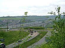
The M2 motorway, and the raillink crossing the Medway, between Cuxton and Borstal. The Nashenden valley on the other bank is typical of Kentish downland scenery.

The Medway Gap is a topographic feature in the English county of Kent near Rochester.

It was created when the prehistoric River Medway cut through line of chalk hills now known as the North Downs; other rivers such as the Darent and the Stour have similar features.

Its past significance as a means of travel is indicated by the prehistoric Medway megaliths in the area. Today a local rail route and a relatively major road (the A228) utilise the valley. The river here is bridged by the M2 motorway and High Speed 1 viaducts.

It also has the effect of creating local weather patterns, thereby frequently exhibiting opposite conditions to the surrounding countryside.

It is also a used by local government to refer to the series of small towns north west of Maidstone, within Tonbridge and Malling such as Aylesford, East Malling, Eccles, Larkfield, Leybourne, Snodland and West Malling


Wikimedia Foundation. 2010.

Игры ⚽ Нужен реферат?

Look at other dictionaries:

  • Medway — This article is about the Medway towns in England. For others, see Medway (disambiguation). Medway (Unitary Authority) Geography Status: Unitary, Borough Region …   Wikipedia

  • Medway services — The southbound services County Kent Road M2 Coordinates …   Wikipedia

  • River Medway — For similarly named rivers, see Medway River (disambiguation). Coordinates: 51°26′57″N 0°44′18″E / 51.44917°N 0.73833°E / 51.44917; 0.73833 …   Wikipedia

  • Thames and Medway Canal — The Thames and Medway Canal is a disused canal in Kent, south east England, also known as the Gravesend and Rochester Canal. It was originally some 11 km (7 miles) long and cut across the neck of the Hoo peninsula, linking the River Thames at… …   Wikipedia

  • North Downs — The North Downs near Folkestone Country England Counties Kent, Surrey …   Wikipedia

  • Tonbridge and Malling — is a local government district and borough in the English county of Kent.Tonbridge and Malling borough covers an area from the North Downs at Burham and Snodland in the north to the town of Tonbridge in the south. The River Medway flows in a… …   Wikipedia

  • Boston Post Road — Routes of the Boston Post Road The Boston Post Road was a system of mail delivery routes between New York City and Boston, Massachusetts that evolved into the first major highways in the United States. The three major alignments were the Lower… …   Wikipedia

  • Strood — This article is about the town in Kent, England. For the creek in Essex, see The Strood infobox UK place official name= Strood unitary england=Medway lieutenancy england=Kent region= South East England country=England latitude= 51.403168… …   Wikipedia

  • United Kingdom — a kingdom in NW Europe, consisting of Great Britain and Northern Ireland: formerly comprising Great Britain and Ireland 1801 1922. 58,610,182; 94,242 sq. mi. (244,100 sq. km). Cap.: London. Abbr.: U.K. Official name, United Kingdom of Great… …   Universalium

  • River Thames — Thames redirects here. For other uses, see Thames (disambiguation). Coordinates: 51°29′56″N 0°36′31″E / 51.4989°N 0.6087°E / 5 …   Wikipedia

Share the article and excerpts

Direct link
Do a right-click on the link above
and select “Copy Link”