- Old Stone Church (Lewisburg, West Virginia)
-
Old Stone Church
 Old Stone Church, November 1974
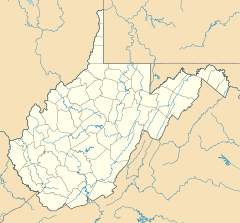

Location: Church and Foster Sts., Lewisburg, West Virginia Coordinates: 37°48′4″N 80°26′55″W / 37.80111°N 80.44861°WCoordinates: 37°48′4″N 80°26′55″W / 37.80111°N 80.44861°W Area: 2 acres (0.81 ha) Built: 1796 Architect: Unknown Architectural style: Old Virginia Governing body: Private NRHP Reference#: 72001286[1] Added to NRHP: February 23, 1972 Old Stone Church is a historic Presbyterian church located at Lewisburg, Greenbrier County, West Virginia. It was built in 1796, and is a two story, rectangular limestone building. An addition was built in 1830, making the building 75 feet by 44 feet in size. It features an open cupola belfry. During the American Civil War it served as a hospital for both Union and Confederate forces.[2]
It was listed on the National Register of Historic Places in 1976. The related Stone Manse was listed on the National Register of Historic Places in 2004.[1]
References
- ^ a b "National Register Information System". National Register of Historic Places. National Park Service. 2009-03-13. http://nrhp.focus.nps.gov/natreg/docs/All_Data.html.
- ^ C. Doyle Kester (June 1970). "National Register of Historic Places Inventory Nomination Form: Old Stone Church". State of West Virginia, West Virginia Division of Culture and History, Historic Preservation. http://www.wvculture.org/shpo/nr/pdf/greenbrier/72001286.pdf. Retrieved 2011-08-02.
External links
U.S. National Register of Historic Places in West Virginia Lists by county Barbour • Berkeley • Boone • Braxton • Brooke • Cabell • Calhoun • Clay • Doddridge • Fayette • Gilmer • Grant • Greenbrier • Hampshire • Hancock • Hardy • Harrison • Jackson • Jefferson • Kanawha • Lewis • Lincoln • Logan • Marion • Marshall • Mason • McDowell • Mercer • Mineral • Mingo • Monongalia • Monroe • Morgan • Nicholas • Ohio • Pendleton • Pleasants • Pocahontas • Preston • Putnam • Raleigh • Randolph • Ritchie • Roane • Summers • Taylor • Tucker • Tyler • Upshur • Wayne • Webster • Wetzel • Wirt • Wood • Wyoming

Other lists Categories:- Properties of religious function on the National Register of Historic Places in West Virginia
- Presbyterian churches in West Virginia
- Buildings and structures in Greenbrier County, West Virginia
- Religious buildings completed in 1796
- Stone churches in the United States
- National Register of Historic Places listings in Greenbrier County, West Virginia
- Greenbrier County, West Virginia in the American Civil War
- Stone churches in West Virginia
- West Virginia Registered Historic Place stubs


Wikimedia Foundation. 2010.