- Ensenada Municipality, Baja California
-
Ensenada Municipality
Municipio de Ensenada— Municipality — Camp on the beach NW of Punta Colonet, Baja California.

Coat of armsLocation of Ensenada in Baja California.
Country Mexico State Baja California Municipal seat Ensenada Largest city Ensenada Municipality established December 29, 1953[1] Government – Municipal president Pablo Alejo Lopez (PAN) Area – Total 52,482.4 km2 (20,263.6 sq mi) Population (2010) – Total 466,814 – Density 8.9/km2 (23/sq mi) Data source: INEGI 2010 Census Time zone PST (UTC-8) – Summer (DST) PDT (UTC-7) INEGI code 001 Website (Spanish) Ayuntamiento de Ensenada Source: Enciclopedia de los Municipios de México The municipality (Spanish: municipio) of Ensenada, with a land area of 52,482.40 km2 (20,263.57 sq mi), takes up the majority of the state of Baja California. It is the largest in Mexico by area and the Americas. It contains all of Baja California apart from a strip at the north and, at the northeast extremity of the state, the municipality of Mexicali. It is bordered by the Pacific Ocean on the west, the Sea of Cortez on the east, and by all of the other municipalities in Baja California on the North. Its municipal seat (Spanish: cabecera municipal) is Ensenada 31°51′28″N 116°36′21″W / 31.85778°N 116.60583°W, which lies near the northwest corner of the municipality, although almost all of the municipality's territory lies far to its southeast. Its current (as of 2009[update]) municipal president (Spanish: presidente municipal) is Pablo Alejo López Núñez of the PAN. A major port is planned to be built in Punta Colonet, a largely uninhabited area 80 km (50 mi) south of the city of Ensenada. Located offshore, Guadalupe Island is part of the municipality, making Ensenada the westernmost municipality of Latin America.
In 2010 the municipality had a population of 466,814 inhabitants. The 2005 census recorded 413,481 inhabitants.
Contents
Subdivisions
Ensenada municipality is administratively subdivided into 26 boroughs (Spanish: delegaciones), of which Ensenada and Chapultepec form the city of Ensenada, the municipal seat:
- La Mision - Borough seat: La Misión
- El Porvenir
- Francisco Zarco (Guadalupe)
- Real del Castillo
- El Sauzal
- Ensenada - Borough seat: Ensenada, municipal seat (Spanish: cabecera municipal)
- San Antonio de las Minas
- Chapultepec
- Maneadero (with subdelegación Esteban Cantú)
- Santo Tomás
- Erendira - Borough seat: Eréndira
- San Vicente
- Ojos Negros
- Primo Tapia
- Valle de la Trinidad
- Punta Colonet - Borough seat: Punta Colonet
- Camalu - Borough seat: Camalú
- Vicente Guerrero
- San Quintin - Borough seat: San Quintín
- El Rosario - Borough seat: El Rosario
- Puerecitos - Borough seat: Puertecitos
- El Marmol
- Punta Prieta - Borough seat: Punta Prieta
- Bahía de los Angeles
- Calmallí (Villa Jesús María)
- Isla de Cedros
Major communities
The 2010 census lists 1,709 populated places (localidades) within the municipality, but this includes solitary ranches and houses with a population of just a few or even only one person. There were 476 places that had a population of 10 or more, and 120 have a population of 100 or more. There were an additional 1,216 unpopulated localities enumerated. The largest places are, with population figures as of 2010:[2]
Name 2010 Census Population Ensenada 279,765 Rodolfo Sánchez Taboada (Maneadero) 22,957 Lázaro Cárdenas 16,294 Vicente Guerrero 11,455 El Sauzal de Rodríguez 8,832 Camalú 8,621 Benito García (El Zorrillo) 6,598 Emiliano Zapata 5,756 San Quintín 4,777 San Vicente 4,362 Colonia Lomas de San Ramón (Triquis) 3,805 Real del Castillo Nuevo (Ojos Negros) 3,533 Ejido Papalote 3,413 Lázaro Cárdenas (Valle de la Trinidad) 3,366 Ejido México (Punta Colonet) 3,278 Colonia Nueva Era 3,256 Rancho Verde 2,758 Francisco Zarco (Valle de Guadalupe) 2,664 Santa Fe 2,632 Total Municipality 466,814 See also
- Additional Information [1]
- Punta Colonet, Baja California
Notes
- ^ (Spanish) pp. 78–79, La Transformación de Baja California en Estado, 1931–1952, Lawrence Douglas Taylor Hansen, Estudios Fronterizos, 1, #1 (Jan-June 2000), UABC, Mexicali, pp. 47–87.
- ^ 2010 census tables: INEGI
References
- Ensenada: Its background, founding, and early development http://www.sandiegohistory.org/journal/84winter/ensenada.htm
- (Spanish) Link to tables of population data from Census of 2005 INEGI: Instituto Nacional de Estadística, Geografía e Informática
- (Spanish) Los Municipios con Mayor y Menor Extensión Territorial Instituto Nacional para el Federalismo y el Desarrollo Municipal
- (Spanish) Subdivisions (delegaciones)
External links
- (Spanish) Ayuntamiento de Ensenada Official government website.
- (English) Property frenzy in Baja California, Diane Lindquist, San Diego Union-Tribune, April 24, 2006. Article on planned port construction at Punta Colonet.
Articles relating to Ensenada Municipality  State of Baja California
Major cities 
Regions Baja California Desert · Baja California Gold Coast · Colorado River Delta · Sierra Juárez and San Pedro Mártir pine-oak forests
Metro areas Municipalities Ensenada · Mexicali · Rosarito Beach · Tecate · Tijuana
Major cities 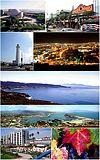
Municipalities Ensenada Municipality · Rosarito Beach Municipality · Tijuana Municipality
Metro areas Bodies of water Tijuana River · Bahia de Todos Santos
Categories:- Municipalities of Baja California
- Ensenada Municipality


Wikimedia Foundation. 2010.