D.A.R. State Forest (Minnesota)

D.A.R. State Forest (Minnesota)
D.A.R. State Forest

Geography
Location Pine County, Minnesota, United States
Elevation 1,181 ft (360 m)
Area 643 acres (2.60 km2; 1.005 sq mi)
Established 1943
Governing body Minnesota Department of Natural Resources,
Website dnr.state.mn.us/state forests/sft00015/index.html
Ecology
WWF Classification Western Great Lakes Forests
EPA Classification Northern Lakes and Forests
Map
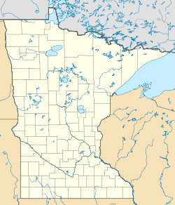
D.A.R. State Forest is located in Minnesota
{{{alt}}}
D.A.R. State Forest

The D.A.R. State Forest is a state forest located in Pine County, Minnesota. It is named after the Daughters of the American Revolution and is located east of Banning State Park. There are no facilities in the forest established for outdoor recreation activities, including hiking. Visitors are recommended to stay at nearby Banning State Park, Nemadji State Forest, or General C. C. Andrews State Forest.[1]

References

Coordinates: 46°07′23″N 92°26′44″W / 46.1230°N 92.4456°W / 46.1230; -92.4456


Wikimedia Foundation. 2010.

Игры ⚽ Нужна курсовая?

Look at other dictionaries:

  • Nemadji State Forest — Geography Location Pine and Carltoncounties, Minnesota, United States Elevation 1,306 feet (398 m …   Wikipedia

  • Cloquet Valley State Forest — Geography Location St. Louis County, Minnesota, United States Area 327,098 acres (1,323.72 km2; 511 …   Wikipedia

  • Northwest Angle State Forest — Geography Location Lake of the Woods County, Minnesota, United States Elevation 1,083 feet (330 m) …   Wikipedia

  • D.A.R. State Forest — This article is about a state forest in Massachusetts. For the state forest in Minnesota, see D.A.R. State Forest (Minnesota). The D.A.R. State Forest is a Massachusetts state forest located in near the town of Goshen in Hampshire County,… …   Wikipedia

  • Mississippi Headwaters State Forest — Geography Location Beltrami, Clearwater, and Hubbard counties, Minnesota, United States Elevation …   Wikipedia

  • Chengwatana State Forest — Geography Location Pine and Chisago counties, Minnesota, United States Area 29,039 acres (117.52&# …   Wikipedia

  • Crow Wing State Forest — Geography Location Crow Wing County, Minnesota, United States Area 31,307 acres (126.69 km2; 48.917  …   Wikipedia

  • Solana State Forest — Offroad im Solana State Forest Der Solana State Forest ist ein 275,7 km² großer Staatsforst im US Bundesstaat Minnesota. Er befindet sich im Südosten des Aitkin County und teilweise im Pine County. Das Waldgebiet ist größtenteils flach… …   Deutsch Wikipedia

  • Rice Lake State Park (Minnesota) — Geobox|Protected area name = Rice Lake State Park category = Minnesota State Park category iucn = V image caption = Rice Lake is a shallow, marsh ringed lake. country = United States country state = Minnesota state state type = State region type …   Wikipedia

  • Richard J. Dorer Memorial Hardwood State Forest — The Richard J. Dorer Memorial Hardwood State Forest is a convert|2000000|acre|km2 reserve of current and former forest in Minnesota s Driftless Area. Only a small portion of the land is state owned, with the remainder owned by private individuals …   Wikipedia

Share the article and excerpts

Direct link
Do a right-click on the link above
and select “Copy Link”