- Colquechaca Municipality
-
Colquechaca Municipality — Municipality — Location within Bolivia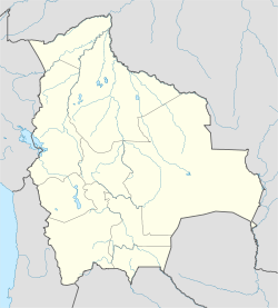
 Colquechaca Municipality
Coordinates: 18°53′S 66°5′W / 18.883°S 66.083°WCoordinates: 18°53′S 66°5′W / 18.883°S 66.083°W Country  Bolivia
Department Potosí Department Province Chayanta Province Seat Colquechaca Area - Total 712.7 sq mi (1,846 km2) Elevation 13,123 ft (4,000 m) Population (2001) - Total 31,037 - Ethnicities Quechua Time zone -4 (UTC-4) Colquechaca Municipality is the first municipal section of the Chayanta Province in the Potosí Department in Bolivia. Its seat is Colquechaca.
Qullqichaka which is the proper spelling of the compound Quechua word means "silver bridge" (qullqi: silver, money; chaka: bridge).[1]
Contents
Subdivision
The municipality consists of the following cantons:
- Ayoma
- Colquechaca
- Macha
- Rosario
- Surumi
The people
The people are predominantly indigenous citizens of Quechua descent.[2]
Ethnic group % Quechua 95.3 Aymara 0.9 Guaraní, Chiquitos, Moxos 0.0 Not indigenous 3.8 Other indigenous groups 0.0 References
- ^ Teofilo Laime Ajacopa, Bolivian Quechua dictionary (Quechua - Spanish, Spanish Quechua)
- ^ obd.descentralizacion.gov.bo/municipal/fichas/ (inactive)
External links
 Potosí DepartmentCapital: Potosí
Provinces 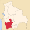
Municipalities (and seats) Acasio (Acasio) • Arampampa (Arampampa) • Atocha (Atocha) • Betanzos (Betanzos) • Caiza "D" (Caiza "D") • Ckochas (Ckochas) • Caripuyo (Caripuyo) • Chaquí (Chaquí) • Chayanta (Chayanta) • Chuquihuta (Chuquihuta) • Colcha "K" (Colcha "K") • Colquechaca (Colquechaca) • Cotagaita (Cotagaita) • Llallagua (Llallagua) • Llica (Llica) • Mojinete Municipality (Mojinete) Ocurí (Ocurí) • Pocoata (Pocoata) • Porco (Porco) • Potosí (Potosí) • Puna (Puna) • Ravelo (Ravelo) • Sacaca (Sacaca) • San Agustín (San Agustín) • San Antonio de Esmoruco (San Antonio de Esmoruco) • San Pablo de Lípez (San Pablo de Lípez) • San Pedro de Buena Vista (San Pedro de Buena Vista) • San Pedro de Quemes (San Pedro de Quemes) • Tacobamba (Tacobamba) • Tahua (Tahua) • Tinguipaya (Tinguipaya) • Tomave (Tomave) • Toro Toro (Toro Toro) • Tupiza (Tupiza) • Uncía (Uncía) • Urmiri (Urmiri) • Uyuni (Uyuni) • Villazón (Villazón) • Vitichi (Vitichi) • Yocalla (Yocalla)Categories:- Potosí Department geography stubs
- Municipalities of Potosí Department


Wikimedia Foundation. 2010.