- Ocurí Municipality
-
Ocurí Municipality — Municipality — Ocurí Location within Bolivia
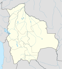
 Ocurí Municipality
Coordinates: 18°50′S 65°48′W / 18.833°S 65.8°WCoordinates: 18°50′S 65°48′W / 18.833°S 65.8°W Country  Bolivia
Department Potosí Department Province Chayanta Province Seat Ocurí Area – Total 304.2 sq mi (788 km2) Elevation 13,451 ft (4,100 m) Population (2001) – Total 18,516 – Ethnicities Quechua Time zone -4 (UTC-4) Ocurí Municipality is the fourth municipal section of the Chayanta Province in the Potosí Department in Bolivia. Its seat is Ocurí.
Contents
Subdivision
The municipality consists of the following cantons:
- Chairapata
- Maragua
- Marcoma
- Ocurí
The people
The people are predominantly indigenous citizens of Quechua descent.[1]
Ethnic group % Quechua 93.4 Aymara 0.2 Guaraní, Chiquitos, Moxos 0.2 Not indigenous 6.1 Other indigenous groups 0.1 References
- ^ obd.descentralizacion.gov.bo/municipal/fichas/ (inactive)
External links
 Potosí DepartmentCapital: Potosí
Provinces 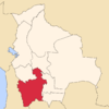
Municipalities (and seats) Acasio (Acasio) • Arampampa (Arampampa) • Atocha (Atocha) • Betanzos (Betanzos) • Caiza "D" (Caiza "D") • Ckochas (Ckochas) • Caripuyo (Caripuyo) • Chaquí (Chaquí) • Chayanta (Chayanta) • Chuquihuta (Chuquihuta) • Colcha "K" (Colcha "K") • Colquechaca (Colquechaca) • Cotagaita (Cotagaita) • Llallagua (Llallagua) • Llica (Llica) • Mojinete Municipality (Mojinete) Ocurí (Ocurí) • Pocoata (Pocoata) • Porco (Porco) • Potosí (Potosí) • Puna (Puna) • Ravelo (Ravelo) • Sacaca (Sacaca) • San Agustín (San Agustín) • San Antonio de Esmoruco (San Antonio de Esmoruco) • San Pablo de Lípez (San Pablo de Lípez) • San Pedro de Buena Vista (San Pedro de Buena Vista) • San Pedro de Quemes (San Pedro de Quemes) • Tacobamba (Tacobamba) • Tahua (Tahua) • Tinguipaya (Tinguipaya) • Tomave (Tomave) • Toro Toro (Toro Toro) • Tupiza (Tupiza) • Uncía (Uncía) • Urmiri (Urmiri) • Uyuni (Uyuni) • Villazón (Villazón) • Vitichi (Vitichi) • Yocalla (Yocalla)Categories:- Potosí Department geography stubs
- Municipalities of Potosí Department


Wikimedia Foundation. 2010.