- Minnesota State Highway 610
-
Trunk Highway 610

MN 610 highlighted in red. The unbuilt portion is represented with a dashed line.Route information Defined by MS § 161.115(264) Maintained by Mn/DOT Length: 9.828 mi[2] (15.817 km) Existed: June 2, 1975[1] – present Major junctions West end: 
 CR 81 / CR 130 in Maple Grove
 US 169 in Brooklyn Park
 MN 252 in Brooklyn Park
 MN 47 in Coon Rapids
East end:  US 10 in Blaine
Location Counties: Hennepin, Anoka Highway system Minnesota Trunk Highways
Interstate • U.S. • State
Inter-County • County roads • Legislative routes←  I-535
I-535I-694  →
→Minnesota State Highway 610 (MN 610) is an east–west freeway in the Twin Cities region of Minnesota; located in northern Hennepin County and southern Anoka County. The freeway currently connects U.S. Highway 169 (US 169) and U.S. Highway 10 (US 10). MN 610 crosses the Mississippi River on the Richard P. Braun Bridge between suburban Brooklyn Park and Coon Rapids. The highway is currently 9.828 miles (15.817 km) in length.
The freeway was authorized in 1975, and most of the currently open sections were completed by 2000 (7.197 miles, 11.582 km); the 2.631-mile (4.234 km) section westward to County Road 81 (CR 81) in Maple Grove was completed and opened in 2011. There is a segment that is planned to extend farther to end at Interstate 94 (I-94), but the Minnesota Department of Transportation (Mn/DOT) has not funded that segment.
Contents
Route description
MN 610 currently starts at its interchange with CR 81 in Maple Grove. From this starting point, the freeway runs eastbound through the northern suburbs of the Twin Cities. MN 610 is four lanes in width and has several interchanges with local streets and county roads before expanding to six lanes and meeting the northern terminus of MN 252 on the west bank of the Mississippi River. After MN 252 interchange, the MN 610 freeway turns to the northeast and crosses the Mississippi River on the dual-span, eight-lane Richard P. Braun Bridge.[3][4]
Across the river, the freeway runs along the south side of the Coon Rapids Dam Regional Park before curving around to the east. It continues through suburban Coon Rapids as a six-lane freeway to a partial interchange with northbound MN 47. This interchange is used by eastbound traffic transitioning to westbound US 10. The final section east to US 10 in Blaine is four lanes. The second interchange along this section of the freeway with University Avenue is used to connect with MN 47 southbound. The last interconnected interchange is at the eastern terminus as traffic defaults onto US 10 eastbound.[3][4]
Legally, MN 610 is defined as Route 333 in the Minnesota Statutes § 161.115(264).[5] The highway is not marked with this legislative route number along the actual highway.[3] The entire route of MN 610 has been listed on the National Highway System,[6] a system of roads important to the nation's economy, defense, and mobility.[7]
History
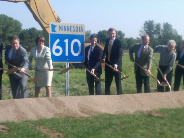
 Senators Al Franken and Amy Klobuchar with other dignitaries breaking ground on the MN 610 extension
MN 610 was first proposed in the middle of the 1960s as a "North Crosstown" freeway. Studies for the highway started in the 1970s.[8] The highway was first authorized on June 2, 1975.[1] The westbound span of the Mississippi River bridge was built in 1985,[9] and, along with the existing freeway east of MN 252, was opened in October 1987.[10] Officials in Minnesota proposed tolls as a means to fund the construction on the highway in 1989.[11] Local officials supported the highway construction, but opposed the tolling plans.[12]
West of MN 252, the freeway construction started in June 1997. The freeway was opened to traffic in 2000, with a traffic light at the intersection of MN 610 and US 169 initially.[13] Construction on the second bridge over the Mississippi River for eastbound traffic started in 1999,[14] to be completed in 2002.[13]
Construction of the portion between US 169 and CR 81 was estimated to cost $48 million in 2010, of which $27 million is being funded by federal stimulus money. The project began in October 2009, and it was scheduled to be completed in July 2011.[15] The remainder of the highway to I-94 is not on a Mn/DOT schedule to be built.[15] The new western terminus will be located at Elm Creek Boulevard in Maple Grove. The freeway continues westward from this point in the median of CR 81, but this section will be an unused stub end past the ramps that connect to CR 81[8] During the 2011 Minnesota state government shutdown, construction on MN 610 was halted for 20 days. Until work stopped on July 1, 2011, a ribbon-cutting ceremony had been scheduled to open the new freeway section on July 12.[16] The ribbon cutting ceremony was on August 17 and the road officially opened on August 19.[17]
Future
MN 610 is planned to extend west to I-94 in Maple Grove,[1] and the freeway's mile markers reflect these plans, with the zero point calibrated to this future terminus.[2] A portion of this new section is very unusual; it is routed down the middle of the median of CR 81 in Maple Grove, forming a roadway within a roadway.[8]
Going forward, there are worries about traffic after the last extension was opened in 2011. The local mayors are concerned with the traffic levels on CR 81 now that MN 610 is opened. "County Road 81" is already a fairly busy road without this additional traffic, and now there will be a substantial increase in traffic," according to Maple Grove Mayor Mark Steffenson; he is urging Mn/DOT to complete the remainder of the freeway to I-94 to alleviate these traffic concerns.[17]
Exit list
All exits are unnumbered.
County Location Mile[2] Destinations Notes Hennepin Maple Grove 0.000  I-94
I-94Future western terminus of MN 610 Maple Grove Parkway 2.486 CR 81 / CR 130 / Elm Creek BoulevardOpened on August 19, 2011;[17] current western terminus 3.579  CR 202 (Zachary Lane)
Opened on August 19, 2011[17] Brooklyn Park 5.117 US 169Interchange reconstructed in 2011; former western terminus 5.806  CR 103 (West Broadway Avenue)
6.817  CR 14 (Zane Avenue)
7.850  CR 12 (Noble Avenue)
9.584 MN 252 southNorthern terminus of MN 252 Mississippi River 9.815–
10.067Richard P. Braun Bridge Anoka Coon Rapids 10.433  CR 1 (East River Road)
Eastbound exit, westbound entrance 11.066  CR 3 (Coon Rapids Boulevard)
Eastbound exit, westbound entrance 11.747 MN 47 north to US 10 westEastbound exit, westbound entrance Blaine 11.922  CR 51 (University Avenue) to MN 47
Eastbound exit, westbound entrance 12.314 US 10 eastEastern terminus of MN 610; eastbound exit, westbound entrance 1.000 mi = 1.609 km; 1.000 km = 0.621 mi
Concurrency terminus • Closed/Former • Incomplete access • UnopenedReferences
- ^ a b c Minnesota State Legislature (June 2, 1975). "Laws of Minnesota for 1975" (PDF). Minnesota Office of the Revisor of Statutes. p. 637. https://www.revisor.mn.gov/data/revisor/law/1975/0/1975-214.pdf. Retrieved May 8, 2010.
- ^ a b c Staff (September 9, 2009). "Statewide Trunk Logpoint Listing" (PDF). Minnesota Department of Transportation. http://www.dot.state.mn.us/roadway/data/reports/logpoint/statelpt.pdf. Retrieved September 17, 2011.
- ^ a b c Minnesota Department of Transportation (2009–2010). Official State Highway Map (Map). Section V24–W25, Metropolitan Saint Paul – Minneapolis inset.
- ^ a b Google, Inc. Google Maps – Overview Map of MN 610 (Map). Cartography by Google, Inc. http://maps.google.com/maps?f=q&source=s_q&hl=en&geocode=&q=Brooklyn+Park,+MN&sll=37.0625,-95.677068&sspn=64.497063,65.654297&ie=UTF8&hq=&hnear=Brooklyn+Park,+Hennepin,+Minnesota&ll=45.129742,-93.332634&spn=0.114568,0.193634&t=h&z=13. Retrieved May 8, 2010.
- ^ Minnesota State Legislature (2009). "§ 161.115, Additional Trunk Highways". Minnesota Statutes. Minnesota Office of the Revisor of Statutes. https://www.revisor.mn.gov/statutes/?id=161.115. Retrieved May 8, 2010.
- ^ Federal Highway Administration (August 2003) (PDF). National Highway System: Minneapolis – St. Paul (Map). http://www.fhwa.dot.gov/planning/nhs/maps/mn/minneapolis_mn.pdf. Retrieved January 26, 2011.
- ^ Adderly, Kevin (August 26, 2010). "National Highway System". Federal Highway Administration. http://www.fhwa.dot.gov/planning/nhs/. Retrieved January 26, 2011.
- ^ a b c Staff (2010). "Highway 610". Minnesota Department of Transportation. Archived from the original on March 3, 2009. http://web.archive.org/web/20090303033810/http://www.dot.state.mn.us/metro/projects/610/. Retrieved May 7, 2010.
- ^ Staff (2010). "27239". National Bridge Inventory. Federal Highway Administration. http://nationalbridges.com/index.php?option=com_lqm&6ca8b06494c1f015a0e186a192dad967=1&task=showResults&query=8&lqm_id=296025&&format=raw&&Itemid=2. Retrieved May 8, 2010.
- ^ Baker, Ann (January 3, 1990). "'Missing Link' Highway Plans to be Outlined". St. Paul Pioneer Press: p. 1N.
- ^ Blake, Laurie (September 13, 1989). "Levine taking a look at tolls to pay for roads, bridges". Star Tribune (Minneapolis): p. 4B.
- ^ Ahem, Don (December 24, 1990). "Officials in Northern Suburbs Ready to Fight Toll-Road Proposal". St. Paul Pioneer Press: p. 7A.
- ^ a b Blake, Laurie (July 20, 2000). "Intersection of Hwy. 610, Hwy. 169 will have signals". Star Tribune (Minneapolis): p. 2B.
- ^ Staff (2010). "27252". National Bridge Inventory. Federal Highway Administration. http://nationalbridges.com/index.php?option=com_lqm&6ca8b06494c1f015a0e186a192dad967=1&task=showResults&query=8&lqm_id=296030&&format=raw&&Itemid=2. Retrieved May 8, 2010.
- ^ a b "Minnesota's Biggest Stimulus Road Project Moves Ahead". The Seattle Times. November 16, 2009.
- ^ Erlien, Wendy (July 22, 2011). "Work Resumes on Highway 610 in Maple Grove". Maple Grove Patch. http://maplegrove.patch.com/articles/work-resumes-on-highway-610-in-maple-grove. Retrieved August 11, 2011.
- ^ a b c d Baca, Maria Elena (August 16, 2011). "High-fives all around for another leg of Hwy. 610". Star-Tribune (Minneapolis). Archived from the original on August 19, 2011. http://www.webcitation.org/613tW2CdH. Retrieved August 19, 2011.
External links
Categories:- State highways in Minnesota
- Freeways in the United States


Wikimedia Foundation. 2010.