- Chavey Down
-
Coordinates: 51°25′06″N 0°42′33″W / 51.418246°N 0.709245°W
Chavey Down 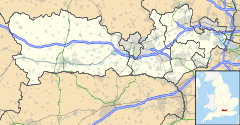
 Chavey Down
Chavey Down shown within BerkshireOS grid reference SU894698 Metropolitan borough Bracknell Forest Metropolitan county Berkshire Region South East Country England Sovereign state United Kingdom Post town Bracknell Postcode district SL5 Dialling code 01344 Police Thames Valley Fire Royal Berkshire Ambulance South Central EU Parliament South East England UK Parliament Berkshire List of places: UK • England • Berkshire Chavey Down is a hamlet in Berkshire, England, and part of the civil parish of Winkfield.
The settlement lies near to the A329 road, and is situated approximately 1 mile (1.6 km) west of Ascot Racecourse.
External links
 Media related to Chavey Down at Wikimedia Commons
Towns Civil parishes Bracknell suburbs Birch Hill · Bullbrook · Crown Wood · Easthampstead · Farley Wood · Forest Park · Great Hollands · Hanworth · Harmans Water · Home Farm · Lawrence Hill · Martins Heron · Priestwood · Quelm Park · Temple Park · Warfield Park · Whitegrove · Wick Hill · Wildridings · Wooden HillOther villages
and hamletsAmen Corner · Billingbear · Brock Hill · Brookside · Burleigh · Chavey Down · College Town · Cranbourne · Hawthorn Hill · Hayley Green · Jealott's Hill · Little Sandhurst · Maidens Green · Moss End · Newell Green · North Ascot · Nuptown · Owlsmoor · Popeswood · Swinley · Warfield Street · The Warren · West End · Winkfield Row · WoodsideCategories:- Berkshire geography stubs
- Villages in Berkshire
- Bracknell Forest

Wikimedia Foundation. 2010.