- Mais (Bowness)
-
Coordinates: 54°57′04″N 3°12′43″W / 54.951°N 3.212°W
Maia 
Village centre of Bowness-on-Solway, and site of Maia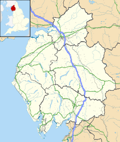
 Maia
Maia
 Maia shown within Cumbria
OS grid reference NY223626 List of places: UK • England • Cumbria Mais, or Maia, (with the modern name of Bowness-on-Solway) in Cumbria, England was a Roman fort on Hadrian's Wall, and was the last fort at the western end of the Wall.
The Notitia Dignitatum does not mention the fort at Bowness on Solway, but the Ravenna Cosmography gives the name of the fort as 'Maia', and the Rudge Cup gives the name as 'Mais'. It is thought that the fort was called 'Maia' meaning 'The Larger' because it was the second largest fort on the Wall. However there is also a possibility that the fort was named after the Greek and Roman goddess Maia.
Contents
Description
The fort stands on a sea-cliff over 50 feet (15 m) high, rising steeply from the shore, and commanding lower ground in all directions. The name 'Bowness' means 'rounded headland', indicating the good position of the fort, having commanding views of the nearby coastline. It was built over the site of the eightieth milecastle.
The fort was originally built with a turf and clay rampart, similar to the turf Wall in that area, but when the Wall was rebuilt in stone, the fort was also rebuilt in stone.
The fort is believed to have measured 710 feet (220 m) by 420 feet (130 m), covering about 7 acres (28,000 m2). It is the second largest fort on the Wall, after Stanwix (Petriana). The Wall approached the fort from the east, joining it at the north-east corner. The Wall continued on from the north-west corner, and from there it is uncertain where it went. Old inhabitants reported that, 250 yards (230 m) west of the fort a large quantity of stone was dug out of the beach. This may be an indication that the Wall was taken down to the low-tide mark, as it was at Segedunum, at the eastern end of the Wall.
Over the years the cliff face has been eroded, and the north wall of the fort collapsed into the sea long ago. The fort had three gates, east, west and south. There was no need for a north gate as the north wall was on the cliff-tops.
A civilian settlement, or vicus, existed south of the fort lining the road to Kirkbride, and this was occupied well into the fourth century.
Garrison
 Start of the Hadrian's Wall Path at Bowness.
Little is known of the garrison, but its third-century commander was a tribune, indicating that it was probably a thousand-strong (military) cohort of infantry, perhaps part-mounted.
Excavations
When the site was excavated in 1930, the southern rampart was uncovered and the west gate was located. In 1967, further excavations found the western rampart. In 1973 more extensive excavations were carried out, and traces of the original turf and clay western rampart were found, as well as evidence of a timber gate-tower.
References
- J. Collingwood Bruce, Roman Wall (1863), Harold Hill & Son, ISBN 0 90046 332 5
- Frank Graham, The Roman Wall, Comprehensive History and Guide (1979), Frank Graham, ISBN 0 85983 140 X
External links
- Maia at www.Roman-Britain.org
- iRomans Selection of objects from Maia within Tullie House Museums collection
Wall Forts (East to West) Segedunum • Pons Aelius • Condercum • Vindobala • Onnum • Cilurnum • Procolita • Vercovicium • Aesica • Magnis • Banna • Camboglanna • Uxelodunum • Aballava • Coggabata • Maia
Outpost Forts Stanegate Forts Corstopitum • Newbrough • Vindolanda • Haltwhistle Burn • Magnis • Throp • Nether Denton • Castle Hill Boothby • Brampton Old Church • LuguvaliumSupply Forts Categories:- Forts of Hadrian's Wall
- Roman forts in England
- Former populated places in England


Wikimedia Foundation. 2010.