- New Boston, New Hampshire
-
New Boston, New Hampshire — Town — Center of New Boston from a c. 1912 postcard. The building that now houses Dodge's Store is on the left.

SealLocation in Hillsborough County, New Hampshire
Coordinates: 42°58′33″N 71°41′30″W / 42.97583°N 71.69167°WCoordinates: 42°58′33″N 71°41′30″W / 42.97583°N 71.69167°W Country United States State New Hampshire County Hillsborough Incorporated 1763 Government – Board of Selectmen Christine Quirk, Chair
Rodney Towne
Dwight LovejoyArea – Total 43.2 sq mi (111.9 km2) – Land 42.8 sq mi (111.0 km2) – Water 0.4 sq mi (1.0 km2) 0.66% Elevation 420 ft (128 m) Population (2010) – Total 5,321 – Density 123.2/sq mi (47.6/km2) Time zone Eastern (UTC-5) – Summer (DST) Eastern (UTC-4) ZIP code 03070 Area code(s) 603 FIPS code 33-50740 GNIS feature ID 0873674 Website www.newbostonnh.gov New Boston is a town in Hillsborough County, New Hampshire, United States. The population was 5,321 at the 2010 census.[1] New Boston is home to the annual Hillsborough County Agricultural Fair and the Molly Stark Cannon.
Contents
History
The town was first granted in 1736 by colonial governor Jonathan Belcher of Massachusetts and New Hampshire. At the time, lands to the west of the Merrimack River, disputed between the two provinces, were treated by Belcher as part of Massachusetts, and he granted the town to several Boston families. It was to have been called Lanestown or Piscataquog Township, but by 1751 they called it New Boston after their hometown. Not all the grantees took up their claims, and the land was regranted 10 years later to settlers from Londonderry. When the town was incorporated in 1763, Governor Benning Wentworth formally recognized the long-used name of New Boston.
In 1820, the town had 25 sawmills, six grain mills, two clothing mills, two carding mills, two tanneries and a bark mill. It also had 14 schoolhouses and a tavern. The Great Village Fire of 1887, which started when a spark from a cooper's shop set a barn on fire, destroyed nearly 40 buildings in the lower village. In 1893, the railroad came to New Boston, and farm produce was sent by rail to city markets. The train line was abandoned in the mid-1970s, and the former rail bed is today a walking path.
The town is home to the 2,800-acre (1,100 ha) New Boston Air Force Station, which started as an Army Air Corps bombing range in 1942. By 1960, it had become a U.S. Air Force base for tracking military satellites. New Boston was also home to the Gravity Research Foundation from the late 1940s through the mid-1960s. Founder Roger Babson placed it in New Boston because he believed it safe from nuclear fallout should New York or Boston be attacked.
Dodge's Store, in the center of town, was established in 1872 and was owned and operated by five generations of the Dodge family until 1994. Clarence H. Dodge started the family business, and ownership remained in the Dodge family until Malcom J. Dodge sold the business in 1994 due to a downturn in the economy. The store closed on August 29, 2011, due to the owner's financial problems.[2]
Geography
According to the United States Census Bureau, the town has a total area of 43.2 square miles (112 km2), of which 42.8 square miles (111 km2) is land and 0.4 square miles (1.0 km2) is water, comprising 0.88% of the town. New Boston is drained by the South Branch Piscataquog River. Joe English Hill, elevation 1,285 feet (392 m) above sea level and the highest point in the town, is in the south.
Demographics
As of the census[3] of 2000, there were 4,138 people, 1,434 households, and 1,162 families residing in the town. The population density was 96.6 people per square mile (37.3/km²). There were 1,462 housing units at an average density of 34.1 per square mile (13.2/km²). The racial makeup of the town was 98.02% White, 0.36% African American, 0.10% Native American, 0.36% Asian, 0.31% from other races, and 0.85% from two or more races. Hispanic or Latino of any race were 0.63% of the population.
There were 1,434 households out of which 44.4% had children under the age of 18 living with them, 70.3% were married couples living together, 7.5% had a female householder with no husband present, and 18.9% were non-families. 12.4% of all households were made up of individuals and 2.6% had someone living alone who was 65 years of age or older. The average household size was 2.88 and the average family size was 3.15.
In the town the population was spread out with 30.4% under the age of 18, 4.7% from 18 to 24, 33.5% from 25 to 44, 26.4% from 45 to 64, and 5.0% who were 65 years of age or older. The median age was 36 years. For every 100 females there were 100.2 males. For every 100 females age 18 and over, there were 99.6 males.
The median income for a household in the town was $66,020, and the median income for a family was $69,458. Males had a median income of $47,173 versus $32,417 for females. The per capita income for the town was $26,488. About 3.1% of families and 4.3% of the population were below the poverty line, including 5.7% of those under age 18 and none of those age 65 or over.
-

The Tavern c. 1905
-

The Creamery c. 1912
-

Depot c. 1905
Education
New Boston is part of School Administrative Unit 19, along with Dunbarton and Goffstown. New Boston Central School provides public elementary school through grade six for town residents. Students subsequently attend Mountain View Middle School in Goffstown through eighth grade, followed by Goffstown High School.
Politics
New Boston is part of New Hampshire's 2nd congressional district,[4] represented by Republican Charles Bass. New Boston's town administrator is Peter Flynn as of September 2011.
Culture
New Boston's fairgrounds are host to several events each year, including the Hillsborough County Fair.
The town's Fourth of July celebration is one of the larger productions in the area, starting with a parade featuring an assortment of floats created by locals, marching bands, and emergency vehicles, winding through the center of town and ending at the fair grounds. The annual firing of the Molly Stark cannon also takes place.
References
- ^ United States Census Bureau, American FactFinder, 2010 Census figures. Retrieved March 23, 2011.
- ^ Cabinet.com "Town tradition comes to an end"
- ^ "American FactFinder". United States Census Bureau. http://factfinder.census.gov. Retrieved 2008-01-31.
- ^ "New Hampshire’s Representatives - Congressional District Maps (NH)". GovTrack.us. 1999-02-22. http://www.govtrack.us/congress/findyourreps.xpd?state=NH. Retrieved 2011-04-16.
External links
- Town website
- New Boston's First Settler, Thomas Smith
- Hillsborough County Agricultural Fair
- New Boston Historical Society
- New Hampshire Economic and Labor Market Information Bureau Profile
Municipalities and communities of Hillsborough County, New Hampshire Cities 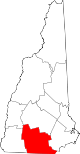
Towns Amherst | Antrim | Bedford | Bennington | Brookline | Deering | Francestown | Goffstown | Greenfield | Greenville | Hancock | Hillsborough | Hollis | Hudson | Litchfield | Lyndeborough | Mason | Merrimack | Milford | Mont Vernon | New Boston | New Ipswich | Pelham | Peterborough | Sharon | Temple | Weare | Wilton | Windsor
Villages East Merrimack | Grasmere | Pinardville
Categories:- Towns in Hillsborough County, New Hampshire
- Populated places established in 1763
-


Wikimedia Foundation. 2010.