- Dunbarton, New Hampshire
-
Dunbarton, New Hampshire — Town — Location in Merrimack County, New Hampshire
Coordinates: 43°06′09″N 71°36′59″W / 43.1025°N 71.61639°WCoordinates: 43°06′09″N 71°36′59″W / 43.1025°N 71.61639°W Country United States State New Hampshire County Merrimack Incorporated 1765 Government – Board of Selectmen Leslie Hammond, Chairman
Ronald Wanner
Chuck GraybillArea – Total 31.4 sq mi (81.2 km2) – Land 30.9 sq mi (80.0 km2) – Water 0.5 sq mi (1.2 km2) 1.50% Elevation 825 ft (251 m) Population (2010) – Total 2,758 – Density 87.8/sq mi (33.9/km2) Time zone Eastern (UTC-5) – Summer (DST) Eastern (UTC-4) ZIP code 03046 Area code(s) 603 FIPS code 33-19460 GNIS feature ID 0873583 Website www.dunbartonnh.org Dunbarton, is a town in Merrimack County, New Hampshire, United States. The population was 2,758 at the 2010 census.[1]
Contents
History
Originally granted as Gorham's-town in 1735, and re-granted as Starkstown in 1748, the town was incorporated in 1765 as Dunbarton. The name came from Dunbartonshire in Scotland, hometown to Archibald Stark, a prominent settler.
Notable inhabitants
- Robert Lowell, prominent American poet, buried in Stark Cemetery
- Robert Rogers (soldier), commander of Rogers' Rangers during the French and Indian War
Geography
According to the United States Census Bureau, the town has a total area of 31.4 square miles (81 km2), of which 30.9 sq mi (80 km2) is land and 0.5 sq mi (1.3 km2) is water, comprising 1.50% of the town. The highest point in Dunbarton is 925 feet (282 m) above sea level near NH Route 13 north of Dunbarton Center. Dunbarton lies fully within the Merrimack River watershed.[2]
Demographics
As of the census[3] of 2000, there were 2,226 people, 814 households, and 648 families residing in the town. The population density was 72.1 people per square mile (27.8/km²). There were 858 housing units at an average density of 27.8 per square mile (10.7/km²). The racial makeup of the town was 98.43% White, 0.09% African American, 0.45% Native American, 0.45% Asian, 0.04% from other races, and 0.54% from two or more races. Hispanic or Latino of any race were 0.31% of the population.
There were 814 households out of which 39.6% had children under the age of 18 living with them, 73.8% were married couples living together, 3.6% had a female householder with no husband present, and 20.3% were non-families. 14.1% of all households were made up of individuals and 3.2% had someone living alone who was 65 years of age or older. The average household size was 2.73 and the average family size was 3.03.
In the town the population was spread out with 27.5% under the age of 18, 4.0% from 18 to 24, 34.8% from 25 to 44, 26.6% from 45 to 64, and 7.1% who were 65 years of age or older. The median age was 38 years. For every 100 females there were 102.4 males. For every 100 females age 18 and over, there were 102.6 males.
The median income for a household in the town was $65,081, and the median income for a family was $67,448. Males had a median income of $46,042 versus $31,641 for females. The per capita income for the town was $27,892. About 2.3% of families and 2.8% of the population were below the poverty line, including 2.4% of those under age 18 and 4.9% of those age 65 or over.
References
- ^ United States Census Bureau, American FactFinder, 2010 Census figures. Retrieved March 23, 2011.
- ^ Foster, Debra H.; Batorfalvy, Tatianna N.; and Medalie, Laura (1995). Water Use in New Hampshire: An Activities Guide for Teachers. U.S. Department of the Interior and U.S. Geological Survey. http://nh.water.usgs.gov/Publications/nh.intro.html.
- ^ "American FactFinder". United States Census Bureau. http://factfinder.census.gov. Retrieved 2008-01-31.
External links
Municipalities and communities of Merrimack County, New Hampshire Cities 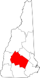
Towns Allenstown | Andover | Boscawen | Bow | Bradford | Canterbury | Chichester | Danbury | Dunbarton | Epsom | Henniker | Hill | Hooksett | Hopkinton | Loudon | New London | Newbury | Northfield | Pembroke | Pittsfield | Salisbury | Sutton | Warner | Webster | Wilmot
Villages Blodgett Landing | Contoocook | East Andover | Elkins | Penacook | South Hooksett | Suncook | Tilton-Northfield‡
Footnotes ‡This populated place also has portions in an adjacent county or counties
Categories:- Towns in Merrimack County, New Hampshire


Wikimedia Foundation. 2010.