- Ortonville, Michigan
-
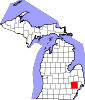
Ortonville — Village — Downtown Ortonville Location of Ortonville, Michigan
Coordinates: 42°51′08″N 83°26′35″W / 42.85222°N 83.44306°WCoordinates: 42°51′08″N 83°26′35″W / 42.85222°N 83.44306°W Country United States State Michigan County Oakland Settled 1848 Platted 1866 Incorporated (village) 1902 Government[1][2] – Type General Law Village – President Wayne Wills – President Pro-tem Kay Green Area[3] – Total 1.0 sq mi (2.6 km2) – Land 1.0 sq mi (2.6 km2) – Water 0.0 sq mi (0.0 km2) Elevation 942 ft (287 m) Population (2010)[3] – Total 1,442 – Density 1,436.4/sq mi (554.6/km2) Time zone EST (UTC-5) – Summer (DST) EDT (UTC-4) ZIP code 48462 Area code(s) 810, 248 FIPS code 26-61220[4] GNIS feature ID 0634118[5] Website http://www.ortonvillevillage.com/ Ortonville is a village in north Oakland County in the U.S. state of Michigan. The village is within Brandon Township, although some development near the village lies within adjacent Groveland Township. The population was 1,442 at the 2010 census.[6]
Contents
Overview
Ortonville, a northern rural village in Oakland County, was founded in 1848 by Amos Orton, who built a dam across Kearsley Creek to furnish water power for his sawmill. The town was platted in 1866 and incorporated as a village in 1902. It is located about halfway between Pontiac and Flint.
According to the census[4] of 2010 the population of the village of Ortonville is 1,422. The population of Brandon Township is 15,175, and nearby Groveland Township is 5,476.
Surrounding towns include Goodrich to the north, Oxford to the east, Clarkston to the south, and Holly to the west.
Public school system
Ortonville's primary public schools are Brandon Schools,[7] in Brandon Township. Students are mostly Brandon and Groveland Township residents with a few from surrounding areas of northern Clarkston and eastern Oxford. Brandon High School is the home of the Blackhawks. The athletic teams compete in the Flint Metro League.
The schools in the district are:
- Brandon High School (grades 9–12)
- Brandon Middle School (grades 7 & 8)
- Brandon Fletcher Intermediate School (grades 5 & 6)
- Oakwood Elementary (grades K–4)
- Harvey Swanson Elementary (grades K–4)
- Belle Ann Elementary (grades K–4)
- H.T. Burt Lifelong Learning Center
- Brandon Alternative High School
Demographics
As of the census[4] of 2000, there were 1,535 people, 537 households, and 400 families residing in the village. The population density was 1,546.2 per square mile (598.7/km²). There were 572 housing units at an average density of 576.2 per square mile (223.1/km²). The racial makeup of the village was 98.24% White, 0.07% African American, 0.46% Native American, 0.39% Asian, 0.46% from other races, and 0.39% from two or more races. Hispanic or Latino of any race were 1.69% of the population.
There were 537 households out of which 45.8% had children under the age of 18 living with them, 56.2% were married couples living together, 14.7% had a female householder with no husband present, and 25.5% were non-families. 22.5% of all households were made up of individuals and 7.4% had someone living alone who was 65 years of age or older. The average household size was 2.81 and the average family size was 3.29.
In the village the population was spread out with 32.4% under the age of 18, 7.3% from 18 to 24, 35.5% from 25 to 44, 17.5% from 45 to 64, and 7.3% who were 65 years of age or older. The median age was 33 years. For every 100 females there were 93.6 males. For every 100 females age 18 and over, there were 87.0 males.
The median income for a household in the village was $60,972, and the median income for a family was $72,443. Males had a median income of $59,083 versus $31,250 for females. The per capita income for the village was $24,110. About 3.3% of families and 4.8% of the population were below the poverty line, including 4.0% of those under age 18 and 5.2% of those age 65 or over.
References
- ^ Main
- ^ CITY GOVERNMENT - Ortonville Michigan
- ^ a b Area Fact Sheet for Ortonville, MI
- ^ a b c "American FactFinder". United States Census Bureau. http://factfinder.census.gov. Retrieved 2008-01-31.
- ^ U.S. Geological Survey Geographic Names Information System: Ortonville, Michigan
- ^ "Race, Hispanic or Latino, Age, and Housing Occupancy: 2010 Census Redistricting Data (Public Law 94-171) Summary File (QT-PL), Ortonville village, Michigan". U.S. Census Bureau, American FactFinder 2. http://factfinder2.census.gov. Retrieved August 19, 2011.
- ^ http://brandon.k12.mi.us Brandon School District Website
External links
Municipalities and communities of Oakland County, Michigan Cities Auburn Hills | Berkley | Birmingham | Bloomfield Hills | Clarkston | Clawson | Farmington | Farmington Hills | Fenton‡ | Ferndale | Hazel Park | Huntington Woods | Keego Harbor | Lake Angelus | Lathrup Village | Madison Heights | Northville‡ | Novi | Oak Park | Orchard Lake Village | Pleasant Ridge | Pontiac | Rochester | Rochester Hills | Royal Oak | South Lyon | Southfield | Sylvan Lake | Troy | Walled Lake | Wixom
Villages Beverly Hills | Bingham Farms | Franklin | Holly | Lake Orion | Leonard | Milford | Ortonville | Oxford | Wolverine Lake
Charter
townshipsBloomfield | Brandon | Commerce | Highland | Independence | Lyon | Milford | Oakland | Orion | Oxford | Royal Oak | Springfield | Waterford | West Bloomfield | White Lake
General law
townshipsUnincorporated
communitiesDrayton Plains | Goodison | Lakeville | Union Lake
Footnotes ‡This populated place also has portions in an adjacent county or counties
Metro Detroit Topics Architecture · Culture · Detroit River · Economy · Freeways · History · Historic places · International Riverfront · Lake St. Clair · Media · Music · Parks and beaches · People · Skyscrapers · Sports · Theatre · Tourism · Transportation
Major city Municipalities
over 80,000Canton Township · Clinton Township · Dearborn · Livonia · Sterling Heights · Troy · Warren · WestlandMunicipalities
45,000 to 80,000Dearborn Heights · Farmington Hills · Grosse Pointe · Macomb Township · Novi · Pontiac · Redford Township · Rochester Hills · Royal Oak · St. Clair Shores · Shelby Township · Southfield · Taylor · Waterford Township · West Bloomfield TownshipSatellite cities Counties in MSA Counties in CSA Regions Outlying regions Categories:- Populated places in Oakland County, Michigan
- Villages in Michigan
- Populated places established in 1848


Wikimedia Foundation. 2010.