- Cisne, Illinois
-
Cisne Village Country United States State Illinois County Wayne Coordinates 38°30′52″N 88°26′9″W / 38.51444°N 88.43583°W Area 0.6 sq mi (2 km2) - land 0.6 sq mi (2 km2) Population 673 (2000) Density 1,054.8 / sq mi (407 / km2) Timezone CST (UTC-6) - summer (DST) CDT (UTC-5) Postal code 62823 Area code 618 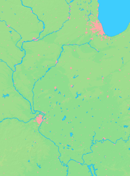

 Location of Cisne within Illinois
Wikimedia Commons: Cisne, Illinois Cisne is a village in Wayne County, Illinois, United States. The population was 673 at the 2000 census. Cisne was named in 1870 in honor of Levi Cisne on the suggestion of Charles A. Beecher, who was influential in building the railroad and the station around which the village of Cisne grew. Sources: The Story of Cisne by L.S. Harrington; and The House of Cisne, by J. C. Lappin, Wayne County Historical Society Scrapbook, Wayne County Press, Fairfield Illinois, October 3, 1955.
Contents
Geography
Cisne is located at 38°30′52″N 88°26′9″W / 38.51444°N 88.43583°W (38.514492, -88.435932).[1]
According to the United States Census Bureau, the village has a total area of 0.6 square miles (1.6 km2), all of it land.
Demographics
As of the census[2] of 2000, there were 673 people, 291 households, and 185 families residing in the village. The population density was 1,054.8 people per square mile (406.0/km²). There were 325 housing units at an average density of 509.4 per square mile (196.1/km²). The racial makeup of the village was 98.81% White, 0.30% African American, 0.30% Asian, and 0.59% from two or more races. Hispanic or Latino of any race were 0.59% of the population.
There were 291 households out of which 26.5% had children under the age of 18 living with them, 51.5% were married couples living together, 9.3% had a female householder with no husband present, and 36.4% were non-families. 34.0% of all households were made up of individuals and 22.7% had someone living alone who was 65 years of age or older. The average household size was 2.22 and the average family size was 2.78.
In the village the population was spread out with 21.8% under the age of 18, 9.8% from 18 to 24, 22.6% from 25 to 44, 18.3% from 45 to 64, and 27.5% who were 65 years of age or older. The median age was 42 years. For every 100 females there were 83.9 males. For every 100 females age 18 and over, there were 76.5 males.
The median income for a household in the village was $26,172, and the median income for a family was $34,286. Males had a median income of $26,635 versus $25,234 for females. The per capita income for the village was $14,044. About 12.4% of families and 15.5% of the population were below the poverty line, including 13.5% of those under age 18 and 22.4% of those age 65 or over.
References
- ^ "US Gazetteer files: 2010, 2000, and 1990". United States Census Bureau. 2011-02-12. http://www.census.gov/geo/www/gazetteer/gazette.html. Retrieved 2011-04-23.
- ^ "American FactFinder". United States Census Bureau. http://factfinder.census.gov. Retrieved 2008-01-31.
External links
Municipalities and communities of Wayne County, Illinois County seat: Fairfield Cities 
Villages Cisne | Golden Gate | Jeffersonville | Johnsonville | Keenes | Mill Shoals‡ | Mount Erie | Sims | Wayne City
Townships Unincorporated
communitiesFootnotes ‡This populated place also has portions in an adjacent county or counties
Categories:- Villages in Illinois
- Populated places in Wayne County, Illinois


Wikimedia Foundation. 2010.