- Mountain Ranch, California
-
Mountain Ranch — census-designated place — Location in Calaveras County and the state of California
Coordinates: 38°13′42″N 120°32′27″W / 38.22833°N 120.54083°WCoordinates: 38°13′42″N 120°32′27″W / 38.22833°N 120.54083°W Country  United States
State  California
County Calaveras Area[1] – Total 41.244 sq mi (106.822 km2) – Land 41.188 sq mi (106.677 km2) – Water 0.056 sq mi (0.145 km2) 0.14% Elevation 2,136 ft (651 m) Population (2010) – Total 1,628 – Density 37.7/sq mi (14.6/km2) Time zone Pacific (PST) (UTC-8) – Summer (DST) PDT (UTC-7) ZIP code 95246 Area code(s) 209 FIPS code 06-49628 GNIS feature ID 0229196 Reference #: 282 Mountain Ranch (formerly, El Dorado and El Dorado Town) is a census-designated place (CDP) in Calaveras County, California, United States. The population was 1,628 at the 2010 census, up from 1,557 at the 2000 census. The town is registered as California Historical Landmark #282. The town center is quite small with fewer than 50 people living in it, the 5 mile square area surround the town accounts for the balance of the population.
Contents
History
Mountain Ranch's post office was established in 1858.[2] In 1868, it was moved to another town called El Dorado Camp 1.5 miles south, as there was already an El Dorado post office in CA, El Dorado Camp became known as Mountain Ranch. Currently, there are 3 post office buildings in the town. The present one, a small post office which was built in 1956, and a post office built in 1923 which was once billed as the worlds smallest post office. The original location of the town of Mountain Ranch also has a historical landmark. The bell on the historical marker was used in the local school from 1885 to 1953. Established as Cave City School District in 1855, this school joined with the Banner District in 1946 to become the El Dorado Union Elementary School District.
Geography
According to the United States Census Bureau, the CDP has a total area of 41.2 square miles (107 km2), of which 99.86% is land, and 0.14% is water.
Demographics
2010
The 2010 United States Census[3] reported that Mountain Ranch had a population of 1,628. The population density was 39.5 people per square mile (15.2/km²). The racial makeup of Mountain Ranch was 1,472 (90.4%) White, 15 (0.9%) African American, 33 (2.0%) Native American, 18 (1.1%) Asian, 2 (0.1%) Pacific Islander, 15 (0.9%) from other races, and 73 (4.5%) from two or more races. Hispanic or Latino of any race were 123 persons (7.6%).
The Census reported that 1,628 people (100% of the population) lived in households, 0 (0%) lived in non-institutionalized group quarters, and 0 (0%) were institutionalized.
There were 748 households, out of which 113 (15.1%) had children under the age of 18 living in them, 410 (54.8%) were opposite-sex married couples living together, 53 (7.1%) had a female householder with no husband present, 23 (3.1%) had a male householder with no wife present. There were 50 (6.7%) unmarried opposite-sex partnerships, and 5 (0.7%) same-sex married couples or partnerships. 211 households (28.2%) were made up of individuals and 89 (11.9%) had someone living alone who was 65 years of age or older. The average household size was 2.18. There were 486 families (65.0% of all households); the average family size was 2.60.
The population was spread out with 213 people (13.1%) under the age of 18, 86 people (5.3%) aged 18 to 24, 201 people (12.3%) aged 25 to 44, 712 people (43.7%) aged 45 to 64, and 416 people (25.6%) who were 65 years of age or older. The median age was 55.3 years. For every 100 females there were 105.8 males. For every 100 females age 18 and over, there were 106.3 males.
There were 960 housing units at an average density of 23.3 per square mile (9.0/km²), of which 620 (82.9%) were owner-occupied, and 128 (17.1%) were occupied by renters. The homeowner vacancy rate was 2.8%; the rental vacancy rate was 9.8%. 1,352 people (83.0% of the population) lived in owner-occupied housing units and 276 people (17.0%) lived in rental housing units.
2000
As of the census[4] of 2000, there were 1,557 people, 656 households, and 474 families residing in the CDP. The population density was 37.8 people per square mile (14.6/km²). There were 816 housing units at an average density of 19.8 per square mile (7.6/km²). The racial makeup of the CDP was 90.30% White, 1.41% Black or African American, 1.73% Native American, 0.83% Asian, 0.58% from other races, and 5.14% from two or more races. 5.07% of the population were Hispanic or Latino of any race.
There were 656 households out of which 19.7% had children under the age of 18 living with them, 64.6% were married couples living together, 5.3% had a female householder with no husband present, and 27.7% were non-families. 21.8% of all households were made up of individuals and 7.6% had someone living alone who was 65 years of age or older. The average household size was 2.37 and the average family size was 2.76.
In the CDP the population was spread out with 18.7% under the age of 18, 3.8% from 18 to 24, 18.9% from 25 to 44, 38.3% from 45 to 64, and 20.4% who were 65 years of age or older. The median age was 50 years. For every 100 females there were 103.3 males. For every 100 females age 18 and over, there were 100.3 males.
The median income for a household in the CDP was $38,311, and the median income for a family was $39,324. Males had a median income of $33,864 versus $33,289 for females. The per capita income for the CDP was $19,594. About 10.0% of families and 13.5% of the population were below the poverty line, including 9.7% of those under age 18 and 2.1% of those age 65 or over.
Politics
In the state legislature Mountain Ranch is located in the 1st Senate District, represented by Republican Dave Cox, and in the 25th Assembly District, represented by Republican Kristin Olsen. Federally, Mountain Ranch is located in California's 3rd congressional district, which has a Cook PVI of R +7[5] and is represented by Republican Dan Lungren.
Notable Natives
References
- ^ U.S. Census
- ^ Durham, David L. (1998). California's Geographic Names: A Gazetteer of Historic and Modern Names of the State. Quill Driver Books. p. 806. ISBN 9781884995149.
- ^ All data are derived from the United States Census Bureau reports from the 2010 United States Census, and are accessible on-line here. The data on unmarried partnerships and same-sex married couples are from the Census report DEC_10_SF1_PCT15. All other housing and population data are from Census report DEC_10_DP_DPDP1. Both reports are viewable online or downloadable in a zip file containing a comma-delimited data file. The area data, from which densities are calculated, are available on-line here. Percentage totals may not add to 100% due to rounding. The Census Bureau defines families as a household containing one or more people related to the householder by birth, opposite-sex marriage, or adoption. People living in group quarters are tabulated by the Census Bureau as neither owners nor renters. For further details, see the text files accompanying the data files containing the Census reports mentioned above.
- ^ "American FactFinder". United States Census Bureau. http://factfinder.census.gov. Retrieved 2008-01-31.
- ^ "Will Gerrymandered Districts Stem the Wave of Voter Unrest?". Campaign Legal Center Blog. http://www.clcblog.org/blog_item-85.html. Retrieved 2007-10-20.
Municipalities and communities of Calaveras County, California City 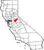
CDPs Arnold | Avery | Copperopolis | Dorrington | Forest Meadows | Mokelumne Hill | Mountain Ranch | Murphys | Rail Road Flat | Rancho Calaveras | San Andreas | Vallecito | Valley Springs | Wallace | West Point
Unincorporated
communitiesAlabama Hill | Big Bar | Big Meadow | Big Trees | Big Trees Village | Big Valley | Blue Lake Junction | Blue Lake Springs | Bummerville | Burson | Calaveritas | Camp Connell | Camp Pardee | Campo Seco | Canyon View | Carmen City | Cave City | Cedar Vista | Copper Cove Subdivision | Copper Cove Village | Cottage Springs | Douds Landing | Douglas Flat | Ebbetts Pass Highlands | Felix | Fisher Place | Fly-In Acres | Fort Jones | Fourth Crossing | Fuchs | Ganns | Glencoe | Goodmans Corner | Grizzly Ridge | Hams | Hanford Hill | Happy Valley | Hathaway Pines | Hathaways Mountain Pines | Independence | Indian Creek | Indian Hills | Jenny Lind | Jesus Maria | La Honda Park | Lake Camanche Ranches | Lakemont Pines | Lakeside Terrace | Lilac Park | Lombardi | Lost City | Lynn Park Acres | Manuel Mill | McKay | Meadowmont | Milton | Mother Lode Acres | Mountain Ranch Subdivision | Mountain Retreat | Mumbert Acres | Oak Grove | Oak Park Estates | Paloma | Pinebrook | Ponderosa Park | Porter | Quail Oaks | Red Apple | Rich Gulch | Rocky Hill | Sandoz | Sandy Gulch | Scenic Valley Ranchos | Sheep Ranch | Sherman Acres | Skyhigh | Snowshoe Springs | South Camanche Shore | Sunset Point | Tamarack | Tamarack Springs | Telegraph City | The Shores of Poker Flat | Timber Trails | Toyanza Subdivision | Toyon | White Pines | Wilseyville | Wyldewood
Former
settlementsAltaville | Antelope House | Balaklava Hill | Blue Mountain | Brownsville | Buckeye Hill | Camanche | Camp Spirito | Carson Hill | Chichi | El Dorado Bar | Fremont Valley | Greasertown | Hodson | Independence Flat | Lower Calaveritas | Mammoth Cave | McLeans Bar | McLeans Ferry | Melones | Mill Valley | North American House | Norval | Oregon Bar | Pattees Ranch | Poverty Bar | Sandy Bar | Spanish Bar | Stony Bar | Stoutenburg | Taylors Bar | Tremont House | Yaqui Camp
Categories:- Census-designated places in Calaveras County, California
- California Historical Landmarks


Wikimedia Foundation. 2010.