- Dot Lake, Alaska
-
Dot Lake, Alaska — CDP — Location of Dot Lake, Alaska
Coordinates: 63°39′31″N 144°3′57″W / 63.65861°N 144.06583°WCoordinates: 63°39′31″N 144°3′57″W / 63.65861°N 144.06583°W Country United States State Alaska Census Area Southeast Fairbanks Area – Total 279.1 sq mi (722.9 km2) – Land 278 sq mi (720.1 km2) – Water 1.1 sq mi (2.8 km2) Population (2000) – Total 19 Time zone Alaska (AKST) (UTC-9) – Summer (DST) AKDT (UTC-8) Area code(s) 907 FIPS code 02-19720 Dot Lake is a census-designated place (CDP) in Southeast Fairbanks Census Area, Alaska, United States. It is located on the Alaska Highway between Delta Junction and Tok. The population was 19 at the 2000 census.
Contents
Geography
Dot Lake is located at 63°39′31″N 144°3′57″W / 63.65861°N 144.06583°W (63.658742, -144.065816)[1].
According to the United States Census Bureau, the CDP has a total area of 279.1 square miles (723 km2), of which, 278.0 square miles (720 km2) of it is land and 1.1 square miles (2.8 km2) of it (0.38%) is water.
Demographics
As of the census[2] of 2000, there were 19 people, 10 households, and 6 families residing in the CDP. The population density was 0.1 people per square mile (0.0/km²). There were 19 housing units at an average density of 0.1/sq mi (0.0/km²). The racial makeup of the CDP was 84.21% White, and 15.79% from two or more races.
There were 10 households out of which 20.0% had children under the age of 18 living with them, 50.0% were married couples living together, 10.0% had a female householder with no husband present, and 40.0% were non-families. 40.0% of all households were made up of individuals and 20.0% had someone living alone who was 65 years of age or older. The average household size was 1.90 and the average family size was 2.50.
In the CDP the population was spread out with 15.8% under the age of 18, 5.3% from 18 to 24, 26.3% from 25 to 44, 42.1% from 45 to 64, and 10.5% who were 65 years of age or older. The median age was 46 years. For every 100 females there were 90.0 males. For every 100 females age 18 and over, there were 77.8 males.
The median income for a household in the CDP was $13,750, and the median income for a family was $62,500. Males had a median income of $46,250 versus $0 for females. The per capita income for the CDP was $19,406. There were no families and 5.6% of the population living below the poverty line, including no under eighteens and 33.3% of those over 64.
Education
Dot Lake is part of the Alaska Gateway School District. Dot Lake School, a K-12 campus, serves community students.
References
- ^ "US Gazetteer files: 2010, 2000, and 1990". United States Census Bureau. 2011-02-12. http://www.census.gov/geo/www/gazetteer/gazette.html. Retrieved 2011-04-23.
- ^ "American FactFinder". United States Census Bureau. http://factfinder.census.gov. Retrieved 2008-01-31.
Municipalities and communities of Southeast Fairbanks Census Area, Alaska Cities 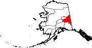
CDPs Alcan Border | Big Delta | Chicken | Deltana | Dot Lake | Dot Lake Village | Dry Creek | Eagle Village | Fort Greely | Healy Lake | Northway | Northway Junction | Northway Village | Tanacross | Tetlin | Tok
Unincorporated
communitiesCategories:- Census-designated places in Alaska
- Populated places in Southeast Fairbanks Census Area, Alaska


Wikimedia Foundation. 2010.