- Mignon, Alabama
-
Mignon, Alabama — CDP — The Avondale Mills in Mignon Location in Talladega County and the state of Alabama
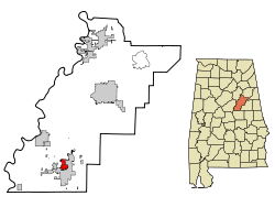
Coordinates: 33°10′58″N 86°15′52″W / 33.18278°N 86.26444°W Country United States State Alabama County Talladega Area – Total 2.8 sq mi (7.4 km2) – Land 2.8 sq mi (7.3 km2) – Water 0 sq mi (0.1 km2) Elevation 522 ft (159 m) Population (2000) – Total 1,348 – Density 481.4/sq mi (182.2/km2) Time zone Central (CST) (UTC-6) – Summer (DST) CDT (UTC-5) FIPS code 01-48616 GNIS feature ID 0144902 Mignon is a census-designated place (CDP) in Talladega County, Alabama, United States. At the 2000 census the population was 1,348.
Geography
Mignon is located at 33°10′59″N 86°15′52″W / 33.18306°N 86.26444°W (33.182929, -86.264456)[1].
According to the U.S. Census Bureau, the CDP has a total area of 2.8 square miles (7.3 km2), of which, 2.8 square miles (7.3 km2) of it is land and 0.04 square miles (0.10 km2) of it (0.71%) is water.
Demographics
As of the census[2] of 2000, there were 1,348 people, 550 households, and 365 families residing in the CDP. The population density was 480.4 people per square mile (185.2/km²). There were 640 housing units at an average density of 228.1 per square mile (87.9/km²). The racial makeup of the CDP was 76.19% White, 22.11% Black or African American, 0.52% Native American, 0.15% Asian, and 1.04% from two or more races. 0.52% of the population were Hispanic or Latino of any race.
There were 550 households out of which 28.7% had children under the age of 18 living with them, 44.5% were married couples living together, 16.5% had a female householder with no husband present, and 33.5% were non-families. 30.2% of all households were made up of individuals and 14.5% had someone living alone who was 65 years of age or older. The average household size was 2.45 and the average family size was 3.02.
In the CDP the population was spread out with 24.7% under the age of 18, 8.8% from 18 to 24, 28.6% from 25 to 44, 22.7% from 45 to 64, and 15.3% who were 65 years of age or older. The median age was 38 years. For every 100 females there were 94.2 males. For every 100 females age 18 and over, there were 88.7 males.
The median income for a household in the CDP was $21,019, and the median income for a family was $27,589. Males had a median income of $28,352 versus $19,375 for females. The per capita income for the CDP was $11,675. About 28.1% of families and 28.1% of the population were below the poverty line, including 48.1% of those under age 18 and 12.3% of those age 65 or over.
References
- ^ "US Gazetteer files: 2010, 2000, and 1990". United States Census Bureau. 2011-02-12. http://www.census.gov/geo/www/gazetteer/gazette.html. Retrieved 2011-04-23.
- ^ "American FactFinder". United States Census Bureau. http://factfinder.census.gov. Retrieved 2008-01-31.
Coordinates: 33°10′59″N 86°15′52″W / 33.182929°N 86.264456°W
Municipalities and communities of Talladega County, Alabama Cities Childersburg | Lincoln | Oxford‡ | Sylacauga | Talladega

Towns CDPs Mignon
Unincorporated
communitiesAlpine | Hopeful
Ghost town Footnotes ‡This populated place also has portions in an adjacent county or counties
Categories:- Populated places in Talladega County, Alabama
- Census-designated places in Alabama


Wikimedia Foundation. 2010.