- Maryland Route 214
-
Maryland Route 214
Central Avenue 
Route information Maintained by MDSHA Length: 24.97 mi[1][2] (40.19 km) Major junctions West end: East Capitol Street at Washington, D.C. line 
 I-95 / I-495
 MD 202
 US 301
 MD 424
 MD 2
MD 2 MD 253
East end: Chesapeake Drive in Beverly Beach Highway system Maryland highway system
Interstate • US • State • Minor • Former • Turnpikes←  MD 213
MD 216  →
→Maryland Route 214 (Central Avenue in Prince George's County and most of Anne Arundel County) is an east–west state highway that runs through Prince George's County and Anne Arundel County within the U.S. state of Maryland. Central Avenue runs along the center of Prince George's County and divides it into north and south. Points of interest near Route 214 are Watkins Regional Park, Six Flags America amusement park, the Evangel Temple and FedEx Field, the home of the Washington Redskins.
Contents
Route description
Maryland Route 214 carries Central Avenue out of Washington, D.C. at the Southern Avenue intersection, the latter of which forms the city line. MD 214 passes through suburbs in Capitol Heights and merges into East Capitol Street, widening the two-lane street into a six-lane divided boulevard. The route continues east as it interchanges with the Capital Beltway, and then, MD 202. As the road's surroundings grow more wooded, the route interchanges with US 301, featuring a very widespread set of ramps which allows merging into US 301 on the inside lanes.
East of US 301, the road narrows to two lanes with shoulders, and the surroundings become much more rural, featuring expanses of fields and forests as it crosses the Patuxent River into Anne Arundel County. Continuing in much the same fashion as it did in Prince George's, MD 214 passes through Davidsonville, and later intersects MD 2 just southwest of Londontowne, at which point the road turns southeast. The road works its way south to Mayo, where its name changes to Beverly Avenue upon crossing Rogers Road. As it curves to the east suddenly near the south end of town, Beverly Avenue leaves MD 214, and the road follows Grande View Avenue to the end of the road at a gate.
Junction list
County Location Mile[1][2] Intersection Notes Prince George's Capitol Heights 0.00 East Capitol Street west Washington, D.C. border, western terminus 0.80  MD 332 west (Old Central Avenue)
Kettering 3.67 I-95 / I-495 (Capital Beltway) – College Park, Baltimore, Andrews AFB, Richmond, VAI-95/495 exit 15 4.61 MD 202 (Largo Road) – Upper MarlboroInterchange 6.77  MD 193 (Watkins Park Drive)
Bowie 10.85 US 301 (Crain Highway)Interchange Anne Arundel Davidsonville 16.09 MD 424 north (Davidsonville Road)Mayo 19.47 MD 2 (Solomons Island Road) – Annapolis, Prince FrederickLondontowne 20.06 MD 253 north (Mayo Road)20.83  MD 468 south (Muddy Creek Road) – Shady Side, Edgewater
Beverly Beach 24.97 Road end Eastern terminus References
- ^ a b Maryland State Highway Administration (2008). "Highway Location Reference: Prince George's County" (PDF). http://apps.roads.maryland.gov/keepingcurrent/performTrafficStudies/dataAndStats/hwyLocationRef/2008_hlr_all/co16.pdf. Retrieved 2010-04-19.
- ^ a b Maryland State Highway Administration (2008). "Highway Location Reference: Anne Arundel County" (PDF). http://apps.roads.maryland.gov/KeepingCurrent/performTrafficStudies/dataAndStats/hwyLocationRef/2008_hlr_all/co02.pdf. Retrieved 2010-05-01.
External links
Roads in Prince George's County, Maryland Maryland State Highways 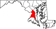
U.S. Routes Interstate Highways Roads by name Categories:- State highways in Maryland
- Roads in Prince George's County, Maryland
- Roads in Anne Arundel County, Maryland


Wikimedia Foundation. 2010.