- Durham, New Hampshire
-
Town of Durham — Town — 

SealLocation within Strafford County, New Hampshire
Coordinates: 43°08′02″N 70°55′35″W / 43.13389°N 70.92639°WCoordinates: 43°08′02″N 70°55′35″W / 43.13389°N 70.92639°W Country United States State New Hampshire County Strafford Settled 1635 Incorporated 1732 Government - Town Council Diana Carroll, Chair
Douglas Clark
William (Bill) Cote
Neil Niman
Michael Sievert
Robin Mower
Julian Smith
Peter Stanhope
Jay B. GoozeArea - Total 24.8 sq mi (64.1 km2) - Land 22.4 sq mi (58.0 km2) - Water 2.4 sq mi (6.1 km2) 9.57% Elevation 50 ft (15 m) Population (2010) - Total 14,638 - Density 590.2/sq mi (227.9/km2) Time zone EST (UTC-5) - Summer (DST) EDT (UTC-4) ZIP code 03824 Area code(s) 603 FIPS code 33-19700 GNIS feature ID 0873584 Website www.ci.durham.nh.us Durham is a town in Strafford County, New Hampshire, United States. The population was 14,638 at the 2010 census.[1] Durham is home to the University of New Hampshire.
The primary settlement in town, where 10,345 people resided at the 2010 census,[1] is defined by the U.S. Census Bureau as the Durham census-designated place (CDP) and includes the densely-populated portion of the town centered on the intersection of New Hampshire Route 108 and Main Street and including the university which dominates the town.
Contents
History
 General View of UNH in 1913
Situated beside Great Bay at the mouth of the Oyster River, Durham was originally called Oyster River Plantation. It was settled in 1635 as a part of Dover.[citation needed]
The town is named after Durham, Northumberland, England, from whence came two of its earliest settlers, William and Henry Hilton. They were two of four sons. Their father had lent Charles of England money and he knew he would never get it back, so he offered to forgive the debt if Charles granted two of his sons land in the New World. They arrived from England in a well-provisioned ship called the Providence.[citation needed]
During King William's War, on July 18, 1694, the English settlement was attacked in the Raid on Oyster River by French career soldier Claude-Sébastien de Villieu with about 250 Abenaki Indians from Norridgewock under command of their sagamore, Bomazeen (or Bomoseen). In all, 45 inhabitants were killed and 49 taken captive, with half the dwellings, including 5 garrisons, burned to the ground.[citation needed]
The community would rebuild, however, and by 1716 Durham was a separate parish, named after Durham, England.[citation needed] Incorporated in 1732, Durham once included portions of the present-day towns of Madbury, Lee and Newmarket.[citation needed] Because of its arable land, the town would develop as a farming community.
A descendant of an early settler, Benjamin Thompson bequeathed his assets and family estate, Warner Farm, to the state for the establishment of an agricultural college.[citation needed] Originally founded in 1866 in Hanover, the New Hampshire College of Agriculture and the Mechanic Arts moved to Durham in 1893 and became University of New Hampshire in 1923. Thompson Hall, built in 1892 with an iconic clock tower, is named in his honor. Designed in the Romanesque Revival style by the Concord architectural firm of Dow & Randlett, it was listed on the National Register of Historic Places in 1996.[citation needed]
Police Department
A police force of some manner has served Durham since at least 1848.[2] Durham Police Department is made up of 20 full-time and part-time officers and provides service 24-hours a day.[3]
The Police Department's Adopt-A-Cop program was instituted in 1999 to improve relationships between University of New Hampshire fraternities. Each fraternity is assigned a police officer who attends house meetings and events and acts a liaison between the fraternity and the community.[4]
Fire Department
The first fire department organization in Durham was organized in 1927 and the first salaried firefighter was employed in 1934.[5]
The Durham Fire Department is one of the few fire departments in the country that is funded by both a municipality and a university.[5]
In addition, McGregor Memorial EMS is a regional, non-profit organization delivering emergency medical services and education to the New Hampshire Seacoast area since 1968.
Geography
According to the United States Census Bureau, the town has a total area of 24.8 square miles (64 km2), of which 22.4 sq mi (58 km2) is land and 2.4 sq mi (6.2 km2) is water, comprising 9.57% of the town. The town is drained by the Oyster River. The highest point in Durham is Beech Hill, at 291 feet (89 m) above sea level, located on the town's northern border.[6] Durham lies fully within the Piscataqua River (coastal) watershed.[7]
The village area of the town, defined as a census-designated place (CDP), has a total area of 2.7 sq mi (7.0 km2), of which 0.1 sq mi (0.26 km2) (1.85%) is water.
Demographics
Historical populations Census Pop. %± 1850 1,497 — 1860 1,534 2.5% 1870 1,298 −15.4% 1880 962 −25.9% 1890 871 −9.5% 1900 996 14.4% 1910 823 −17.4% 1920 749 −9.0% 1930 1,217 62.5% 1940 1,533 26.0% 1950 4,770 211.2% 1960 5,504 15.4% 1970 8,869 61.1% 1980 10,652 20.1% 1990 11,818 10.9% 2000 12,664 7.2% 2010 14,638 15.6%  Hamilton Smith Hall c. 1920
As of the census of 2000, there were 12,664 people, 2,882 households, and 1,582 families residing in the town. The population density was 565.5 people per square mile (218.4/km²). There were 2,923 housing units at an average density of 130.5 per square mile (50.4/km²). The racial makeup of the town was 94.55% White, 0.77% African American, 0.21% Native American, 3.10% Asian, 0.13% Pacific Islander, 0.27% from other races, and 0.97% from two or more races. 1.24% of the population were Hispanic or Latino of any race.
There were 2,882 households out of which 28.3% had children under the age of 18 living with them, 48.3% were married couples living together, 4.8% have a woman whose husband does not live with her, and 45.1% were non-families. 20.2% of all households were made up of individuals and 6.6% had someone living alone who was 65 years of age or older. The average household size was 2.79 and the average family size was 3.03.
The age distribution, heavily influenced by the presence of UNH, is: 12.0% under the age of 18, 56.5% from 18 to 24, 13.3% from 25 to 44, 12.1% from 45 to 64, and 6.1% who were 65 years of age or older. The median age was 21 years, which is also typical for a college town. For every 100 females there are 82.3 males. For every 100 females age 18 and over, there were 79.9 males.
The median income for a household in the town was $51,697, and the median income for a family was $83,609. Males had a median income of $54,519 versus $31,548 for females. The per capita income for the town was $17,210. 27.7% of the population and 2.8% of families were below the poverty line. Out of the total people living in poverty, 5.5% are under the age of 18 and 1.1% are 65 or older.
Town center
As of the census of 2000, there were 9,024 people, 1,703 households, and 727 families residing in the town center, or CDP. The population density was 3,398.7 people per square mile (1,309.8/km²). There were 1,718 housing units at an average density of 249.4 persons/km² (647.1 persons/sq mi). The racial makeup of the town was 93.27% White, 0.83% African American, 0.29% Native American, 3.96% Asian, 0.18% Pacific Islander, 0.32% from other races, and 1.15% from two or more races. 1.31% of the population were Hispanic or Latino of any race.
There were 1,703 households out of which 20.9% had children under the age of 18 living with them, 37.2% were married couples living together, 4.2% have a woman whose husband does not live with her, and 57.3% were non-families. 25.2% of all households were made up of individuals and 8.8% had someone living alone who was 65 years of age or older. The average household size was 2.59 and the average family size was 2.91.
The age distribution of the village area is: 6.8% under the age of 18, 71.5% from 18 to 24, 9.4% from 25 to 44, 7.1% from 45 to 64, and 5.2% who were 65 years of age or older. The median age was 21 years. The distribution and median age are both typical for university towns. For every 100 females there are 79.0 males. For every 100 females age 18 and over, there were 77.1 males.
The median income for a household is $30,040, and the median income for a family was $70,066. Males had a median income of $48,155 versus $26,250 for females. The per capita income for the town was $12,088. 39.9% of the population and 5.9% of families were below the poverty line. Out of the total people living in poverty, 12.3% are under the age of 18 and 1.8% are 65 or older. However, much of the population "living in poverty" consists of students, many of whom are still partially supported by their parents.
Notable inhabitants
- Daniel Ford, writer
- Sam Fuld, Major League Baseball player
- Manuela Lutze,[citation needed] four-time Olympic rower
- Joyce Maynard, writer
- Hercules Mooney, Revolutionary War officer
- Don Murray, journalist
- Deron Quint, National Hockey League player
- Alexander Scammel, Col. of the 3rd New Hampshire Regiment
- Daniel C. Stillson (1830–1899), inventor of the Stillson pipe wrench
- John Sullivan, Revolutionary War general
- Benjamin Thompson, farmer, businessman & benefactor of U.N.H.
Sites of Interest
See also
Photo gallery
-

Pettee Hall
-

Taylor Hall
-

Murkland Hall
-

Thompson Hall
-

Dimond Library
-

St. Thomas Moore Parish
-

Downtown at Madbury Road and Main Street
-

Babcock Hall
References
- ^ a b United States Census Bureau, American FactFinder, 2010 Census figures. Retrieved March 23, 2011.
- ^ "Police Dept. History". Town of Durham, NH. http://www.ci.durham.nh.us/departments/police/history.html. Retrieved December 16, 2010.
- ^ "A Welcome from the Chief of Police". Town of Durham, NH. http://ci.durham.nh.us/DEPARTMENTS/POLICE/chief.html. Retrieved December 16, 2010.
- ^ "Durham PD Programs". Town of Durham, NH. http://ci.durham.nh.us/DEPARTMENTS/POLICE/programs.html. Retrieved December 16, 2010.
- ^ a b "Durham Fire Department History". Town of Durham, NH. http://ci.durham.nh.us/DEPARTMENTS/fire_dept/History.html. Retrieved December 16, 2010.
- ^ U.S. Geological Survey. Dover Quadrangle, New Hampshire-Maine map. 1:62,500. 15 Minute Series (Topographic). Washington D.C.: USGS, 1956. Available from University of New Hampshire Dimond Library Documents Department & Data Center, http://docs.unh.edu/NH/dovr56sw.jpg accessed 2009-03-17.
- ^ Foster, Debra H.; Batorfalvy, Tatianna N.; and Medalie, Laura (1995). Water Use in New Hampshire: An Activities Guide for Teachers. U.S. Department of the Interior and U.S. Geological Survey. http://nh.water.usgs.gov/Publications/nh.intro.html.
External links
- Town website
- New Hampshire Economic and Labor Market Information Bureau Profile
- University of New Hampshire
- History of the Oyster River Massacre
- Oyster River Community Blog
Municipalities and communities of Strafford County, New Hampshire County seat: Dover Cities 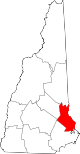
Towns Barrington | Durham | Farmington | Lee | Madbury | Middleton | Milton | New Durham | Rollinsford | Strafford
Villages Bow Lake Village | Center Strafford | East Rochester | Milton Mills
Categories:- Towns in Strafford County, New Hampshire
- University towns in the United States
- Populated places established in 1732


Wikimedia Foundation. 2010.