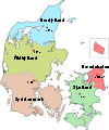
Norddjurs Municipality

Norddjurs Municipality
Location of Norddjurs municipality

Norddjurs is a municipality (Danish, kommune) in Region Midtjylland in Denmark. It covers an area of 661 km² and a total population of 38,581 (2008).

The municipality is also a part of the East Jutland metropolitan area with 1.2 million inhabitants.[1]

On 1 January 2007 Norddjurs municipality was created as the result of Kommunalreformen ("The Municipal Reform" of 2007), consisting of the former municipalities of Grenå, Nørre Djurs and Rougsø, along with the eastern part of Sønderhald municipality.

References

  1. ^ [1]

External links


Coordinates: 56°30′N 10°48′E / 56.50°N 10.80°E / 56.50; 10.80


Wikimedia Foundation. 2010.

Игры ⚽ Поможем написать реферат

Look at other dictionaries:

  • Sønderhald Municipality — Until January 1, 2007 Sønderhald municipality was a municipality (Danish, kommune ) in the former Aarhus County in the eastern part of the Jutland peninsula (Djurs) in central Denmark. It covered an area of 138 km², and had a total population of… …   Wikipedia

  • Grenaa Municipality — Until January 1, 2007, Grenaa municipality or Grenå municipality was a municipality (Danish, kommune ) in Aarhus County on the east coast of the Jutland peninsula in central Denmark. The municipality covered an area of 196 km², and had a total… …   Wikipedia

  • Rougsø Municipality — Until January 1, 2007 Rougsø municipality was a municipality (Danish, kommune ) in the former Aarhus County on the east coast of the Jutland peninsula in central Denmark. It covered an area of 224 km², and had a total population of 8.078 (2005).… …   Wikipedia

  • Nørre Djurs Municipality — Until January 1, 2007 Nørre Djurs municipality ( Northern Djursland ) was a municipality (Danish, kommune) in the former Aarhus County on the east coast of the Jutland peninsula in central Denmark. The municipality covered an area of 237 km² …   Wikipedia

  • Odense Municipality — Coordinates: 55°23′45.48″N 10°23′18.73″E / 55.3959667°N 10.3885361°E / 55.3959667; 10.3885361 …   Wikipedia

  • Copenhagen Municipality — Coordinates: 55°40′31″N 12°34′13″E / 55.67528°N 12.57028°E / 55.67528; 12.57028 …   Wikipedia

  • Odder Municipality — Location of Odder municipality Odder municipality is a municipality in Region Midtjylland on the east coast of the Jutland peninsula in central Denmark just south of Aarhus and is a part of the greater Aarhus area. The municipality includes the… …   Wikipedia

  • Randers Municipality — (Randers Kommune) Municipalities of Denmark The old Town Hall on the square in Randers with statue of Niels Ebbesen in f …   Wikipedia

  • Middelfart Municipality — Map of the municipality Middelfart municipality is a municipality (Danish, kommune) in Region of Southern Denmark on the west coast of the island of Funen in southern Denmark. The municipality covers an area of 297 km². It has a total population… …   Wikipedia

  • Nyborg Municipality — (Nyborg Kommune) Municipalities of Denmark Country Denmark Region …   Wikipedia

Share the article and excerpts

Direct link
Do a right-click on the link above
and select “Copy Link”