- Mount Pelly
-
Mount Pelly Ovayok 
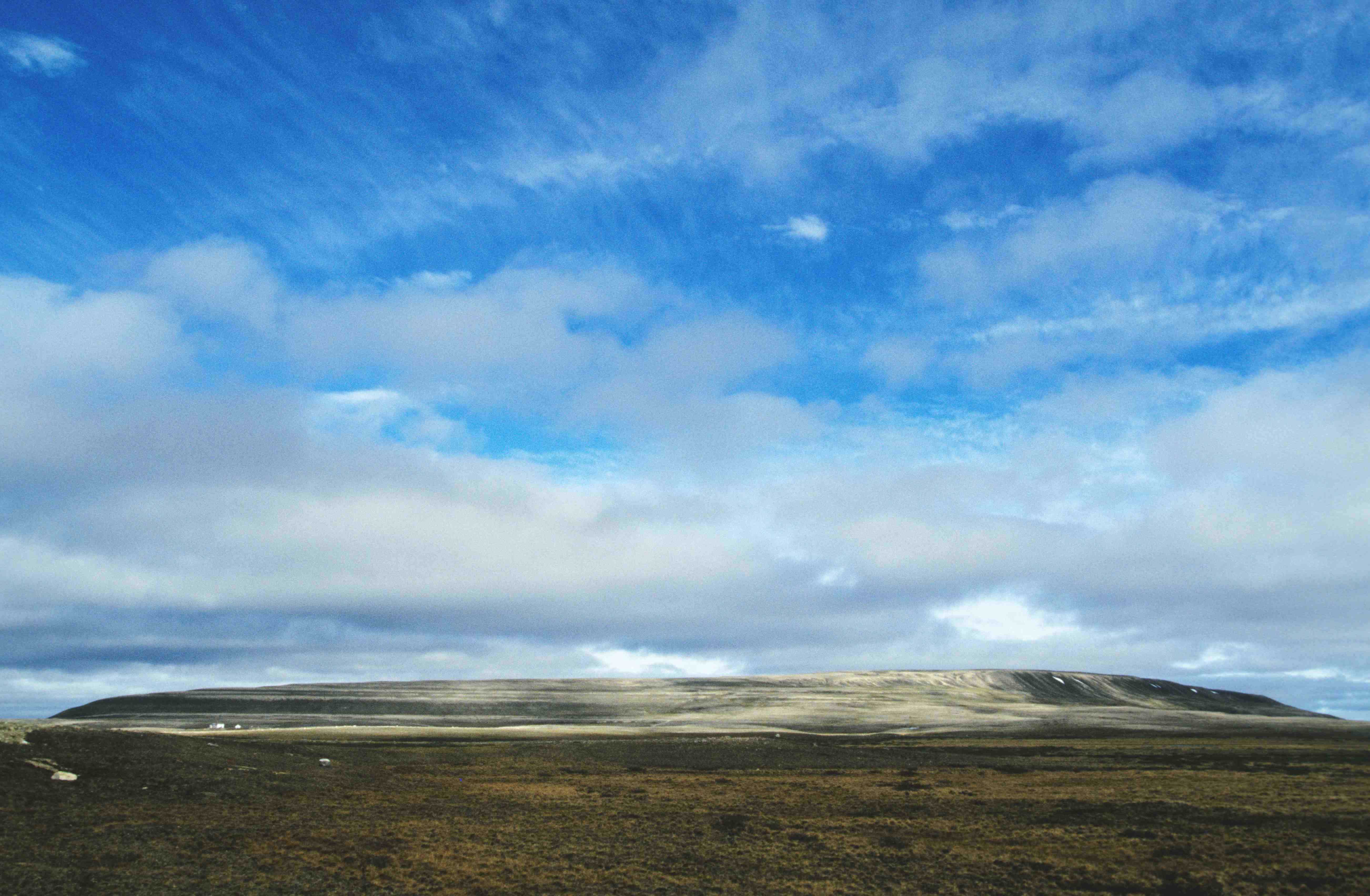
Mount Pelly, north of Cambridge Bay (Victoria Island)Elevation More than 200 m (660 ft) Location Location Nunavut, Canada Coordinates 69°10′40″N 104°43′20″W / 69.17778°N 104.72222°WCoordinates: 69°10′40″N 104°43′20″W / 69.17778°N 104.72222°W Geology Type Esker Mount Pelly or Pelly Mountain (Inuinnaqtun: Ovayok or Uvajuq) is an esker[1] in Kitikmeot, Nunavut. It is located in the Canadian North on Victoria Island within the Ovayok Territorial Park.[2] The hill, which is more than 200 m (660 ft) high, is located 15 km (9.3 mi) north west of the hamlet of Cambridge Bay, Nunavut.[2]
Contents
History
The area around Ovayok has long been used by Inuit as a hunting area and there are over 120 archaeological sites on the esker. These include pirujaq (storage cache), campsites and a grave. The oddest find was a stack of loon bones that had been "cut at every joint". This find, which the local elders indicated was something they had never seen and must have happened before their grandparents were alive, fitted in with an Inuit legend. The legend indicated that people in the area were starving and they were saved only when a skilled hunter killed a loon. To feed all the people the bones had to be broken at the joints so all could be fed.[3]
Modern history
The esker was given its English name by Thomas Simpson and Peter Warren Dease in 1839 to honour Sir John Henry Pelly, governor of the Hudson's Bay Company. Simpson and Dease had travelled from Great Bear Lake, down the Coppermine River, to Back River. In 1850-51 John Rae, while searching the south coast of Victoria Island for clues to the lost expedition of John Franklin, climbed to the top of Mount Pelly.[3]
Traditional belief
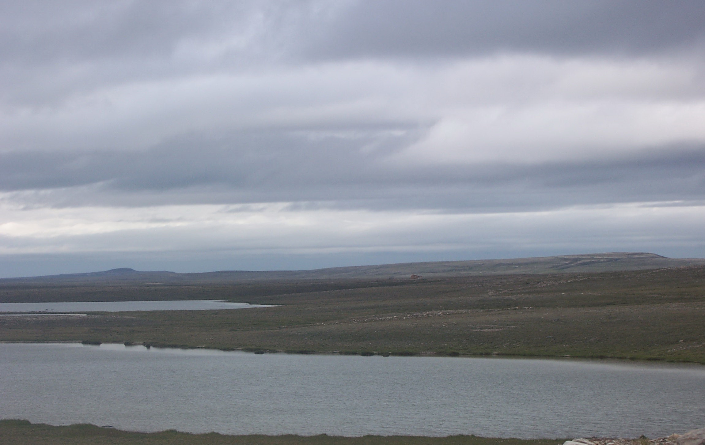
 Inuuhuktu (Baby Pelly) and Amaaqtuq (Lady Pelly)
Behind Mount Pelly are two more eskers called Inuuhuktu (Baby Pelly) and Amaaqtuq (Lady Pelly). Inuit legend says that the three hills are a family of starving giants. They were crossing Victoria Island looking for food and the father, Ovayok, died first. Next the son, Inuuhuktu (English; "son"[4]), died and was followed by the mother, Amaaqtuq (English; "packing baby",[5] see amauti), who was carrying her baby.[3]
References
- ^ Mount Pelly Territorial Park, Cambridge Bay
- ^ a b Nunavut Parks
- ^ a b c David F. Pelly & Kim Crockatt, ed (1999). Uvajuq The Origin of Death. Elsie Anaginak Klengenberg (illustrator). Kitikmeot Heritage Society. ISBN 9780969078388.
- ^ "Inuuhuktu". Asuilaak Living Dictionary. http://www.livingdictionary.com/search/viewResults.jsp?resultsId=1195324950343ri. Retrieved 2009-05-24.
- ^ Ohokak, G.; M. Kadlun, B. Harnum. Inuinnaqtun-English Dictionary. Kitikmeot Heritage Society.
Mountains of Nunavut Kitikmeot Region Pelly · ShalerKivalliq Region Qikiqtaaluk Region Apex · Polar Sun Spire
Mountains of the
Arctic CordilleraAdam · Angilaaq · Angna · Arthur · Asgard · Baffin · Baldr · Bastille · Battle · Beaufort · Biederbick · Blackwelder · Blue · Boulder · Breidablik · Bruce · Byam Martin · Challenger · Commonwealth · Conger · Cunningham · Douro · Everett · Garfield · Geodetic · Grinnell · Grogan Morgan · Haddington · Hartz · Inglefield · Innuitian · Jeffries · Joy · Kisimngiuqtuq · Krag · Krieger · Midnight Sun · Nukap · Odin · Osborn · Outlook · Precipitous · Prince of Wales · Princess Margaret · Qiajivik · Sawtooth · Scoresby · Selamiut · Stokes · Stokes · Swiss · Thor · Thorndike · Thule · Torngat · Treuter · Ukpik · Victoria and Albert · White Crown · White TripletsMountains of the
British Empire RangeMountains of the
United States RangeCategories:- Mountains of Kitikmeot Region
Wikimedia Foundation. 2010.