- Crumptonia, Alabama
-
Crumptonia, Alabama Crumptonia Plantation in Crumptonia, Alabama.
Country United States State Alabama County Dallas Elevation 141 ft (43 m) Time zone Central (CST) (UTC-6) – Summer (DST) CDT (UTC-5) ZIP code Area code(s) 251 Crumptonia is an unincorporated community in Dallas County, Alabama.[1] It is named for a local plantation house of the same name, built in 1855 by Claudius M. Cochran and later owned the Crumpton family.[2]
Geography
Crumptonia is located at 32°12′50″N 87°17′20″W / 32.214°N 87.289°WCoordinates: 32°12′50″N 87°17′20″W / 32.214°N 87.289°W and has an elevation of 141 feet (43 m).[1]
References
- ^ a b "Crumptonia, Alabama". "AL HomeTownLocator". http://alabama.hometownlocator.com/al/dallas/crumptonia.cfm. Retrieved 2008-11-05.
- ^ Cooper, Chip; Knopke, Harry; Gamble, Robert (1993). Silent in the Land. Tuscaloosa, Alabama: CKM Press. pp. 179. ISBN 0963671308.
Municipalities and communities of Dallas County, Alabama Cities 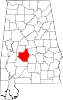
Town CDP Unincorporated
communitiesBeloit | Bogue Chitto | Browns | Carlowville | Crumptonia | Elm Bluff | Marion Junction | Minter | Plantersville | Pleasant Hill | Richmond | Safford | Sardis | Summerfield | Tyler
Ghost town Categories:- Unincorporated communities in Alabama
- Populated places in Dallas County, Alabama
- Populated places established in 1855
- Alabama geography stubs


Wikimedia Foundation. 2010.