Croftfoot

Croftfoot

Coordinates: 55°48′50″N 4°14′03″W / 55.813836°N 4.234137°W / 55.813836; -4.234137

Croftfoot
Scottish Gaelic: Bun a' Chroit
Scots: Croaftfuit
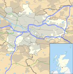
Croftfoot is located in Glasgow
Croftfoot

 Croftfoot shown within Glasgow
OS grid reference NS601601
Council area Glasgow City Council
Lieutenancy area Glasgow
Country Scotland
Sovereign state United Kingdom
Post town GLASGOW
Postcode district G44
Dialling code 0141
Police Strathclyde
Fire Strathclyde
Ambulance Scottish
EU Parliament Scotland
UK Parliament Glasgow South
Scottish Parliament Glasgow Cathcart
Glasgow
List of places: UK • Scotland • Glasgow

Croftfoot (Scots: Croaftfuit, Scottish Gaelic: Bun a' Chroit)[1] is a residential district on the southeastern side of the Scottish city of Glasgow. It is named after an old steading which was situated at the eastern end of the present day Croftfoot Road, where the Castlemilk Burn now enters a culvert downstream from the site of Castlemilk House.

In addition to shops and amenities, the housing stock largely comprises cottage flats constructed in the 1930s by MacTaggart & Mickel and rented out by the Western Heritable Investment Co. Ltd. The houses went up for sale from the late fifties and many have since been upgraded internally and externally.

The area is served by Croftfoot railway station.

References

  1. ^ List of railway station names in English, Scots and Gaelic – NewsNetScotland


Wikimedia Foundation. 2010.

Игры ⚽ Поможем решить контрольную работу

Look at other dictionaries:

  • Croftfoot railway station — Croftfoot Croftfoot railway station, looking west Location Place Glasgow Rutherglen …   Wikipedia

  • Glasgow — Glaswegian redirects here. For the Scots dialect spoken in Glasgow, see Glasgow patter. This article is about the original Glasgow in Scotland. For other uses, see Glasgow (disambiguation). Coordinates: 55°51′29″N 4°15′32″W /  …   Wikipedia

  • Nitshill — (Scots: Nitshull, Scottish Gaelic: Cnoc nan Cnòthan)[1] is a district on the south side of Glasgow. It is north of South Nitshill, south of Crookston, and southwest of Silverburn and Pollok. Nitshill was originally a coal mining village. The… …   Wikipedia

  • Maryhill — For other uses, see Maryhill (disambiguation). Coordinates: 55°53′39″N 4°17′40″W / 55.894141°N 4.294395°W / 55.894141; 4.294395 …   Wikipedia

  • Kelvinbridge — Coordinates: 55°52′29″N 4°16′47″W / 55.874763°N 4.279765°W / 55.874763; 4.279765 …   Wikipedia

  • Mount Vernon, Glasgow — Coordinates: 55°50′35″N 4°08′31″W / 55.843°N 4.142°W / 55.843; 4.142 …   Wikipedia

  • Castlemilk — ( Caisteal Mheilc in Gaelic) is a huge district of Glasgow, Scotland. It lies to the south of the city adjacent to Rutherglen, Croftfoot, Simshill and Carmunnock. Castlemilk House, a stately old mansion built around Cassilton Tower, which was… …   Wikipedia

  • Saint Mirin — Born c. 565 Died 620 Honored in Roman Catholic Church, Orthodox Church Feast 15 September Patronage …   Wikipedia

  • Cowcaddens — Coordinates: 55°52′05″N 4°15′35″W / 55.868194°N 4.259635°W / 55.868194; 4.259635 …   Wikipedia

  • St Enoch railway station — Glasgow St Enoch St Enoch railway station hotel in 1879. Photograph by James Valentine Location Place …   Wikipedia

Share the article and excerpts

Direct link
Do a right-click on the link above
and select “Copy Link”