- Chak 104 NB
-
Chak 104 NB 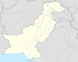
 Chak 104 NB
Coordinates: 32°00′N 72°20′E / 32.00°N 72.33°ECoordinates: 32°00′N 72°20′E / 32.00°N 72.33°E Country  Pakistan
Province Punjab Elevation 90 m (295 ft) Time zone PST (UTC+5) Chak no 104 NB is a village in the Punjab province of Pakistan. It is located at 32.01166,72.559714 with an altitude of 180 meters.[1] It is part of the tehsil and district of Sargodha[2] and lies 10 km north of Sargodha. Development projects were soon started in the village after the independence of Pakistan from the British in 1947, including water supply, transportation, education, sports and health facilities.
It was due to these reasons that Chak 104 NB was given the title of Model Village of Punjab in 1965 and the award was given by the general Musa Khan, then the governor of West Pakistan.
Dr. Nasar ullah khan Ghuman played a vital role in the social, economical,political and intellectual development of not only the village but of the whole area.
Due to the commanding role , people of this village are known as the trend setter of the district.
As Sargodha district has distinction in various field of life albeit an agrarian city. It serve the nation with its illustrious sons. As martial races are abundant in Sargodha, one of the sons of the soil is Brig. Saadullah Khan HJ(Swordian) (Gold medalist, Pakistan movement), Former active member of the Pakistan Muslim League under the guidance of Quaid e Azam while he was studying at Islamia College Lahore , also have the honour of having first sword of honour of Sargodha District from military academy Kakul in 1951. Author of the book "From East Pakistan to Bangla desh". He also served as the Chairman of the Faisalabad Development Authority for five years. Dr. Ch. Nasrullah Khan Ghuman was the first MBBS from Sargodha and completed his education from King Edward Medical College Lahore in 1937. He was a great reformer and social activist and rendered meritorious services for the people.
References
Towns and cities of Sargodha Towns 46 Adda · Chak 21 S.B. · Aminabad Noon · Ali Pur Noon · Atta Abad Noon · Bakhar Bar · Batree Shahabdin Di · Bhalwal · Bhera · Ali Pur Syedan · Ranjhianwala · Sheikh Da Lok · Kasu Pur (Dulhar) · Turti pur · Kohlian · Chak No.96 S.B · Chack No 111 N.B · Chack No 113 N.B · Chack No 135 S.B · Chack No. 112 N.B · Chack No. 129 S.B · Chack No. 7 N.B · Chak 104 NB · Chak 132 S.B · Chak 8ML · Chak No 71 NB · Chauki Bhagatt · Chawa · Faruka · Fateh Pur Noon · Ghorh Pur Noon · Hathi Wind · Haveli Majoka · Islam Pur Lokari · Jahanian Shah · Jhawarian · Kalra · Khair Pur Noon · Khan Muhammad Wala · Kikrawn Wala Noon · Kot Hakim Khan Noon · Kot Momin · Lak More · Lakhiwal Sharif · Lilyani · Mari Shah Sakhira · Middh Ranjha · Mitha Lak · Mitha Tiwana · Nihang · Nurpur Noon · Phularwan · Pind Rahim Shah · Pul 11 · Sahiwal · Sardar Pur Noon · Sargodha · Shah Nikdar · Shaheenabad · Shahpur · Share Muhammad Wala Noon · Sheikhpu Kuhna · Sillanwali · Talbey Wala Pattan · Thatti Noor Dee · Zaffer Abad NoonCategories:- Populated places in Sargodha District
- Punjab, Pakistan geography stubs

Wikimedia Foundation. 2010.