- Maxton, North Carolina
-
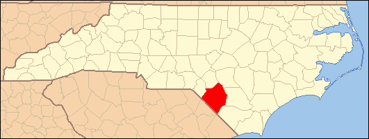
Maxton, North Carolina — Town — Location within the state of North Carolina
 Maxton, North Carolina
Coordinates: 34°44′17″N 79°21′4″W / 34.73806°N 79.35111°WCoordinates: 34°44′17″N 79°21′4″W / 34.73806°N 79.35111°W Country United States State North Carolina Counties Robeson, Scotland Incorporated 1874 Government - Type Town Council - Mayor Gladys Dean Area - Total 2.2 sq mi (5.8 km2) - Land 2.2 sq mi (5.8 km2) - Water 0.0 sq mi (0.0 km2) Elevation 194 ft (59 m) Population (2000) - Total 2,551 - Density 1,145.3/sq mi (442.2/km2) Time zone Eastern (EST) (UTC-5) - Summer (DST) EDT (UTC-4) ZIP code 28364 Area code(s) 910 FIPS code 37-42020[1] GNIS feature ID 1021370[2] Website www.ci.maxton.nc.us Maxton is a town in Robeson County and Scotland County Counties, North Carolina, in the United States. The population was 2,551 at the time of the 2000 U.S. Census.
Contents
History
The Maxton area was first settled in the 1700s. The community was incorporated in 1874 under the name of Shoe Hill. The name changed to Tilden, in honor of 1876 U.S. President candidate Samuel J. Tilden. The name reverted to Shoe Hill in 1881 before finally settling on Maxton in 1887.[3]
Maxton is the location of two former, but historically important schools. Floral College was founded in 1841. It was the first college in North Carolina to grant degrees to women. Charles N. Hunter a famous African-American educator who would go on to found the North Carolina Industrial Association opened his first school in Maxton.[3]
Geography
Maxton is located at 34°44′17″N 79°21′4″W / 34.73806°N 79.35111°W (34.738147, -79.351068).[4]
According to the United States Census Bureau, the town has a total area of 2.2 square miles (5.8 km²).
Demographics
As of the census[1] of 2000, there were 2,551 people, 985 households, and 676 families residing in the town. The population density was 1,145.3 people per square mile (441.7/km²). There were 1,073 housing units at an average density of 481.7 per square mile (185.8/km²). The racial makeup of the town was 25.52% White, 64.09% African American,7.02% Native American, 0.31% Asian, 0.16% Pacific Islander, 1.10% from other races, and 1.80% from two or more races. Hispanic or Latino of any race were 1.61% of the population.
There were 985 households out of which 31.7% had children under the age of 18 living with them, 36.3% were married couples living together, 28.4% had a female householder with no husband present, and 31.3% were non-families. 27.9% of all households were made up of individuals and 11.7% had someone living alone who was 65 years of age or older. The average household size was 2.58 and the average family size was 3.16.
In the town the population was spread out with 29.3% under the age of 18, 9.1% from 18 to 24, 26.0% from 25 to 44, 22.7% from 45 to 64, and 12.9% who were 65 years of age or older. The median age was 34 years. For every 100 females there were 84.1 males. For every 100 females age 18 and over, there were 78.0 males.
The median income for a household in the town was $23,143, and the median income for a family was $30,039. Males had a median income of $27,259 versus $20,218 for females. The per capita income for the town was $12,783. About 23.7% of families and 28.5% of the population were below the poverty line, including 43.4% of those under age 18 and 22.3% of those age 65 or over.
Notable people
- Angus McLean - Governor of North Carolina 1924-1928[3]
- Malcom McLean - trucking industry innovator and "father of containerization[3]
References
- ^ a b "American FactFinder". United States Census Bureau. http://factfinder.census.gov. Retrieved 2008-01-31.
- ^ "US Board on Geographic Names". United States Geological Survey. 2007-10-25. http://geonames.usgs.gov. Retrieved 2008-01-31.
- ^ a b c d "History". Town of Maxton. http://www.ci.maxton.nc.us/history.htm. Retrieved July 12, 2011.
- ^ "US Gazetteer files: 2010, 2000, and 1990". United States Census Bureau. 2011-02-12. http://www.census.gov/geo/www/gazetteer/gazette.html. Retrieved 2011-04-23.
Municipalities and communities of Robeson County, North Carolina City 
Towns Fairmont | Lumber Bridge | Marietta | Maxton‡ | McDonald | Orrum | Parkton | Pembroke | Proctorville | Raynham | Red Springs‡ | Rennert | Rowland | St. Pauls
CDPs Unincorporated
communitiesFootnotes ‡This populated place also has portions in an adjacent county or counties
Municipalities and communities of Scotland County, North Carolina City 
Towns East Laurinburg | Gibson | Maxton‡ | Wagram
Townships Laurel Hill | Spring Hill | Stewartsville | Williamson
Unincorporated
communitiesLaurel Hill | Montclair | Old Hundred
Footnotes ‡This populated place also has portions in an adjacent county or counties
Categories:- Populated places in Robeson County, North Carolina
- Populated places in Scotland County, North Carolina
- Towns in North Carolina
- Populated places in North Carolina with African American majority populations
- Populated places established in the 1700s


Wikimedia Foundation. 2010.