- Menoken, North Dakota
-
Menoken — Census-designated place — Location within the state of North Dakota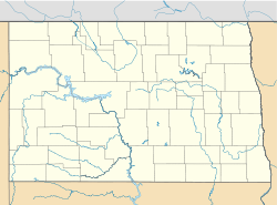
 Menoken
Coordinates: 46°49′14″N 100°31′52″W / 46.82056°N 100.53111°WCoordinates: 46°49′14″N 100°31′52″W / 46.82056°N 100.53111°W Country United States State North Dakota County Burleigh Elevation 1,722 ft (525 m) Population (2010)[1] – Total 70 Time zone Central (CST) (UTC-6) – Summer (DST) CDT (UTC-5) ZIP codes 58558 FIPS code 38-52180[2] GNIS feature ID 2628575[2] Menoken is a census-designated place in southwestern Burleigh County, North Dakota, United States. An unincorporated community, it was designated as part of the U.S. Census Bureau's Participant Statistical Areas Program on June 10, 2010.[3] It was not counted separately during the 2000 Census,[4] but was included in the 2010 Census,[5] where a population of 70 was reported.[1]
It lies southeast of the city of Bismarck, the county seat of Burleigh County.[3] The community has had many different names, including Blaine, Burleigh, Burleigh Station, Clarke's Farm, and Seventeenth Siding. It was first named Blaine for James G. Blaine, U.S. Senator from Maine. "Clarke's Farm" was given for C.J. Clarke of Pittsburgh, a local farmer. "Menoken" is originally an Indian name.[6] Although it is unincorporated, it has a post office, with the ZIP code of 58558.[7]
References
- ^ a b "2010 Census Redistricting Data (Public Law 94-171) Summary File". American FactFinder. United States Census Bureau. http://factfinder2.census.gov/faces/tableservices/jsf/pages/productview.xhtml?pid=DEC_10_PL_GCTPL2.ST13&prodType=table. Retrieved 2 May 2011.
- ^ a b "US Board on Geographic Names". United States Geological Survey. 2007-10-25. http://geonames.usgs.gov. Retrieved 2008-01-31.
- ^ a b "Menoken Census Designated Place". Geographic Names Information System, U.S. Geological Survey. http://geonames.usgs.gov/pls/gnispublic/f?p=gnispq:3:::NO::P3_FID:2628575. Retrieved 2010-07-13.
- ^ U.S. Census Bureau (2003). "Population and Housing Unit Counts, North Dakota" (PDF). 2000 Census of Population and Housing. Government Printing Office. http://www.census.gov/prod/cen2000/phc-3-36.pdf. Retrieved 2008-07-20.
- ^ U.S. Census Bureau (February 13, 2008). "Census Designated Place (CDP) Program for the 2010 Census—Final Criteria" (PDF). Federal Register. http://www.census.gov/geo/www/psap2010/cdp_criteria.pdf. Retrieved 2010-07-13.
- ^ Wick, Douglas A. (1988). North Dakota Place Names. Bismarck, North Dakota: Hedemarken Collectibles. ISBN 0-9620968-0-6. OCLC 191277027.
- ^ Zip Code Lookup
Municipalities and communities of Burleigh County, North Dakota Cities 
Townships Apple Creek | Boyd | Canfield | Christiania | Clear Lake | Crofte | Cromwell | Driscoll | Ecklund | Estherville | Florence Lake | Francis | Ghylin | Gibbs | Glenview | Grass Lake | Harriet-Lien | Hay Creek | Hazel Grove | Logan | Long Lake | McKenzie | Menoken | Missouri | Morton | Naughton | Painted Woods | Richmond | Rock Hill | Schrunk | Sibley Butte | Steiber | Sterling | Taft | Telfer | Thelma | Trygg | Wild Rose | Wilson | Wing
CDPs Driscoll | Menoken
Unorganized
territoriesBurnt Creek-Riverview | Lincoln-Fort Rice | Lyman | Phoenix
Unincorporated
communitiesFootnotes ‡This populated place also has portions in an adjacent county or counties
Categories:- North Dakota geography stubs
- Populated places in Burleigh County, North Dakota
- Unincorporated communities in North Dakota
- Census-designated places in North Dakota


Wikimedia Foundation. 2010.