- Mutitjulu, Northern Territory
-
Mutitjulu
Northern Territory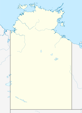
 Mutitjulu
Population: 150 (estimate) Elevation: 523 m (1,716 ft) Location: - 14 km (9 mi) southwest of Yulara, NT
- 89 km (55 mi) north of Amata, SA
- 350 km (217 mi) southwest of Alice Springs
- 680 km (423 mi) north of Southern Ocean
State District: MacDonnell Federal Division: Lingiari Mean max temp Mean min temp Annual rainfall 38.5 °C
101 °F4.7 °C
40 °F217 mm
8.5 inMutitjulu in Australia's Northern Territory, pop. approx. 150, is an Indigenous Australian community at the eastern end of Uluru (also known as Ayers Rock). It is named after a knee-shaped water-filled rock hole at the base of Uluru, and is located in the world-famous Uluru-Kata Tjuta National Park. Its people are Traditional Owners and joint managers of the park with Parks Australia.
Coordinates: 25°20′S 131°04′E / 25.333°S 131.067°E The majority of the Anangu (people) are Pitjantjatjara but there are also associated Yankunytjatjara, Luritja and Ngaanyatjarra people with the languages spoken being Pitjantjatjara, Luritja and Yangkunytjatjara. Arrernte people also have a traditional relationship with Uluru.
Contents
Tourism
Mutitjulu community run a number of guided tours for tourists visiting Uluru, who show tourists certain sites, and share Tjukurpa the story of Uluru, as well as of its inhabitants. These tours are called Anangu Tours, from the Pitjantjatjara word Anangu which means "people".
Access to the community is controlled by Anangu, who do not allow visitors to go to Mutitjulu community without permission. The community reserves the right to forbid visitors from entering their land.
The people of Mutitjulu are also the traditional owners of Uluru, and have an art exhibition there which tourists can freely visit and buy paintings and other artefacts.
Economy
Much of the economy of Mutitjulu comes from tourism at Uluru and nearby Yulara, a proportion of which is funnelled back to the local economy. As a result, Mutitjulu is much wealthier than most other Indigenous Australian communities.
Education
The community has a school which services students from Year 1 to Year 7, and a high school, Nyangatjatjara Secondary College. The cultural traditions of Mutitjulu dictate that once reaching adolescence, children must be taught only with peers of the same sex. Nyangatjatjara Secondary College is a boarding school, and hosts the young men and young women of the community separately in consecutive semesters.
In spite of the relative wealth of the community, Anglo-European education standards at Mutitjulu, as with other Indigenous Australian communities, is far lower than the Australian average. Nonetheless, this is significantly higher than some other Indigenous Australian communities.
Language
Languages spoken are Pitjantjatjara, Luritja and Yankunytjatjara. Communication between the languages, however, is not difficult as most residents most speak several languages and the Aboriginal languages are closely related.
Efforts are made to preserve traditional customs, including traditional languages, but some English is spoken by most residents. The level of English literacy by Mutitjulu residents is higher than in many Indigenous Australian communities primarily due to the regular exposure to tourists at Uluru.
Relationship to Uluru
Many stories have been told by Indigenous Australians from all around Central Australia with regards to Uluru. Some of these stories are recreated in paintings and artwork. Uluru is seen as having an explanation for why we are humans, and the stories help to describe much of the surrounding flora and fauna. By looking at different parts of Uluru, you can see the stories that are told illustrated.
Climbing of Uluru
The local indigenous community request that visitors respect the sacred status of Uluru by not climbing the rock, with signs posted to this effect. Traditionally this activity is reserved for initiated watitjuta (men) during times of ceremony.
In 1983 the former Prime Minister of Australia, Bob Hawke, promised to respect the request from the community that climbing Uluru be prohibited, but he broke his promise when title was handed to the traditional owners in 1985 which deeply hurt the Traditional Owners. At the last minute in the discussions, access for tourists to climb Uluru was made a condition before they could receive the title. The climb crosses an important dreaming track, which has been a cause of sadness and distress among traditional owners.
Ownership of Uluru
The relationship to Uluru can best be described as one of caretaker rather than ownership, where one person or group, referred to as the traditional owner/s of the land, is responsible to take care of Uluru.
For many years, Uluru was owned by Anglo-European-Australians, with hotels placed right beside it. Traditional owners of the land eventually sought to gain land rights over the land, with hotels located at nearby Yulara and creating the community of Mutitjulu, sealing off many areas of Uluru to the general public.
External links
Categories:- Towns in the Northern Territory
- Aboriginal communities in the Northern Territory
- Australian Aboriginal freehold title

Wikimedia Foundation. 2010.