- Manthelon
-
Manthelon

 ManthelonLocation within Upper Normandy region
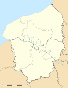 Manthelon
Administration Country France Region Upper Normandy Department Eure Arrondissement Évreux Canton Damville Mayor Colette Bonnard
(2008–2014)Statistics Elevation 115–177 m (377–581 ft)
(avg. 178 m/584 ft)Land area1 14.55 km2 (5.62 sq mi) Population2 292 (2008) - Density 20 /km2 (52 /sq mi) INSEE/Postal code 27387/ 27240 1 French Land Register data, which excludes lakes, ponds, glaciers > 1 km² (0.386 sq mi or 247 acres) and river estuaries. 2 Population without double counting: residents of multiple communes (e.g., students and military personnel) only counted once. Coordinates: 48°54′44″N 1°02′53″E / 48.9122222222°N 1.04805555556°E
Manthelon is a commune in the Eure department in Haute-Normandie in northern France.
Population
Historical population of Manthelon 1962 1968 1975 1982 1990 1999 2008 213 193 184 206 247 271 292 See also
References
Categories:- Communes of Eure
- Eure geography stubs


Wikimedia Foundation. 2010.