- Cleo Springs, Oklahoma
-
Cleo Springs, Oklahoma — Town — Location of Cleo Springs, Oklahoma
Coordinates: 36°24′17″N 98°26′28″W / 36.40472°N 98.44111°WCoordinates: 36°24′17″N 98°26′28″W / 36.40472°N 98.44111°W Country United States State Oklahoma County Major Area – Total 0.6 sq mi (1.5 km2) – Land 0.6 sq mi (1.5 km2) – Water 0.0 sq mi (0.0 km2) Elevation 1,276 ft (389 m) Population (2000) – Total 326 – Density 580.1/sq mi (224.0/km2) Time zone Central (CST) (UTC-6) – Summer (DST) CDT (UTC-5) ZIP code 73729 Area code(s) 580 FIPS code 40-15300[1] GNIS feature ID 1102110[2] Cleo Springs is a town in Major County, Oklahoma, United States. The population was 326 at the 2000 census. The post office was established March 21, 1894 and discontinued May 3, 1917. The Sod House Museum, listed on the National Register of Historic Places and also an Oklahoma Historic site, is located north of town in Alfalfa County.
Contents
Geography
Cleo Springs is located at 36°24′17″N 98°26′28″W / 36.40472°N 98.44111°W (36.404703, -98.441168)[3].
According to the United States Census Bureau, the town has a total area of 0.6 square miles (1.6 km2), all of it land.
Demographics
As of the census[1] of 2000, there were 326 people, 135 households, and 90 families residing in the town. The population density was 580.1 people per square mile (224.8/km²). There were 153 housing units at an average density of 272.3 per square mile (105.5/km²). The racial makeup of the town was 98.16% White, 1.53% African American, and 0.31% from two or more races. Hispanic or Latino of any race were 0.31% of the population.
There were 135 households out of which 31.1% had children under the age of 18 living with them, 59.3% were married couples living together, 5.9% had a female householder with no husband present, and 32.6% were non-families. 31.1% of all households were made up of individuals and 16.3% had someone living alone who was 65 years of age or older. The average household size was 2.41 and the average family size was 3.01.
In the town the population was spread out with 23.3% under the age of 18, 11.3% from 18 to 24, 22.7% from 25 to 44, 27.3% from 45 to 64, and 15.3% who were 65 years of age or older. The median age was 40 years. For every 100 females there were 87.4 males. For every 100 females age 18 and over, there were 88.0 males.
The median income for a household in the town was $31,250, and the median income for a family was $39,000. Males had a median income of $25,781 versus $15,893 for females. The per capita income for the town was $14,824. About 14.1% of families and 13.9% of the population were below the poverty line, including 2.8% of those under age 18 and 20.8% of those age 65 or over.
References
- ^ a b "American FactFinder". United States Census Bureau. http://factfinder.census.gov. Retrieved 2008-01-31.
- ^ "US Board on Geographic Names". United States Geological Survey. 2007-10-25. http://geonames.usgs.gov. Retrieved 2008-01-31.
- ^ "US Gazetteer files: 2010, 2000, and 1990". United States Census Bureau. 2011-02-12. http://www.census.gov/geo/www/gazetteer/gazette.html. Retrieved 2011-04-23.
External links
Municipalities and communities of Major County, Oklahoma City 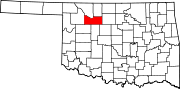
Towns Unincorporated
communitiesCategories:- Populated places in Major County, Oklahoma
- Towns in Oklahoma


Wikimedia Foundation. 2010.