- Baiting Hollow, New York
Infobox Settlement
official_name = Baiting Hollow, New York
settlement_type = CDP
nickname =
motto =
imagesize =
image_caption =
image_pushpin_
mapsize = 250x200px
map_caption =
mapsize1 =
map_caption1 =subdivision_type = Country
subdivision_name =United States
subdivision_type1 = State
subdivision_name1 =New York
subdivision_type2 = County
subdivision_name2 = Suffolk
government_footnotes =
government_type =
leader_title =
leader_name =
leader_title1 =
leader_name1 =
established_title =
established_date =area_footnotes =
area_magnitude =
area_total_km2 = 14.1
area_land_km2 = 8.4
area_water_km2 = 5.7
area_total_sq_mi = 5.4
area_land_sq_mi = 3.2
area_water_sq_mi = 2.2population_as_of = 2000
population_footnotes =
population_total = 1449
population_density_km2 = 173.2
population_density_sq_mi = 448.7timezone = Eastern (EST)
utc_offset = -5
timezone_DST = EDT
utc_offset_DST = -4
elevation_footnotes =
elevation_m = 32
elevation_ft = 105
latd = 40 |latm = 58 |lats = 3 |latNS = N
longd = 72 |longm = 44 |longs = 26 |longEW = Wpostal_code_type =
ZIP code
postal_code = 11933
area_code = 631
blank_name = FIPS code
blank_info = 36-04055
blank1_name = GNIS feature ID
blank1_info = 0942815
website =
footnotes =Baiting Hollow is a hamlet (and
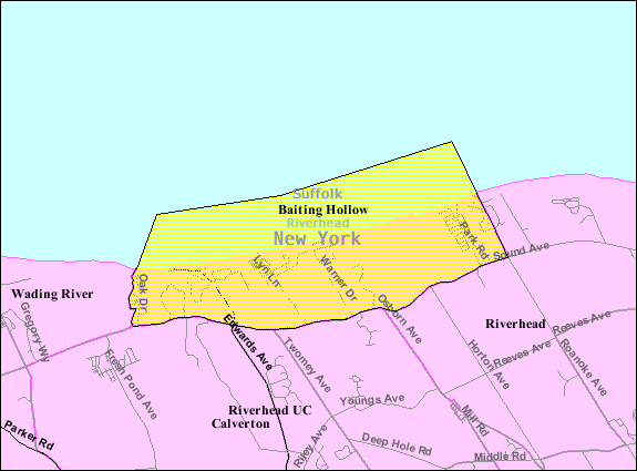
census-designated place ) in Suffolk County,New York ,United States . The population was 1,449 at the 2000 census.The community of Baiting Hollow in located in the Town of Riverhead.
Baiting Hollow lies outside Riverhead. The popular
Splish Splash Water Park is located a mere five minutes from Baiting Hollow.Geography
Baiting Hollow is located at coor dms|40|58|3|N|72|44|26|W|city (40.967514, -72.740514)GR|1.
According to the
United States Census Bureau , the CDP has a total area of 5.4square mile s (14.1km² ), of which, 3.2 square miles (8.4 km²) of it is land and 2.2 square miles (5.7 km²) of it (40.52%) is water.Demographics
As of the
census GR|2 of 2000, there were 1,449 people, 600 households, and 429 families residing in the CDP. Thepopulation density was 448.7 per square mile (173.2/km²). There were 962 housing units at an average density of 297.9/sq mi (115.0/km²). The racial makeup of the CDP was 96.27% White, 1.38% African American, 0.55% Asian, 0.97% from other races, and 0.83% from two or more races. Hispanic or Latino of any race were 4.00% of the population.There were 600 households out of which 24.2% had children under the age of 18 living with them, 63.0% were married couples living together, 5.3% had a female householder with no husband present, and 28.5% were non-families. 24.3% of all households were made up of individuals and 8.2% had someone living alone who was 65 years of age or older. The average household size was 2.39 and the average family size was 2.84.
In the CDP the population was spread out with 18.9% under the age of 18, 4.8% from 18 to 24, 29.3% from 25 to 44, 33.7% from 45 to 64, and 13.3% who were 65 years of age or older. The median age was 44 years. For every 100 females there were 108.2 males. For every 100 females age 18 and over, there were 101.2 males.
The median income for a household in the CDP was $80,622, and the median income for a family was $86,455. Males had a median income of $48,036 versus $51,685 for females. The
per capita income for the CDP was $36,375. About 1.8% of families and 4.4% of the population were below thepoverty line , including none of those under age 18 and 13.8% of those age 65 or over.References
External links

Wikimedia Foundation. 2010.