- Dennis Township, New Jersey
-
Dennis Township, New Jersey — Township — Dennis Township highlighted in Cape May County. Inset map: Cape May County highlighted in the State of New Jersey. Census Bureau map of Dennis Township, New Jersey
Coordinates: 39°12′36″N 74°49′4″W / 39.21°N 74.81778°WCoordinates: 39°12′36″N 74°49′4″W / 39.21°N 74.81778°W Country United States State New Jersey County Cape May Incorporated March 1, 1827 Government[1][2] - Type Township (New Jersey) - Mayor John Murphy (2010) Area - Total 64.3 sq mi (166.5 km2) - Land 61.4 sq mi (158.9 km2) - Water 2.9 sq mi (7.6 km2) Elevation[3] 3 ft (1 m) Population (2009)[4] - Total 5,768 - Density 105.8/sq mi (40.9/km2) Time zone Eastern (EST) (UTC-5) - Summer (DST) EDT (UTC-4) ZIP code 08214 - Dennisville Area code(s) 609 FIPS code 34-17560[5][6] GNIS feature ID 0882046[7] Website http://www.dennistwp.org Dennis Township is a township in Cape May County, New Jersey, United States. It is part of the Ocean City Metropolitan Statistical Area. The township population was 6,492 as of the United States 2000 Census. As of 2009, the estimated township population was 5,768.
Dennis Township was incorporated as a township by an Act of the New Jersey Legislature on March 1, 1827, from portions of Upper Township. Portions of the township were taken to form Sea Isle City borough (May 22, 1882) and Woodbine (March 3, 1903).[8]
New Jersey Monthly magazine ranked Dennis Township as its 20th best place to live in its 2008 rankings of the "Best Places To Live" in New Jersey.[9]
Contents
Geography
According to the United States Census Bureau, the township has a total area of 64.3 square miles (167 km2), of which, 61.3 square miles (159 km2) of it is land and 2.9 square miles (7.5 km2) of it is water. The total area is 4.57% water.
Dennisville is the most important unincorporated community in Dennis Township. Ocean View is served as ZIP code 08230.
Dennis Township borders Cumberland County, Upper Township, Woodbine Borough, Sea Isle City, Middle Township, and the Delaware Bay.
Demographics
Historical populations Census Pop. %± 1930 1,615 — 1940 1,877 16.2% 1950 1,981 5.5% 1960 2,327 17.5% 1970 2,635 13.2% 1980 3,989 51.4% 1990 5,574 39.7% 2000 6,492 16.5% Est. 2009 5,768 [4] −11.2% Population 1930 - 1990[10] As of the census[5] of 2000, there were 6,492 people, 2,159 households, and 1,737 families residing in the township. The population density was 105.8 people per square mile (40.9/km²). There were 2,327 housing units at an average density of 37.9 per square mile (14.6/km²). The racial makeup of the township was 97.43% White, 0.96% African American, 0.09% Native American, 0.43% Asian, 0.02% Pacific Islander, 0.62% from other races, and 0.46% from two or more races. Hispanic or Latino of any race were 1.51% of the population.
There were 2,159 households out of which 41.7% had children under the age of 18 living with them, 65.9% were married couples living together, 9.8% had a female householder with no husband present, and 19.5% were non-families. 15.4% of all households were made up of individuals and 5.7% had someone living alone who was 65 years of age or older. The average household size was 2.91 and the average family size was 3.24.
In the township the population was spread out with 28.3% under the age of 18, 6.4% from 18 to 24, 30.6% from 25 to 44, 22.5% from 45 to 64, and 12.3% who were 65 years of age or older. The median age was 37 years. For every 100 females there were 96.5 males. For every 100 females age 18 and over, there were 93.4 males.
The median income for a household in the township was $56,595, and the median income for a family was $61,445. Males had a median income of $41,404 versus $31,329 for females. The per capita income for the township was $21,455. About 4.0% of families and 5.5% of the population were below the poverty line, including 6.6% of those under age 18 and 4.2% of those age 65 or over.
Government
Local government
Dennis Township is governed under the Township form of government with a five-member Township Committee. The Township Committee is elected directly by the voters in partisan elections to serve three-year terms of office on a staggered basis, with one or two seats coming up for election each year.[1] At an annual reorganization meeting, the Township Committee selects one of its members to serve as Mayor and another as Deputy Mayor. The Committee members serve in a part-time capacity and receive an annual salary.[11]
The governing body originally consisted of three elected officials, one of which would be elected by the membership to serve as the Mayor. In 1989 voters approved a ballot question to increase the membership from three members to five members, and in November 1990 the voters elected two additional Committee members. In January 1991 a full Committee of five members was sworn into office. At that same meeting the governing body established the position of Township Administrator.[11]
As of 2008, members of the Dennis Township Committee are Mayor John Murphy (term ends December 31, 2010), Deputy Mayor Dennis M. Crippen (2008), former Mayor Ruth J. Blessing (2010), Al Dicicco (2009), and Brian O'Connor (2008).[2]
Federal, state and county representation
Dennis Township is in the 2nd Congressional district. New Jersey's Second Congressional District is represented by Frank LoBiondo (R, Ventnor City). New Jersey is represented in the United States Senate by Frank Lautenberg (D, Cliffside Park) and Bob Menendez (D, Hoboken).
Dennis Township is in the 1st legislative district of the New Jersey Legislature, which is represented in the New Jersey Senate by Jeff Van Drew (D, Dennis Township) and in the Assembly by Nelson Albano (D, Vineland) and Matthew W. Milam (D, Vineland).[12]
Cape May County is governed by a Board of Chosen Freeholders consisting of five members, elected at-large to three-year terms of office on a staggered basis, with one or two seats coming up for election each year. As of 2011, Cape May County's Freeholders are Freeholder Director Daniel Beyel (Upper Township, term expires December 31, 2011)[13], Leonard C. Desiderio (Sea Isle City, 2012)[14], Ralph E. Sheets, Jr. (2011)[15], M. Susan Sheppard (Ocean City, 2013)[16] and Gerald M. Thornton (2013).[17][18]
Education
The Dennis Township Public Schools serve students in Kindergarten through eighth grade. As of the 2005-06 school year, the district had a combined enrollment of 755 students.[19] Schools in the district are Dennis Township Primary School for grades K-2, Dennis Township Elementary School for grades 3-5 and Dennis Township Middle School for grades 6-8.
Students in public school for grades 9-12 attend Middle Township High School in Cape May Court House, as part of a sending/receiving relationship with the Middle Township Public Schools.[20]
Many students also attend the Cape May County Technical High School in Crest Haven as an alternate to MTHS.
Notable resident
Notable current and former residents of Dennis Township include:
- Jeff Van Drew, member of the New Jersey Senate who represents the 1st legislative district.[21]
References
- ^ a b 2005 New Jersey Legislative District Data Book, Rutgers University Edward J. Bloustein School of Planning and Public Policy, April 2005, p. 8.
- ^ a b 2008 Dennis Township Mayor & Committee Members, Dennis Township. Accessed July 12, 2008.
- ^ U.S. Geological Survey Geographic Names Information System: Township of Dennis, Geographic Names Information System. Accessed June 13, 2008.
- ^ a b Census data for Dennis township, United States Census Bureau. Accessed October 7, 2010.
- ^ a b "American FactFinder". United States Census Bureau. http://factfinder.census.gov. Retrieved 2008-01-31.
- ^ A Cure for the Common Codes: New Jersey, Missouri Census Data Center. Accessed July 14, 2008.
- ^ "US Board on Geographic Names". United States Geological Survey. 2007-10-25. http://geonames.usgs.gov. Retrieved 2008-01-31.
- ^ "The Story of New Jersey's Civil Boundaries: 1606-1968", John P. Snyder, Bureau of Geology and Topography; Trenton, New Jersey; 1969. p. 114.
- ^ "Best Places To Live - The Complete Top Towns List 1-100", New Jersey Monthly, February 21, 2008. Accessed February 24, 2008.
- ^ New Jersey Resident Population by Municipality: 1930 - 1990, Workforce New Jersey Public Information Network. Accessed March 1, 2007.
- ^ a b History and Organization of the Dennis Township Committee, Dennis Township. Accessed March 6, 2007.
- ^ "Legislative Roster: 2010-2011 Session". New Jersey Legislature. http://www.njleg.state.nj.us/members/roster.asp. Retrieved 2010-02-08.
- ^ Daniel Beyel, Cape May County, New Jersey. Accessed January 6, 2011.
- ^ Leonard C. Desiderio, Cape May County, New Jersey. Accessed January 6, 2011.
- ^ Ralph E. Sheets, Jr., Cape May County, New Jersey. Accessed January 6, 2011.
- ^ M. Susan Sheppard, Cape May County, New Jersey. Accessed January 6, 2011.
- ^ Gerald M. Thornton, Cape May County, New Jersey. Accessed January 6, 2011.
- ^ Freeholders Home Page, Cape May County, New Jersey. Accessed January 3, 2011.
- ^ Data for the Dennis Township Public Schools, National Center for Education Statistics. Accessed July 12, 2008.
- ^ Middle Township High School 2006 School Report Card, New Jersey Department of Education. Accessed February 13, 2008. "Middle Township High School is a four-year, accredited, comprehensive high school situated in central Cape May County. The school serves the communities of Middle Township, Dennis Township, Avalon, and Stone Harbor."
- ^ Assembly Member Jeff Van Drew profile, Project Vote Smart. Accessed August 8, 2007.
External links
- Dennis Township website
- Dennis Township Public Schools
- Dennis Township Public Schools's 2009–10 School Report Card from the New Jersey Department of Education
- Data for the Dennis Township Public Schools, National Center for Education Statistics
- The Cape May County Gazette Local community newspaper
- The Beachcomber
Municipalities and communities of Cape May County, New Jersey Cities 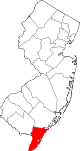
Boroughs Townships Dennis Township | Lower Township | Middle Township | Upper Township
CDPs Communities Beesley's Point | Dennisville | Goshen | Green Creek | Marmora | Ocean View | South Dennis | Swainton | Tuckahoe
Categories:- Townships in Cape May County, New Jersey


Wikimedia Foundation. 2010.