- Orchard Homes, Montana
-
Orchard Homes, Montana — CDP — Location of Orchard Homes, Montana
Coordinates: 46°51′36″N 114°3′29″W / 46.86°N 114.05806°WCoordinates: 46°51′36″N 114°3′29″W / 46.86°N 114.05806°W Country United States State Montana County Missoula Area – Total 6.6 sq mi (17.2 km2) – Land 6.4 sq mi (16.5 km2) – Water 0.3 sq mi (0.7 km2) Elevation 3,153 ft (961 m) Population (2000) – Total 5,199 – Density 814.9/sq mi (314.6/km2) Time zone Mountain (MST) (UTC-7) – Summer (DST) MDT (UTC-6) Area code(s) 406 FIPS code 30-55675 GNIS feature ID 0788477 Orchard Homes is a census-designated place (CDP) in Missoula County, Montana, United States. It is part of the 'Missoula, Montana Metropolitan Statistical Area'. The population was 5,199 at the 2000 census. Orchard homes is a suburb of Missoula.
Geography
Orchard Homes is located at 46°51′36″N 114°3′29″W / 46.86°N 114.05806°W (46.860044, -114.058028)[1].
According to the United States Census Bureau, the CDP has a total area of 6.6 square miles (17 km2), of which, 6.4 square miles (17 km2) of it is land and 0.3 square miles (0.78 km2) of it (3.92%) is water.
Demographics
As of the census[2] of 2000, there were 5,199 people, 2,034 households, and 1,466 families residing in the CDP. The population density was 814.9 people per square mile (314.6/km²). There were 2,091 housing units at an average density of 327.8/sq mi (126.5/km²). The racial makeup of the CDP was 95.35% White, 0.13% African American, 1.35% Native American, 1.29% Asian, 0.12% Pacific Islander, 0.52% from other races, and 1.25% from two or more races. Hispanic or Latino of any race were 1.35% of the population.
There were 2,034 households out of which 31.7% had children under the age of 18 living with them, 58.9% were married couples living together, 9.6% had a female householder with no husband present, and 27.9% were non-families. 21.0% of all households were made up of individuals and 7.9% had someone living alone who was 65 years of age or older. The average household size was 2.55 and the average family size was 2.96.
In the CDP the population was spread out with 24.2% under the age of 18, 9.7% from 18 to 24, 25.1% from 25 to 44, 28.4% from 45 to 64, and 12.6% who were 65 years of age or older. The median age was 40 years. For every 100 females there were 95.3 males. For every 100 females age 18 and over, there were 94.2 males.
The median income for a household in the CDP was $40,240, and the median income for a family was $47,612. Males had a median income of $32,226 versus $20,576 for females. The per capita income for the CDP was $17,885. About 4.4% of families and 6.7% of the population were below the poverty line, including 7.3% of those under age 18 and 4.3% of those age 65 or over.
References
- ^ "US Gazetteer files: 2010, 2000, and 1990". United States Census Bureau. 2011-02-12. http://www.census.gov/geo/www/gazetteer/gazette.html. Retrieved 2011-04-23.
- ^ "American FactFinder". United States Census Bureau. http://factfinder.census.gov. Retrieved 2008-01-31.
Municipalities and communities of Missoula County, Montana City 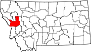
CDPs Bonner-West Riverside | Clinton | East Missoula | Evaro | Frenchtown | Lolo | Orchard Homes | Seeley Lake | Wye
Unincorporated
communitiesGhost town Hell Gate | Coloma
Indian reservation Footnotes ‡This populated place also has portions in an adjacent county or counties
Categories:- Populated places in Missoula County, Montana
- Municipalities and communities of Missoula County, Montana
- Census-designated places in Montana


Wikimedia Foundation. 2010.