- Gretna, Louisiana
-
City of Gretna City  Gretna City Hall
Country United States State Louisiana Parish Jefferson Elevation 0 ft (0 m) [1] Coordinates 29°54′59″N 90°03′15″W / 29.91639°N 90.05417°W Area 3.9 sq mi (10.1 km2) - land 3.5 sq mi (9 km2) - water 0.4 sq mi (1 km2), 10.26% Population 17,736 (2010) Density 4,983.9 / sq mi (1,924.3 / km2) Mayor Ronnie C. Harris Timezone CST (UTC-6) - summer (DST) CDT (UTC-5) ZIP codes 70053, 70056 Area code 504 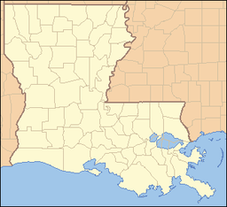
 Location of Gretna in Louisiana
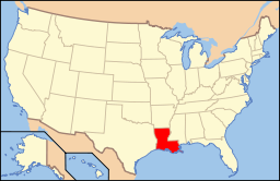 Location of Louisiana in the United States
Website: http://www.gretnala.com The city of Gretna is the parish seat of Jefferson Parish, in the US state of Louisiana. [2] [3] Gretna is on the west bank of the Mississippi River, just east and across the river from uptown New Orleans. It is part of the New Orleans–Metairie–Kenner Metropolitan Statistical Area. The population was 17,736 at the 2010 census.
Contents
History
Gretna was settled in 1836,[4] originally as Mechanicsham, growing with a station on the Mississippi River for the Missouri Pacific Railroad, Texas and Pacific Railway, and Southern Pacific Railroad, with a ferry across the River to New Orleans. The famous spice-maker Zatarain's was founded here in 1889. Gretna was incorporated in 1913, absorbing the section of McDonogh within the Jefferson Parish boundaries. In the 1940 census, Gretna had a population of 10,879.
Hurricane Katrina controversy
 High water along the Mississippi River levee at Gretna, 2005
The City of Gretna received considerable press coverage when, in the aftermath of Hurricane Katrina (late August 2005), people who attempted to escape from New Orleans by walking over the Crescent City Connection bridge over the Mississippi River were turned back at gunpoint by City of Gretna Police, along with Crescent City Connection Police and Jefferson Parish Sheriff's deputies, who set up a roadblock on the bridge in the days following the hurricane. According to eyewitnesses, some of these officers threatened to shoot New Orleans residents and tourists as they attempted to cross into Gretna on foot.[5]
Geography
Gretna is located on 29°54′59″N 90°3′15″W / 29.91639°N 90.05417°W (29.916459, -90.054260) [6] and has an elevation of 0 feet (0 m).[1]
According to the United States Census Bureau, the city has a total area of 3.9 square miles (10 km2), of which, 3.5 square miles (9.1 km2) of it is land and 0.4 square miles (1.0 km2) of it (9.33%) is water.
Demographics
Historical populations Census Pop. %± 1920 7,197 — 1930 9,584 33.2% 1940 10,879 13.5% 1950 13,813 27.0% 1960 21,967 59.0% 1970 24,875 13.2% 1980 20,615 −17.1% 1990 17,208 −16.5% 2000 17,423 1.2% 2010 17,736 1.8% U.S. Decennial Census As of the census[7] of 2000, there were 17,423 people,[3] 6,958 households, and 4,286 families residing in the city. The population density was 4,983.9 people per square mile (1,922.0/km²). There were 7,665 housing units at an average density of 2,192.6 per square mile (845.6/km²). The racial makeup of the city was 56.32% White, 35.53% African American, 0.60% Native American, 3.12% Asian, 0.05% Pacific Islander, 2.63% from other races, and 1.75% from two or more races. Hispanic or Latino of any race were 6.34% of the population.
There were 6,958 households out of which 27.7% had children under the age of 18 living with them, 35.7% were married couples living together, 19.6% had a female householder with no husband present, and 38.4% were non-families. 32.7% of all households were made up of individuals and 11.3% had someone living alone who was 65 years of age or older. The average household size was 2.40 and the average family size was 3.06.
In the city the population was spread out with 23.8% under the age of 18, 10.2% from 18 to 24, 30.6% from 25 to 44, 21.4% from 45 to 64, and 14.0% who were 65 years of age or older. The median age was 36 years, higher than Louisiana's median age of 34.0 years. For every 100 females, there were 100.1 males. For every 100 females age 18 and over, there were 98.3 males.
The median income for a household in the city was $28,065, and the median income for a family was $31,881. Males had a median income of $28,259 versus $21,019 for females. The per capita income for the city was $15,735. About 20.8% of families and 24.2% of the population were below the poverty line, including 34.7% of those under age 18 and 20.2% of those age 65 or over.
Government and infrastructure
 Gretna Post Office
The United States Postal Service operates the Gretna Post Office.[8]
Education
Primary and secondary schools
Gretna's public schools are operated by the Jefferson Parish Public Schools system. Schools serving portions of the city limits are in the City of Gretna unless otherwise noted. Zoned elementary schools serving sections of Gretna include Shirley T. Johnson Gretna Park Elementary School, William Hart Elementary School, McDonogh #26 Elementary School, Kate Middleton Elementary School in the unincorporated area of Terrytown, and George Cox Elementary School in an unincorporated area.[9]
Most residents are zoned to Gretna Middle School, while some are zoned to Livaudais Middle School in Terrytown[10] Most residents are zoned to West Jefferson High School in Harvey, an unincorporated area, while some are zoned to Helen Cox High School, located in an unincorporated area.[11]
L. W. Ruppel Academy, a 5-7 magnet school, is in Gretna.[12] Thomas Jefferson High School [1] is a magnet school in Gretna.
Public libraries
Jefferson Parish Library operates the Gretna Public Library in Gretna. The current facility, with more than 5,800 square feet (540 m2) of space, opened on March 17, 2010. The library includes a 1,000-square-foot (93 m2) meeting room that can accommodate 58 people. The library is almost twice the size of the previous 3,000-square-foot (280 m2) facility.[13]
 Gretna Police Department
Culture
- In his book "On the Road", author Jack Kerouac mentions Gretna.
- Portions of the movie "A Love Song for Bobby Long" were filmed in Gretna.
Notable natives and residents
- Joseph Cao, attorney and former U.S. Representative
- Joe Clay (rockabilly musician)
- Kiem Do (former captain and deputy chief of staff for operations in the Republic of Vietnam Navy)
- Frankie Ford (rock and roll performer)
- John Fourcade (former New Orleans Saints quarterback)
- Emmett Hardy (early jazz great)
- Lash La Rue (Western film actor)
- Greg Monroe, sophomore forward for the Georgetown Hoyas men's basketball team and projected first-round NBA draft pick in 2010
- Mel Ott (1909–1958), baseball hall of famer
- Stanley Joseph Ott, Roman Catholic bishop
- Elfrid Payton (Canadian Football League defensive lineman)
- Ike Taylor, Defensive Back for the Pittsburgh Steelers
- Ricky Templet, Republican state representative from Jefferson Parish; member of Gretna City Council
- Steve Theriot, Certified Public Accountant in Gretna, member of the Louisiana House of Representatives from 1988–1996, and state legislative auditor from 2004–2009, interim Jefferson Parish President
- Joseph F. Toomy, insurance broker and Republican former member of the Louisiana House of Representatives from Jefferson Parish
- Fritz Windhorst, attorney and Republican member of the Louisiana State Senate from 1972–1992
- Stephen J. Windhorst, judge and Republican former member of the Louisiana House
• Daisy Parker, first wife of Louis Armstrong; the couple wed in 1918.
See also
References
- ^ a b "Gretna, Louisiana". Geographic Names Information System. United States Geological Survey. June 4, 1980. http://geonames.usgs.gov/pls/gnispublic/f?p=gnispq:3:::NO::P3_FID:1629954. Retrieved 2008-02-05.
- ^ "Gretna, Louisiana (LA) Detailed Profile" (notes), City Data, 2007, webpage: C-Gretna.
- ^ a b "Census 2000 Data for the State of Louisiana" (town list), US Census Bureau, May 2003, webpage: C2000-LA.
- ^ "City of Gretna". City of Gretna. http://www.gretnala.com. Retrieved 2007-08-30.
- ^ "Police in Suburbs Blocked Evacuees, Witnesses Report". New York Times. 2005-09-10. http://www.nytimes.com/2005/09/10/national/nationalspecial/10emt.html?_r=1. Retrieved 2010-09-19.
- ^ "US Gazetteer files: 2010, 2000, and 1990". United States Census Bureau. 2011-02-12. http://www.census.gov/geo/www/gazetteer/gazette.html. Retrieved 2011-04-23.
- ^ "Gretna, Louisiana Fact Sheet". United States Census Bureau. http://factfinder.census.gov/servlet/SAFFFacts?_event=&geo_id=16000US2231915&_geoContext=01000US%7C04000US22%7C16000US2231915&_street=&_county=Gretna&_cityTown=Gretna&_state=04000US22. Retrieved 2008-02-13.
- ^ "Post Office™ Location - GRETNA." United States Postal Service. Retrieved on September 27, 2010.
- ^ "Westbank Elementary." Jefferson Parish Public School System. Retrieved on September 26, 2010.
- ^ "Westbank Middle." Jefferson Parish Public School System. Retrieved on September 26, 2010.
- ^ "Westbank High." Jefferson Parish Public School System. Retrieved on September 26, 2010.
- ^ "L. W. Ruppel Academy." City of Gretna. Retrieved on September 26, 2010.
- ^ "The New Gretna Library Opens." Jefferson Parish Library. Retrieved on September 28, 2010.
External links
- City of Gretna Website
- Gretna Police Department
- Gretna Heritage Festival
- The real heroes and sheroes of New Orleans (First report of the bridge incident that was later picked up by major media.)
- March to Gretna
- "The Bridge to Gretna" story from CBS News 60 Minutes program, December 18, 2005
Audio and video
- Trapped in New Orleans: Emergency Medical Worker Describes How Police Prevented Evacuation, from Pacifica Democracy Now! program, September 16, 2005
Municipalities and communities of Jefferson Parish, Louisiana Parish seat: GretnaCities 
Towns CDPs Avondale | Barataria | Bridge City | Elmwood | Estelle | Harvey | Jefferson | Lafitte | Marrero | Metairie | River Ridge | Terrytown | Timberlane | Waggaman | Woodmere
Categories:- Cities in Louisiana
- Populated places in Jefferson Parish, Louisiana
- Greater New Orleans
- Parish seats in Louisiana
- Populated places established in 1836


Wikimedia Foundation. 2010.