- Ohlweiler
-
Ohlweiler 
 OhlweilerLocation of Ohlweiler within Rhein-Hunsrück-Kreis district
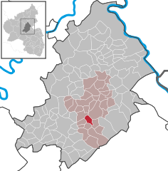
Coordinates 49°57′58″N 7°29′55″E / 49.96611°N 7.49861°ECoordinates: 49°57′58″N 7°29′55″E / 49.96611°N 7.49861°E Administration Country Germany State Rhineland-Palatinate District Rhein-Hunsrück-Kreis Municipal assoc. Simmern Mayor Walter Poppek Basic statistics Area 3.91 km2 (1.51 sq mi) Elevation 320 m (1050 ft) Population 342 (31 December 2010)[1] - Density 87 /km2 (227 /sq mi) Other information Time zone CET/CEST (UTC+1/+2) Licence plate SIM Postal code 55469 Area code 06761 Ohlweiler is an Ortsgemeinde – a municipality belonging to a Verbandsgemeinde, a kind of collective municipality – in the Rhein-Hunsrück-Kreis (district) in Rhineland-Palatinate, Germany. It belongs to the Verbandsgemeinde of Simmern, whose seat is in the like-named town.
Contents
Geography
Location
The municipality, a rural residential community, lies in the central Hunsrück in the Simmerbach valley at the mouth of the Holzbach. Ohlweiler lies roughly 3 km southwest of Simmern and 7 km northeast of Kirchberg.
History
In 1310, Ohlweiler had its first documentary mention. The village belonged to the Duchy of Palatinate-Simmern, which introduced the Reformation in 1556. Later, the Elector of the Rhine was the landholder. Beginning in 1794, Ohlweiler lay under French rule. In 1815 it was assigned to the Kingdom of Prussia at the Congress of Vienna. Since 1946, it has been part of the then newly founded state of Rhineland-Palatinate.
Politics
Municipal council
The council is made up of 8 council members, who were elected by majority vote at the municipal election held on 7 June 2009, and the honorary mayor as chairman[2].
Mayor
Ohlweiler’s mayor is Walter Poppek[3].
Culture and sightseeing
 Ohlweiler Evangelical Church
Buildings
The following are listed buildings or sites in Rhineland-Palatinate’s Directory of Cultural Monuments:[4]
- Evangelical church, Kirchenweg – Classicist aisleless church, 1788, tower partly from the 14th century
- Beside Hauptstraße 17 – bakehouse, one-floor brick building, partly timber-frame, half-hipped roof, late 19th century
Economy and infrastructure
Transport
Bundesstraße 50 is found on the municipality’s outskirts. The Schinderhannes-Radweg (cycle path) runs through the village.
References
- ^ "Bevölkerung der Gemeinden am 31.12.2010" (in German). Statistisches Landesamt Rheinland-Pfalz. 31 December 2010. http://www.statistik.rlp.de/fileadmin/dokumente/berichte/A1033_201022_hj_G.pdf.
- ^ Municipal election results for Ohlweiler
- ^ Ohlweiler’s mayor
- ^ Directory of Cultural Monuments in Rhein-Hunsrück district
External links
- This article incorporates information from the German Wikipedia.
Categories:- Municipalities in Rhineland-Palatinate
- Rhein-Hunsrück geography stubs


Wikimedia Foundation. 2010.