- Oberhosenbach
-
Oberhosenbach 

 OberhosenbachLocation of Oberhosenbach within Birkenfeld district
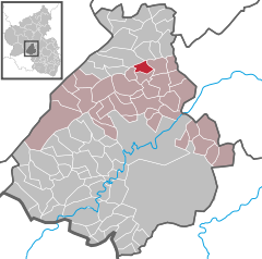
Coordinates 49°48′52″N 7°19′53″E / 49.81444°N 7.33139°ECoordinates: 49°48′52″N 7°19′53″E / 49.81444°N 7.33139°E Administration Country Germany State Rhineland-Palatinate District Birkenfeld Municipal assoc. Herrstein Mayor Kirsten Beetz Basic statistics Area 4.14 km2 (1.60 sq mi) Elevation 430 m (1411 ft) Population 159 (31 December 2010)[1] - Density 38 /km2 (99 /sq mi) Other information Time zone CET/CEST (UTC+1/+2) Licence plate BIR Postal code 55758 Area code 06785 Website www.vg-herrstein.de Oberhosenbach is an Ortsgemeinde – a municipality belonging to a Verbandsgemeinde, a kind of collective municipality – in the Birkenfeld district in Rhineland-Palatinate, Germany. It belongs to the Verbandsgemeinde of Herrstein, whose seat is in the like-named municipality.
Contents
Geography
Location
The municipality lies roughly 18 km north of Idar-Oberstein near the Deutsche Edelsteinstraße (“German Gem Road”) and the Hunsrück Schiefer- und Burgenstraße (“Hunsrück Slate and Castle Road”). Half the municipal area is wooded.
History
In 1318, Oberhosenbach had its first documentary mention as Volmarshusenbach.
Politics
Municipal council
The council is made up of 6 council members, who were elected by majority vote at the municipal election held on 7 June 2009, and the honorary mayor as chairwoman[2].
Mayor
Oberhosenbach’s mayor is Kirsten Beetz, and her deputies are Reinhold Noll and Gabriele Wolter[3].
Coat of arms
The municipality’s arms might be described thus: Per bend vert a cross Latin Or and Or a lion rampant gules armed and langued azure.
Culture and sightseeing
Buildings
The following are listed buildings or sites in Rhineland-Palatinate’s Directory of Cultural Monuments:[4]
- Hauptstraße 9 – Quereinhaus (a combination residential and commercial house divided for these two purposes down the middle, perpendicularly to the street), Firstständer building, 1696
- Hauptstraße 34 – Quereinhaus, 1903; bakehouse typical of the time of building
Economy and infrastructure
Transport
Running south of the municipality is Bundesstraße 41. Serving nearby Fischbach is a railway station on the Nahe Valley Railway (Bingen–Saarbrücken).
References
- ^ "Bevölkerung der Gemeinden am 31.12.2010" (in German). Statistisches Landesamt Rheinland-Pfalz. 31 December 2010. http://www.statistik.rlp.de/fileadmin/dokumente/berichte/A1033_201022_hj_G.pdf.
- ^ Kommunalwahl Rheinland-Pfalz 2009, Gemeinderat
- ^ Oberhosenbach’s council
- ^ Directory of Cultural Monuments in Birkenfeld district
External links
- Municipality’s official webpage (German)
- This article incorporates information from the German Wikipedia.
Categories:- Municipalities in Rhineland-Palatinate
- Birkenfeld district geography stubs


Wikimedia Foundation. 2010.