- Mettweiler
-
Mettweiler 

 MettweilerLocation of Mettweiler within Birkenfeld district
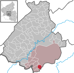
Coordinates 49°34′48″N 7°18′55″E / 49.58°N 7.31528°ECoordinates: 49°34′48″N 7°18′55″E / 49.58°N 7.31528°E Administration Country Germany State Rhineland-Palatinate District Birkenfeld Municipal assoc. Baumholder Mayor Kurt Weingarth Basic statistics Area 5.50 km2 (2.12 sq mi) Elevation 445 m (1460 ft) Population 264 (31 December 2010)[1] - Density 48 /km2 (124 /sq mi) Other information Time zone CET/CEST (UTC+1/+2) Licence plate BIR Postal code 55777 Area code 06783 Mettweiler is an Ortsgemeinde – a municipality belonging to a Verbandsgemeinde, a kind of collective municipality – in the Birkenfeld district in Rhineland-Palatinate, Germany. It belongs to the Verbandsgemeinde of Baumholder, whose seat is in the like-named town.
Contents
Geography
Location
The municipality lies in the Westrich, an historic region that encompasses areas in both Germany and France. The municipal area is 47% wooded.
Neighbouring municipalities
Mettweiler borders in the north on the town of Baumholder, in the southeast on the municipality of Thallichtenberg and in the west on the municipalities of Berschweiler bei Baumholder and Fohren-Linden.
Politics
Municipal council
The council is made up of 6 council members, who were elected by majority vote at the municipal election held on 7 June 2009, and the honorary mayor as chairman[2].
Mayor
Mettweiler’s mayor is Kurt Weingarth[3].
Coat of arms
The municipality’s arms might be described thus: Per fess argent issuant from the line of partition a demilion azure armed and langued gules, and azure two ears of wheat couped per saltire surmounted by a bell Or.
The charge in the upper part of the escutcheon, the lion, is a reference to the village’s former allegiance to the County of Veldenz.
Culture and sightseeing
Regular events
Each year, a kermis and a Brunnenfest (“Fountain Festival”) are held.
Economy and infrastructure
Transport
To the south runs the Autobahn A 62 (Kaiserslautern–Trier). Serving nearby Heimbach is a railway station on the Nahe Valley Railway (Bingen–Saarbrücken).
References
- ^ "Bevölkerung der Gemeinden am 31.12.2010" (in German). Statistisches Landesamt Rheinland-Pfalz. 31 December 2010. http://www.statistik.rlp.de/fileadmin/dokumente/berichte/A1033_201022_hj_G.pdf.
- ^ Kommunalwahl Rheinland-Pfalz 2009, Gemeinderat
- ^ Mettweiler’s mayor
External links
- This article incorporates information from the German Wikipedia.
Categories:- Municipalities in Rhineland-Palatinate
- Birkenfeld district geography stubs


Wikimedia Foundation. 2010.