- Haugh of Urr
-
Coordinates: 54°58′41″N 3°52′05″W / 54.978°N 3.868°W
Haugh of Urr 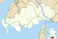
 Haugh of Urr
Haugh of Urr shown within Dumfries and GallowayOS grid reference NX8066 Council area Dumfries and Galloway Lieutenancy area Kirkcudbrightshire Country Scotland Sovereign state United Kingdom Post town CASTLE DOUGLAS Postcode district DG7 Dialling code 01556 Police Dumfries and Galloway Fire Dumfries and Galloway Ambulance Scottish EU Parliament Scotland UK Parliament Dumfries and Galloway Scottish Parliament Dumfries List of places: UK • Scotland • Haugh of Urr, is a village in the Urr parish, Kirkcudbrightshire, in South West Scotland. It is approximately 4 miles (6.4 km) NNW of Dalbeattie, 3 miles (4.8 km) NE of Castle Douglas, 12½ miles west of Dumfries and 12½ miles east of Kirkcudbright. It is pronounced hoch of ur, with Haugh rhyming with the Scottish pronunciation of loch.
Town Local authority Co-ordinates OS grid reference Haugh of Urr Dumfries and Galloway 54°58′N 3°52′W / 54.97°N 03.87°W NX8066 Contents
Description
The village is situated beside the River Urr. (Scots 'Haugh' or 'hauch' means river-meadow or a level piece of ground beside a stream. From the Old English halh, healh meaning corner, nook).[1] It has one pub, the Laurie Arms which incorporates a part-time Post Office, one Church (Church of Scotland), a Village Hall, a Scout hut, and a small village green. The village no longer has any shops. It used to have two shops, one of which included a petrol filling station, while the other included a full-time post office, which reduced to part time in later years. The last shop closed in 2009. Hardgate is a nearby hamlet up the hill and the boundaries are indistinct. Agriculture and tourism are the mainstays of the local economy. The village is known to locals as "The Haugh".
River Urr
 River Urr near Haugh of Urr, 2007
The River Urr is noted for salmon fishing. The river originates at Glenlair and flows for thirty miles from Loch Urr to its outflow into the Solway Firth at Kippford near Dalbeattie.
Motte of Urr
 Motte of Urr c. 1797
 Motte of Urr 2011
The Motte of Urr, is the site of a motte-and-bailey castle. Today this medieval earthwork near the Haugh of Urr is said to be the most extensive bailey earthwork in Scotland. It lies beside the River Urr to the north west of Dalbeattie. It dates from the 12th century, and covers an area of about 2 ha (5 acres). In the present day, there are no excavations or walls. It is associated with Buittle Castle, a courtyard castle dating to about 1230, which was destroyed early in the 14th century and belonged to Devorgilla and her husband John I de Balliol (founder of Balliol College, at Oxford University). Together they bore the future king John of Scotland.
See also
References
- List of United Kingdom locations: Ha-Hd
External links
- Overview of the village http://www.scottish-places.info/towns/townfirst3245.html
- Urr parish church http://www.dlbteparishch.f9.co.uk/page15.html
- Parish information http://www.genuki.org.uk/big/sct/KKD/Urr/
- Vale of Urr http://www.glenlair.org.uk/vale_of_the_urr.asp
- Unpublished records for the parish of Urr in Kirkcudbrighshire http://donjaggi.net/galloway/index.html
- River Urr http://www.glenlair.org.uk/river_urr.asp
- River Urr http://www.geograph.org.uk/photo/425690
- Motte of Urr http://www.scottish-places.info/features/featurefirst8406.html
- Motte of Urr http://thereformation.info/motte.htm
- Buittle Castle http://www.rcahms.gov.uk/pls/portal/newcanmore.details_gis?inumlink=65002
-

The village, 2006
-

Urr Parish Church, 2006
Categories:- Dumfries and Galloway
- Villages in Dumfries and Galloway
- Dumfries and Galloway geography stubs


Wikimedia Foundation. 2010.