- Dumfries and Galloway
-
Dumfries and Galloway
Dumfries an Gallowa
Dùn Phris is Gall-Ghaidhealaibh
Logo
Location 
Geography Area Ranked 3rd - Total 6,426 km2 (2,481 sq mi) Admin HQ Dumfries ISO 3166-2 GB-DGY ONS code 00QH Demographics Population Ranked 12th - Total (2005) 148,200 - Density 23 / km² Politics Dumfries and Galloway Council
http://www.dumgal.gov.uk/Control Conservative/Liberal Democrat (minority control) MPs MSPs Dumfries and Galloway (Scots: Dumfries an Gallowa; Scottish Gaelic: Dùn Phrìs is Gall-Ghaidhealaibh, pronounced [t̪unˈfɾʲiʃ akəs̪ əŋ kaulˠ̪ɣəlˠ̪əv]) is one of 32 unitary council areas of Scotland. It was one of the nine administrative 'regions' of mainland Scotland created in 1975 by the Local Government etc. (Scotland) Act 1973. It resulted from a union of the historic region of Galloway - consisting of the counties of Wigtownshire and Kirkcudbrightshire - and the County of Dumfries (Dumfries-shire), hence "Dumfries and Galloway". The regions were abolished by the Local Government etc. (Scotland) Act 1994 and Dumfries and Galloway became one of the new council areas in 1996.
To the north, the council borders South Ayrshire, East Ayrshire and South Lanarkshire; in the east the Borders; and to the south the county of Cumbria in England. It lies to the north of the Solway Firth and to the east of the Irish Sea. The region is well-known for its many artists and writers.
Contents
Geography
The Dumfries and Galloway region is composed of several sub areas and former counties.
From west to east:- Wigtownshire
- Rhins of Galloway • Machars (archaically, Farines)
- Kirkcudbrightshire
- Dumfriesshire
The term 'Dumfries and Galloway' has been used since at latest the 19th century - by 1911 the three counties had a united Sheriffdom under that name. Dumfries and Galloway covers the majority of the Western area of the Southern Uplands [1], it also hosts Scotland's most Southerly point, at the Mull of Galloway[1] in the west of the region.
Water systems and transport routes through the Southern Uplands
The region has a number of south running water systems which break through the Southern Uplands creating the main road, and rail, arteries north/south through the region and breaking the hills up into a number of ranges.
- River Cree valley carries the A714 north-westward from Newton Stewart to Girvan and Water of Minnoch valley which lies just west of the Galloway Hills carries a minor road northward through Glentrool village into South Ayrshire. This road leaves the A714 at Bargrennan.
- Water of Ken and River Dee form a corridor through the hills called the Glenkens[2] which carries the A713 road from Castle Douglas to Ayr. The Galloway Hills lie to the west of this route through the hills and the Carsphairn and Scaur Hills lie to the east.
- River Nith rises between Dalmellington and New Cumnock in Ayrshire and runs east then south down Nithsdale to Dumfries. Nithsdale carries both the A76 road and the rail line from Dumfries to Kilmarnock. It separates the Carsphairn and Scaur Hills from the Lowther Hills which lie east of the Nith.
- River Annan combines with Evan Water and the River Clyde to form one of the principal routes into central Scotland from England - through Annandale and Clydesdale - carrying the M74 and the west coast railway line. This gap through the hills separates the Lowthers from the Moffat Hills.
- River Esk enters the Solway Firth just south of Gretna having travelled south from Langholm and Eskdalemuir. The A7 travels up Eskdale as far as Langholm and from Langholm carries on up the valley of Ewes Water to Teviothead where it starts to follow the River Teviot to Hawick. Eskdale itself heads north west from Langholm through Bentpath and Eskdalemuir to Ettrick and Selkirk.
The A701 branches off the M74 at Beattock, goes through the town of Moffat, climbs to Annanhead above the Devil's Beef Tub (at the source of the River Annan) before passing the source of the River Tweed and carrying on to Edinburgh. Until fairly recent times the ancient route to Edinburgh travelled right up Annandale to the Beef Tub before climbing steeply to Annanhead.[3] The present road ascends northward on a ridge parallel to Annandale but to the west of it which makes for a much easier ascent.
From Moffat the A708 heads north east along the valley of Moffat Water (Moffatdale) on its way to Selkirk. Moffatdale separates the Moffat hills (to the north) from the Ettrick hills to the south.
National Scenic Areas
There are three National Scenic Areas within this region.
- Nith Estuary[4] - This area follows the River Nith southward from just south of Dumfries into the Solway Firth. Dumfries itself has a rich history going back over 800 years as a Royal Burgh (1186) and is particularly remembered as the place where Robert the Bruce murdered the Red Comyn in 1306 before being crowned King of Scotland - and where Robert Burns spent his last years. His mausoleum is in St Michael's graveyard. Going down the east bank there is the village of Glencaple, Caerlaverock Castle, Caerlaverock Wild Fowl Trust, an ancient Roman fort on Ward Law Hill[5] and neaby in Ruthwell is the Ruthwell Cross and the Brow Well[6] where Robert Burns "took the waters" and bathed in the Solway just before his death. On the west bank, there are several walks and cycle routes in Mabie Forest,[7] Kirkconnell Flow[8] for the naturalist, the National Museum of Costume[9] just outside New Abbey and Sweetheart Abbey within the village. Criffel (569 metres) offers the hill walker a reasonably modest walk with excellent views across the Solway to the Lake District. The house of John Paul Jones founder of the American Navy is also open to visitors near Kirkbean.
- East Stewartry[10] - This takes in the coast line from Balcary Point[11] eastward across Auchencairn Bay and the Rough Firth past Sandyhills to Mersehead.[12] There are several attractive coastal villages within this area - Auchencairn, Kippford, Colvend, Rockcliffe, and Portling. There is also a unigue round tower at Orchardton and the islands of Hestan Isle and Rough Island can be reached at low tide outside the breeding season for birds. Mersehead is an excellent wildfowl reserve. The area is well provided with coastal paths.
- Fleet Valley[13] - This area takes in Fleet Bay with its popular holiday destinations of Auchenlarie, Mossyard Bay, Cardoness, Sandgreen and Carrick Shore. The area also includes the town of Gatehouse of Fleet and the historic villages of Anworth and Girthon - there is a castle at Cardoness in the care of Historic Scotland. There are pleasant hills to walk in around Cairnharrow and Kenlum and Castramon Wood at the north end of the area is a joy particularly with the bluebells in spring.[neutrality is disputed]
Governance
The region was created in 1975, by merging the former counties of Wigtownshire, Kirkcudbrightshire and Dumfriesshire as a two-tier region with the districts of Wigtownshire, Stewartry, Nithsdale and Annandale and Eskdale within it. In 1996 the region became a unitary authority area and the districts were wound up. After 1996 the unitary authority became known as Dumfries and Galloway Council, instead of Dumfries and Galloway Regional Council.
Transport
Transport in the region is operated by bus companies Huston's, McEwan's, Stagecoach Western and Mcall's coaches, and train operators Scot Rail First, Transpennine Express and Virgin Trains & Planes
Railway
 A Virgin Pendolino leaving Lockerbie station for Carlisle
The region has 7 working railway stations. All are on the Glasgow South Western Line, except Lockerbie which is on the West Coast Main Line.
- Stranraer railway station
- Kirkconnel railway station
- Sanquhar railway station
- Dumfries railway station
- Annan railway station
- Gretna Green railway station
- Lockerbie railway station
Bus and coach
The area is served by buses which connect the main population centres. Express bus services link the main towns with Glasgow, Ayr, Edinburgh and Carlisle. Local bus services are also operated across the region.
Sea

Dumfries and Galloway is home to two ports which have services to Northern Ireland, both are in the West of the region. Stena Line have a port in the town of Stranraer, and P&O Irish Sea in the village of Cairnryan.
Air
The region also has no commercial airports; the nearest are Glasgow Prestwick Airport and Carlisle Lake District Airport. The region does host a number of private airfields. The town of Lockerbie was the scene of the Pan Am Flight 103 terrorist attack on December 21, 1988.
Roads
The main roads to and from the region are:
Emergency services
The Dumfries and Galloway Constabulary is the police force for the region, and is the smallest in the United Kingdom. Dumfries and Galloway Fire and Rescue Service provide firefighting services across the region. The Coastguard, Lifeboats, Moffat mountain rescue and Galloway Mountain Rescue also offer emergency services across Dumfries and Galloway.
NHS Dumfries and Galloway provide healthcare services across the region. The two main hospitals are the Dumfries and Galloway Royal Infirmary in Dumfries and Galloway Community Hospital in Stranraer.
Education
Dumfries & Galloway Council provides nursery, primary and secondary education across the region.
Alternative Schools
Nurseries and primary schools
For a list of nurseries and primary schools see this page.
Secondary schools
 Stranraer Academy.
- Annan Academy
- Castle Douglas High School
- Dalbeattie High School
- Douglas Ewart High School, Newton Stewart
- Dalry Secondary School
- Dumfries Academy
- Dumfries High School
- Kirkcudbright Academy
- Langholm Academy
- Lockerbie Academy
- Maxwelltown High School, Dumfries
- Moffat Academy
- Sanquhar Academy
- St Joseph's College
- Stranraer Academy
- Wallace Hall Academy, Thornhill
Wildlife
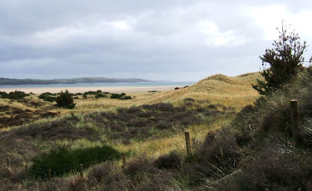
The region is known as a stronghold for several rare and protected species of amphibian, such as the Natterjack toad and the Great crested newt.[14] There are also RSPB Nature Reserves at the Mull of Galloway,[15] Wood of Cree (Galloway Forest Park),[16] Ken Dee Marshes (near Loch Ken)[17] and Mereshead (near Dalbeattie on the Solway Firth)
 Welcome sign
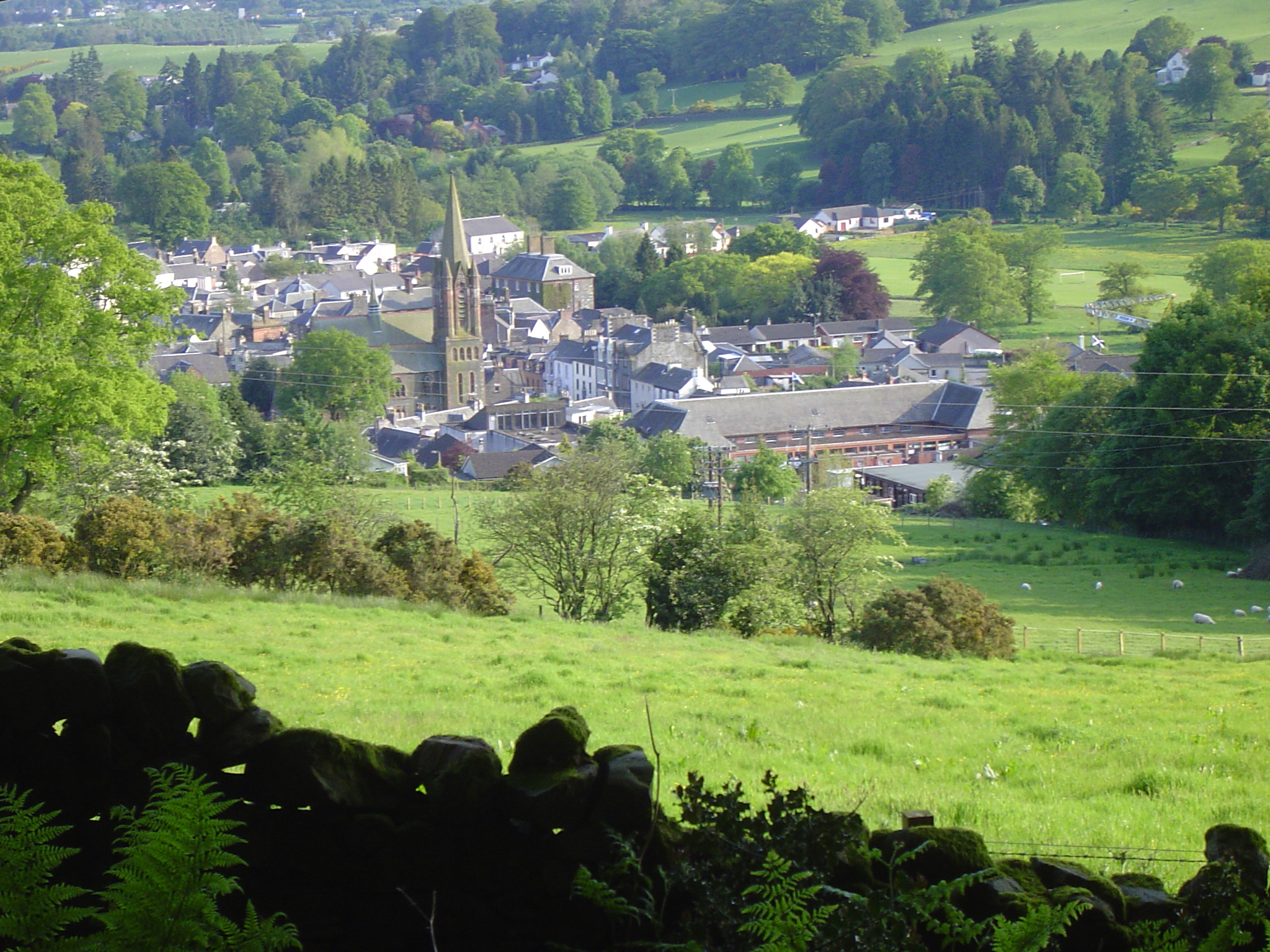
Towns and villages
Main settlements in bold text.
- Ae, Airieland, Airds of Kells, Annan, Anwoth, Ardwell
- Beattock, Beeswing, Borgue, Brydekirk
- Caerlaverock, Cairngaan, Cairnryan, Cargenbridge, Carsphairn, Castle Douglas, Castle Kennedy, Clarencefield, Corsock, Creetown
- Dalbeattie, Dalton, Dornock, Drumlanrig, Drummore, Dumfries, Dundrennan, Dunscore
- Eastriggs, Ecclefechan, Eskdalemuir
- Garlieston, Gatehouse of Fleet, Glenluce, Gretna Green, Gretna
- Haugh of Urr, Hoddom
- Isle of Whithorn
- Johnsfield, Johnstonebridge
- Keir, Kippford, Kirkcolm, Kirkcudbright, Kirkpatrick Durham
- Langholm, Lochmaben, Lockerbie
- Middleshaw, Millhousebridge, Moffat, Moniaive, Muirhead Mull of Galloway
- New Abbey, New Galloway, New Luce, Newton Stewart, Newton Wamphray
- Palnackie, Parton, Penpont, Portpatrick
- Parkgate
- Robgill Tower, Ringford
- Rigg, Ruthwell,
- Sandhead, Sanquhar, St. John's Town of Dalry, Stranraer
- Terregles, Thornhill, Twynholm, Templand
- Unthank
- Wanlockhead, Whithorn, Wigtown
Places of interest
- Caerlaverock Castle - Historic Scotland
- Caerlaverock NNR - National Nature Reserve
- Cardoness Castle
- Cream o' Galloway
- Corsewall Lighthouse, privately owned
- HM Factory, Gretna, Eastriggs - site of a munitions factory [2] during the World War I
- Drumlanrig Castle
- Galloway Forest Park, Forestry Commission
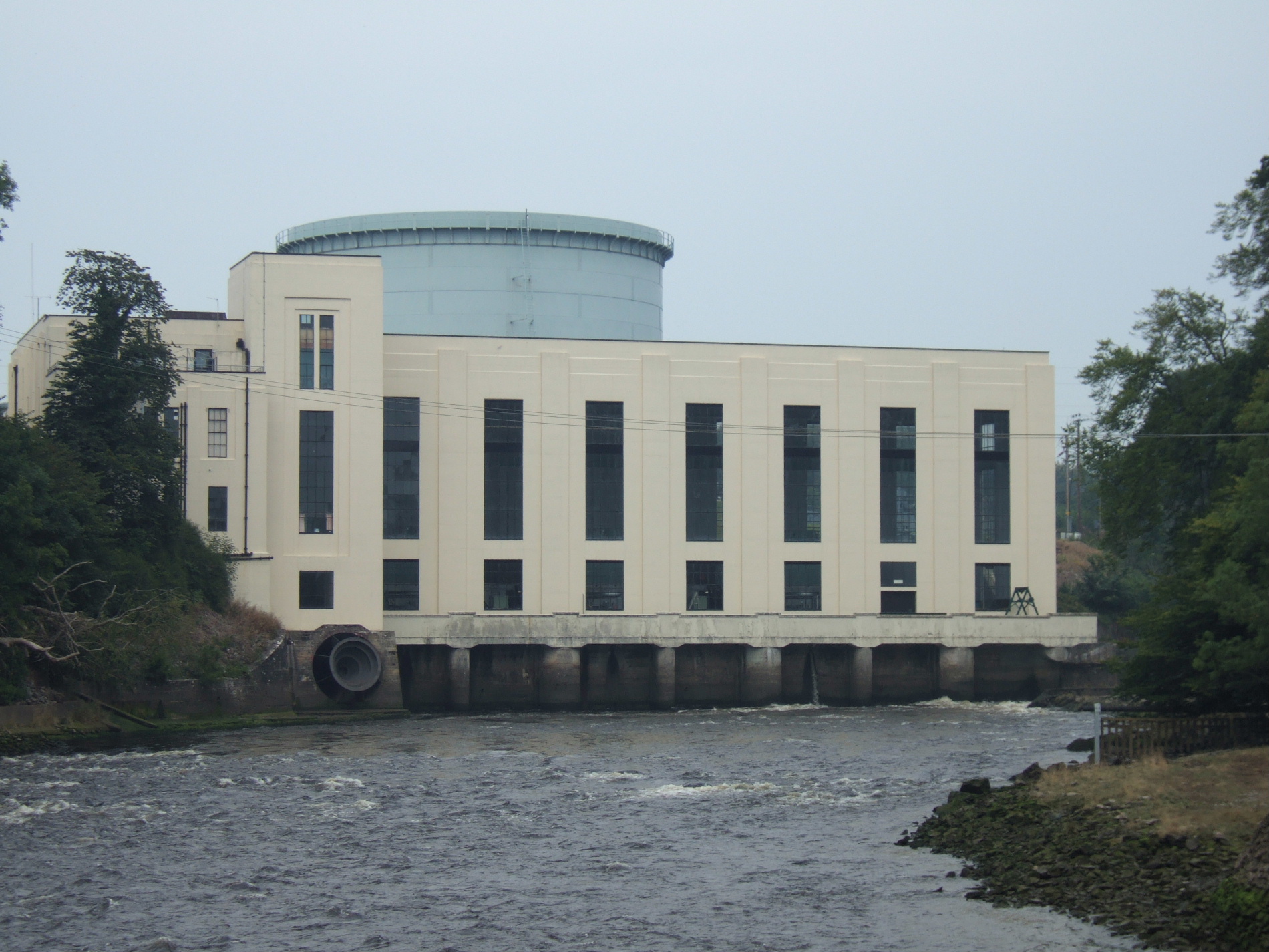
- Galloway Hydro Electric Scheme, Scottish Power
- Glenlair - home of 19th century physicist James Clerk Maxwell
- Glenluce Abbey
- Isle of Whithorn Castle
- Kenmure Castle - a seat of the Clan Gordon
- Loch Ken
- MacLellan's Castle, Kirkcudbright
- Mull of Galloway - RSPB/South Rhins Community Development Trust
- Motte of Urr
- Ruthwell Cross
- Samye Ling Tibetan Monastery
- Southern Upland Way - long distance footpath
- Sweetheart Abbey, New Abbey
- Threave Castle
- WWT Caerlaverock - a reserve of the Wildfowl and Wetlands Trust
Council political composition
The council consists of 47 councillors elected for a four-year term from 13 wards. These wards were introduced for the 2007 election and each returns three or four members by the single transferable vote system of election. This system was introduced by the Local Governance (Scotland) Act 2004,[18] as a means of ensuring a reasonably proportionately representative outcome.
2003–2007
The result of the 2003 election returned a council with no party having overall control.[19] A 'silver' coalition was first formed involving all parties but Conservative and Labour, after this coalition resigned[20] Labour took minority control of the council. The following number of councillors were elected for each party as follows:
Party Councillors Labour 14 Independent 12 Conservative 11 Scottish National Party 5 Liberal Democrat 5 2007–2011
The result of the 2007 election returned the following number of councillors for each party as follows:
Party Councillors Conservative 18 Labour 14 Scottish National Party 10 Liberal Democrat 3 Independent 2 The council is currently controlled by a Conservative and Liberal Democrat minority coalition.
After the resignation of Bruce Hodgson (Conservative councillor for the Abbey ward) a by-election was held on 1 May 2008, with Michael Thomson (Conservative) being returned as the replacement councillor.[21] On Tuesday 20 May 2008, Councillor Robert Higgins stood down as Scottish National Party (SNP) Group Leader, after he received a triple driving ban for reckless driving.[22] Similarly Councillor John Charteris Conservative was banned from driving for 12 months and fined £500 after he to admitted drink driving at Dumfries Sheriff Court on Friday, 29 August 2008 [3]
Current Councillors
By political groupings.
Conservative
- Graham Bell
- Ian Blake
- Ian Carruthers
- John Charteris
- John Dougan
- Peter Duncan Business Leader
- Gillian Dykes
- Patsy Gilroy (Convener)
- Allan Graham
- Roger Grant
- Jack Groom (Provost)
- Ivor Hyslop (Leader) Group Leader
- Ian Lindsay
- Gail MacGregor
- Denis R Male
- Graham Nicol
- Mike Thomson
- Roberta Tuckfield
Labour
- Ted Brown
- James H Dempster
- Archie Dryburgh
- Grahame Forster
- Dr. Jeff Leaver Secretary
- Sean W Marshall
- John Martin
- David J McKie
- Ronnie Nicholson Group Leader
- Ronald E Ogilvie
- Willie Scobie
- Colin Smyth
- David Stitt
- John Syme
Scottish National Party
- Brian Collins
- Rob Davidson Group Leader
- Iain Dick
- Alistair Geddes
- Robert J Higgins
- Thomas Jacques
- Lorna J McGowan Secretary
- Dr. Doug Snell
- Andrew S Wood
- Alastair Witts Deputy Group Leader
Liberal Democrat
- Richard Brodie
- Michael Dickie Secretary
- Sandra McDowall Group Leader
Independent
- Jane S Maitland Group Leader
- George N Prentice Secretary
Gallery
-

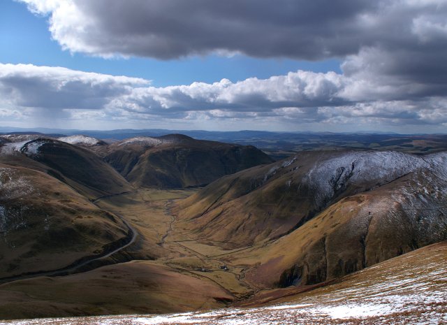
Dalveen Pass from Comb Head summit, near Thornhill, Dumfries and Galloway, Scotland.
-
Lowther Southern Uplands-HDR.jpg
Lowther Hill, somewhere near Dalveen Pass, Dumfries and Galloway, Scotland.
-

Sweetheart Abbey, Dumfries and Galloway (Scotland)
-

Orchardton Tower, Dumfries and Galloway, Scotland
-

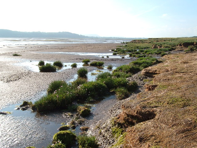
Caerlaverock National Nature Reserve. View across the Nith Estuary, close to the Solway Firth, Dumfries & Galloway.
-

Tongland Power station.
-

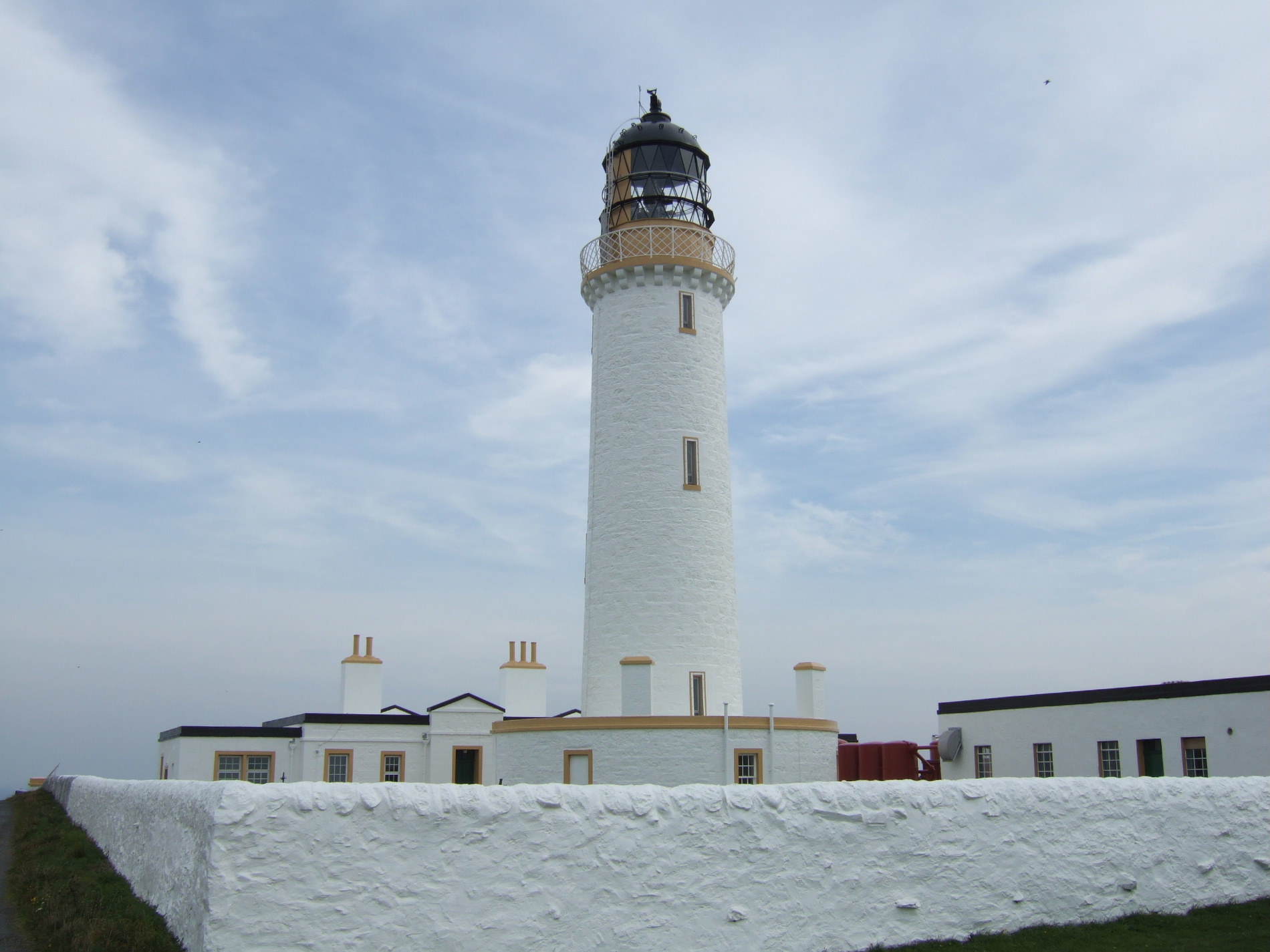
Mull of Galloway headland.
-

Mull of Galloway Lighthouse.
-

A Machars beach.
-

Machars Coastline looking south from Cruggleton Castle.
-

The remains of Cruggleton Castle.
-

The Machars, as viewed from Torrs Warren with Luce Bay standing between.
-

The Devil's Beef Tub.
-

Port William harbour.
-

Moffat.
-

River Nith Estuary.
See also
- Anglo-Scottish border
- Fire and Rescue Authority (Scotland)
References
- ^ www.mull-of-galloway.co.uk
- ^ The Glenkens
- ^ Society of Antiquaries of Scotland Proceedings of the Society Feb 11th 1924 ANCIENT BORDER HIGHWAYS by Harry R G Inglis
- ^ Information of Nith Estuary National Scenic area
- ^ Roman Britain.org - Ward Law
- ^ Dumfries Museum - The Brow Well
- ^ Forestry Commission web page on Mabie Forest and its facilities
- ^ Scotland's Natural Nature Reserves page on the Kirkconnell Flow
- ^ National Museum of Costume web site
- ^ Information on East Stewartry National Scenic Area
- ^ Auchencairn Initiative walk from Balcary to Rascarrel
- ^ RSPB website - Mersehead page
- ^ Information on Fleet Valley National Scenic Area
- ^ BBC NEWS | Scotland | South of Scotland | Rallying cry from frog stronghold
- ^ The RSPB: Mull of Galloway
- ^ The RSPB: Wood of Cree
- ^ The RSPB: Ken-Dee Marshes
- ^ See also Local Governance (Scotland) Act 2004, Office of Public Sector Information (OPSI) website
- ^ BBC NEWS | VOTE 2003 | Dumfries & Galloway
- ^ BBC NEWS | Scotland | Tax defeat leads to resignation
- ^ DGC -Document: By-Election For Abbey Ward - Result
- ^ BBC NEWS | Scotland | South of Scotland | Drive ban councillor quits posts
External links
- Local Authority website
- Dumfries and Galloway at the Open Directory Project
- Walking site dedicated to the south west of Scotland with extensive information on hill and coastal walks.
Council areas of Scotland Aberdeen · Aberdeenshire · Angus · Argyll and Bute · Clackmannanshire · Dumfries and Galloway · Dundee · East Ayrshire · East Dunbartonshire · East Lothian · East Renfrewshire · Edinburgh · Falkirk · Fife · Glasgow · Highland · Inverclyde · Midlothian · Moray · Na h-Eileanan Siar (Western Isles) · North Ayrshire · North Lanarkshire · Orkney · Perth and Kinross · Renfrewshire · Scottish Borders · Shetland · South Ayrshire · South Lanarkshire · Stirling · West Dunbartonshire · West Lothian
Former local government regions of Scotland Categories:- Dumfries and Galloway
- Regions of Scotland
- Council areas of Scotland
- Wigtownshire


Wikimedia Foundation. 2010.