- Dhunat Upazila
-
Dhunat
ধুনট— Upazila — Location in Bangladesh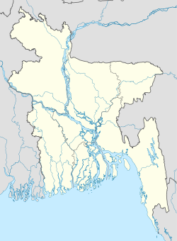
 Dhunat
Coordinates: 24°41′N 89°32.3′E / 24.683°N 89.5383°ECoordinates: 24°41′N 89°32.3′E / 24.683°N 89.5383°E Country Bangladesh Division Rajshahi Division District Bogra District Area – Total 247.73 km2 (95.6 sq mi) Population (1991) – Total 246,984 – Density 997/km2 (2,582.2/sq mi) Time zone BST (UTC+6) Postal code 5850 Website Official map of Dhunat Dhunat (Bengali: ধুনট) is an upazila of Bogra District in the Rajshahi Division, Bangladesh. Dhunat is a town situated near the Jamuna river. Every year a huge amount of crops are grown and the corn is the main agricultural product of this area. This small developing town has many schools, colleges, madrashas. The inhabitants of Dhunat are very simple living. The inhabitants of Dhunat are non-communal. They help each other. The high school of Dhunat is Dhunat N. U. Pilot High School. Established in 1941, it was also known as Dhunat Boys School but formerly it has co-education system and again from 2007 the school began to admit girls. Dhunat Girls High School is another school in the locality. Dhunat Degree College is in Dhunat. Dhunat is declared as a Poura-Corporation in 2001 And by 2006 it has achieved 100% sanitation and it was awarded as the 2nd Poura-corporation among the country.
Contents
Geography
Dhunat is located at 24°41′00″N 89°32′15″E / 24.6833°N 89.5375°E. It has 48901 units of house hold and a total area of 247.73 km² (approximately).
The villages of Dhunat are: Goshainbari, Vandarbari, Panchthupi, Nimgasi, Klerpara, Gopalnagar, Sarugram, Elangee, Kantonagar, Belkuchi, Natabari, Parnatabari, Chorpara, Mathpara, Matikora, Fokirbari, Tarakandi, Bilkajuli, Sonahata, Dhamachama, Shiyali, Jorshimul, Pechibari, Mothurapur, Chalapara, Bagdipara, Pardhunat, Anarpur, Mohonpur, Shoilmari and Rajarumpur.
Demographics
As of the 1991 Bangladesh census, Dhunat has a population of 246984. Males are 50.46% of the population, and females 49.54%. This upazila's eighteen up population is 127195. Dhunat has an average literacy rate of 19.3% (7+ years), and the national average of 32.4% literate.[1]
Administrative
Dhunat has 10 Unions/Wards, 91 Mauzas/Mahallas, and 209 villages.
See also
References
- ^ "Population Census Wing, BBS.". Archived from the original on 2005-03-27. http://web.archive.org/web/20050327072826/http://www.bangladeshgov.org/mop/ndb/arpc91_v1/tables04.htm. Retrieved November 10, 2006.
 Upazilas of the Rajshahi DivisionCapital: Rajshahi
Bogra District Adamdighi · Bogra · Dhunat · Dupchanchia · Gabtali · Kahaloo · Nandigram · Sariakandi · Sahajanpur · Sherpur · Shibganj · Sonatala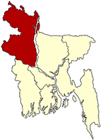
Joypurhat District Naogaon District Atrai · Badalgachhi · Dhamoirhat · Manda · Mahadevpur · Naogaon · Niamatpur · Patnitala · Porsha · Raninagar · SapapharNatore District Nawabganj District Pabna District Rajshahi District Sirajganj District Thakurgaon District Categories:- Upazilas of Bogra District
- Rajshahi Division geography stubs


Wikimedia Foundation. 2010.