- Mahadevpur Upazila
-
Mahadevpur
মহাদেবপুর— Upazila — Location in Bangladesh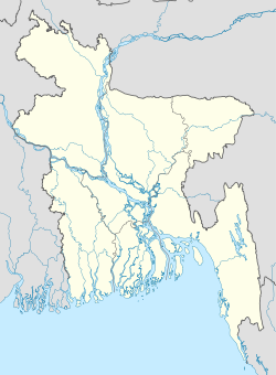
 Mahadevpur
Coordinates: 24°56′N 88°44.5′E / 24.933°N 88.7417°ECoordinates: 24°56′N 88°44.5′E / 24.933°N 88.7417°E Country  Bangladesh
Division Rajshahi Division District Naogaon District Area - Total 397.67 km2 (153.5 sq mi) Population (1991) - Total 232,359 - Density 584/km2 (1,512.6/sq mi) Time zone BST (UTC+6) Website Official Map of Mahadevpur Mahadevpur (Bengali: মহাদেবপুর) is an Upazila of Naogaon District in the Division of Rajshahi, Bangladesh.
Contents
Geography
Mahadevpur is located at 24°56′00″N 88°44′30″E / 24.9333°N 88.7417°E . It has 46642 units of house hold and total area 397.67 km² and its bounded by patnitala on the north, manda and [1] upazilas on the south, badalgachhi and Naogaon Sadar upazilas on the east and niamatpur and porsha upazilas on the west. Main rivers are atrai; Chatra and Bachnar Khari Beels are noted.
Mahadevpur (Town) consists of four mouzas. The area of the town is 7.15 sq km.
Demographics
As of the 1991 Bangladesh census, Mahadevpur has a population of 232359. Males constitute are 51.06% of the population, and females 48.94%. This Upazila's eighteen up population is 125115. Mahadevpur has an average literacy rate of 27.8% (7+ years), and the national average of 5.00% literate.[2]
Health Department
The governmental officers are; THA: Dr. Ahmed hossain Khan
Doctors; 1. Dr. Md. Mokhlecur Rahman (MO O) 2. Dr. Bivash Chandra Mani (MO) 3. Dr. Md. M.A Mannan Choudhury 4. Dr. Md. Humaun Kabir (Cardio)
Administrative
Mahadevpur thana, now an upazila, was established in 1898. It consists of 10 union parishads, 300 villages and 307 mouzas.
Government
The name of administrative officers; UNO: Upazila Chairman: The name of union Chairmans 1. MD. Abdul Mannan Chaudhury Dulal (Chairman,Mohadevpur UP) 2. (Chairman,Hatur UP) 3. (Chairman,Khajur UP) 4. (Chairman,Chandash UP) 5. (Chairman,Raigaon UP) 6. (Chairman,Enayetpur UP) 7. (Chairman,Sofapur UP) 8. (Chairman,Uttargram UP) 9. (Chairman,Charagpur UP) 10. (Chairman,Vimpur UP)
Population
It has a population of 8184; male 52.83%, female 47.17%. Literacy rate among the town people is 53.5%. Population 232359; male 51.06%, female 48.94%; Muslim 77.75%, Hindu 20.3%, others 2.22%; ethnic nationals: Santal, Munda, Oraon, Bunua.
Religious
Religious institutions Mosque 358, temple 13, sacred place 2.
Literacy
Literacy rate and educational institutions Average literacy 27.4%; male 35.4% and female 19.8%. Educational institutions: college 5, high school 39, government primary school 84, non-government high school 41, madrasa 21. Notable institutions: Mahadevpur Sharbomangal High School (1895), Bachra Primary School (1900), Jigatala Minor School (1923), Sarshati High School (1940),Jahangirpur Model High School (1985). Colleges: Jahangirpur Govt. College (1967), Jahangirpur Balika Biddalaya & College (1974), Chandash Degree College (1994), Arif Memorial College (2001).
Main occupations & Land
Main occupations Agriculture 52.24%, agricultural labourer 29.99%, commerce 7.26%, wage labourer 1.49%, service 2.2%, others 6.82%. Land use Agricultural land 30386 hectares; fallow land 375 hectares. Single crop 25%, double crop 41% and treble crop land 34%. Land under irrigation 83%. Land control Among the peasants 20% are rich, 24% medium, 30% marginal, 26% landless. Value of land Market value of land of first grade is Tk 6000 per 0.01 hectare.
Cultural organizations
Cultural organizations Public library 1, rural club 15, theater group 1, cinema hall 3, woman's association 1, jatra party 1, women welfare association 1 and playground 30,Tour organization 1.Notable only one tour organization is We are fearless. ==
See also
References
- ^ naogaon sadar
- ^ "Population Census Wing, BBS.". Archived from the original on 2005-03-27. http://web.archive.org/web/20050327072826/http://www.bangladeshgov.org/mop/ndb/arpc91_v1/tables04.htm. Retrieved November 10, 2006.
 Upazilas of the Rajshahi Division
Capital: Rajshahi Bogra District Adamdighi · Bogra · Dhunat · Dupchanchia · Gabtali · Kahaloo · Nandigram · Sariakandi · Sahajanpur · Sherpur · Shibganj · Sonatala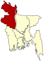
Joypurhat District Naogaon District Atrai · Badalgachhi · Dhamoirhat · Manda · Mahadevpur · Naogaon · Niamatpur · Patnitala · Porsha · Raninagar · SapapharNatore District Nawabganj District Pabna District Rajshahi District Sirajganj District Thakurgaon District Categories:- Upazilas of Naogaon District


Wikimedia Foundation. 2010.