Milnrow Urban District

Milnrow Urban District
Geography
Status Urban district
1911 area 5,194 acres (21.02 km2)
1961 area 5,195 acres (21.02 km2)
HQ Milnrow Town Hall
History
Created 1894
Abolished 1974
Succeeded by Metropolitan Borough of Rochdale
Demography
1911 population 8,584
1971 population 10,345
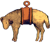
Banded fleece of Milnrow.png

Milnrow Urban District was, from 1894 to 1974, a local government district of the administrative county of Lancashire, in northwest England. It covered an area to the east and southeast of the County Borough of Rochdale, and included the town of Milnrow, the village of New Hey, and the Piethorne Valley; Crompton Urban District lay to the south.

Milnrow Urban District was created by the Local Government Act 1894, and was for the mostpart the successor to the township of Butterworth. In 1974, Milnrow Urban District was abolished by the Local Government Act 1972 and its former area transferred to Greater Manchester to form part of the Metropolitan Borough of Rochdale.

References

A vision of Milnrow UD, visionofbritain.org.uk. URL accessed January 4, 2007.

Coordinates: 53°37′N 2°07′W / 53.61°N 2.11°W / 53.61; -2.11


Wikimedia Foundation. 2010.

Игры ⚽ Нужна курсовая?

Look at other dictionaries:

  • Milnrow — Coordinates: 53°36′36″N 2°06′40″W / 53.6101°N 2.1111°W / 53.6101; 2.1111 …   Wikipedia

  • Civil parishes in Greater Manchester — A map of Greater Manchester, with its 15 parished areas highlighted in red. A civil parish is a subnational entity, forming the lowest unit of local government in England. There are 15 civil parishes in the ceremonial county of Greater Manchester …   Wikipedia

  • Newhey — Coordinates: 53°36′00″N 2°05′54″W / 53.6001°N 2.0982°W / 53.6001; 2.0982 …   Wikipedia

  • County Borough of Rochdale — Not to be confused with Metropolitan Borough of Rochdale. Rochdale Motto: Crede Signo (Believe in this sign) Rochdale Town Hall …   Wikipedia

  • Metropolitan Borough of Rochdale —   Metropolitan borough   Municipal Offices, Rochdale …   Wikipedia

  • List of pre-nationalisation UK electric power companies — The electrical power industry in the United Kingdom was nationalised by the Electricity Act 1947, when over 600 electric power companies were merged into twelve Area Boards.List of companiesCompanies merged into East Midlands Electricity Board… …   Wikipedia

  • Butterworth (ancient township) — infobox historic subdivision Name= Butterworth HQ= Status= Township (? 1894) Civil Parish (1866 1894) Start= End= 1894 Replace= Milnrow Urban District, Littleborough Urban District, Wardle Urban District, County Borough of Rochdale AreaFirst=… …   Wikipedia

  • Wardle, Greater Manchester — infobox UK place country = England latitude= 53.6478 longitude= 2.1323 official name= Wardle population= 7,092 metropolitan borough= Rochdale metropolitan county= Greater Manchester region= North West England constituency westminster= Rochdale… …   Wikipedia

  • Rochdale — infobox UK place country = England map type= Greater Manchester latitude= 53.6136 longitude= 2.1610 official name= Rochdale population = 95,796 (2001 Census) metropolitan borough= Rochdale region= North West England metropolitan county= Greater… …   Wikipedia

  • Local Government Act 1958 — The Local Government Act 1958 (6 7 Eliz.2 c.55) was an Act of the Parliament of the United Kingdom affecting local government in England and Wales outside London. Among its provisions it included the establishment of Local Government Commissions… …   Wikipedia

Share the article and excerpts

Direct link
Do a right-click on the link above
and select “Copy Link”