- Highway 60 (Israel)
-
Highway 60 (Hebrew: כביש 60, "Kvish Shishim") is a north-south intercity road in Israel and the West Bank that stretches from Beersheba to Nazareth.[citation needed]
Contents
Route
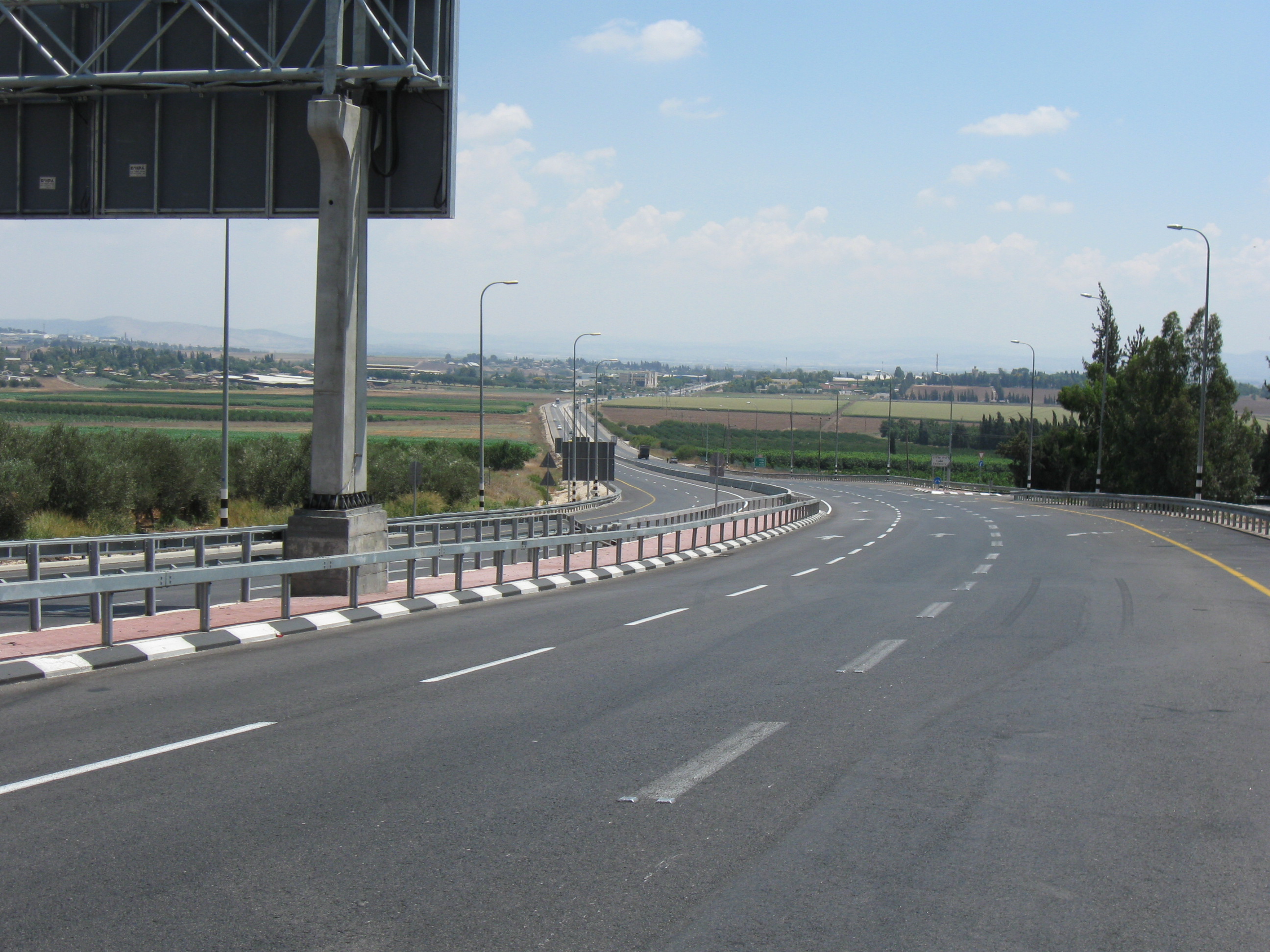
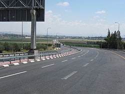 Route 60 south of Afula
The route is also known as the "Route of the Patriarchs" (Hebrew: דרך האבות) since it follows the path of the ancient highway that runs along the length of the central watershed, and which prominently figures into the travels of the Biblical patriarchs.
From its junction with Route 40 in Beersheba to the city's outskirts, Route 60 is a dual carriageway with at-grade intersections. While it continues on to serve as the main north-south artery between Israeli settlements and Palestinian communities such as the cities of Hebron and Bethlehem in the southern West Bank, it is a two-lane, shoulderless road until past Hebron at Gush Etzion Junction, where it regains its lane-separation until short of Bethlehem, that section having recently been widened. Upon entering Jerusalem, its lanes are again mostly separated as it serves as a central artery in the city center. In the northern quarters it becomes a separate grade freeway with multiple interchanges, from where it continues through the central and northern West Bank as a two-lane road, not being divided again until the stretch between Afula and its terminus in downtown Nazareth.[1]
Due to it running through a mainly rural setting, many of the junctions along its route feature hitchhiking posts called trempiadas.
Highway 60 in Jerusalem
Within Jerusalem, Highway 60, known by the municipality as the Talpiot–Atarot route and often referred to by its official Jerusalem Municipality designation, "Road 1" (not to be confused with National Highway 1), is the central north-south artery running through the city centre. The Jerusalem portion of the road begins at the separation wall at the Bethlehem checkpoint, then runs north past Beit Safafa and Gilo, and on through Talpiot. This section, known as "Hebron Road" (Hebrew: דרך חברון), is divided with multiple lanes and has undergone recent construction to include dedicated bus lanes and infrastructure for its eventual conversion into a line of the Jerusalem Light Rail.
At its junction with 'David Remez Street'. in the Abu Tor neighborhood, Route 60 narrows and descends into the Hinnom Valley, curving around Sultan's Pool directly under Mount Zion. It then ascends as 'Hativat Yerushalayim Street' to intersect with the Jaffa Gate entrance to the Old City of Jerusalem.
 Road 60 crossing Street of the Prophets; the Dome of the Rock can be seen in the far right background.
From there it runs underneath the Jaffa Gate Square, briefly overlaps Jaffa Road and then it enters a tunnel passing underneath Jerusalem's New Gate. It emerges just west of the Damascus Gate intersecting with Street of the Prophets, again becoming a divided street. This section of the road includes tracks for the now completed Jerusalem Light Rail's 'red line'.
Briefly called Heil HaHandassa Boulevard and then 'Haim Bar-Lev Boulevard', it continues northward passing Meah Shearim, the American Colony, and French Hill, until Meinertzhagen junction, where it becomes a separate grade freeway. As a freeway, it interchanges with Highway 1 at Sha'ar Mizrah. The freeway then bypasses Shuafat with one of the longest and highest bridges in the country, feeding into Beit Hanina and Pisgat Ze'ev with two more interchanges. It continues as an at-grade road intersecting with 'Neve Yaakov Blvd' and finally exits the city near Kalandia.
Bypass roads
Before the Oslo Accords, Palestinians lived under Israeli authority and could travel freely on the road. After the Palestinian Authority assumed control over various cities, Israel established checkpoints on areas of the route which entered Palestinian jurisdiction. New routes of highway were paved so that Israeli traffic could bypass the Palestinian towns in order to reduce friction. These so-called 'bypass roads,' while a contentious issue in their own right due to the varying levels of limitation on Palestinian access, also served as an improvement to the road which allowed traffic to flow around, rather than through the heart of congested urban areas.
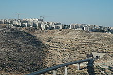 Tunnel and bridge to Gush Etzion below Gilo
One of the more sophisticated segments is the stretch known as the "Tunnels Highway." Designed by a French firm[specify], the route, which leads from southern Jerusalem to the Gush Etzion area, bypasses Bethlehem to the northwest using a pair of tunnels. The northern tunnel, called the Gilo tunnel because it is adjacent to the settlement of Gilo, is 270 metres long. The second tunnel, called the Refaim tunnel based on the nearby Refaim Valley and passing under Har Gilo and Beit Jala, is 900 m long, making it the longest road tunnel in the West Bank. The tunnels are linked by the West Bank's highest and longest bridge, crossing the Walaja Valley.[citation needed]
Arab-Israeli conflict
Route 60 was a central scene of violence during the al-Aqsa Intifada, which was in part defined by the thousands of shooting attacks on its Israeli traffic, including hundreds of casualties.[citation needed] The Israeli Army, in response, has fortified various sections with anti-sniper walls and had established checkpoints along the route.[citation needed] The Tunnels Highway came under particularly heavy assault during the shooting on Gilo neighborhood since it lies between Gilo and Beit Jala. The concrete barriers employed on other dangerous stretches of road were too heavy to be supported by the bridge, and so a barrier of bulletproof composite armour similar to that employed on Merkava tanks was constructed.[citation needed]
The road was also the site of terrorist attacks in June[citation needed] and August 2010.[2][3]
Junctions
km Location Name Type Meaning Road(s) Crossed ↓Beersheba Municipal Boundary↓ Hebron Road 0 Beersheba 


David Hacham Blvd.0.3 Industrial Zone Nordau St., Rothschild Blvd. 0.4 Industrial Zone 
Dekel St. 0.4 Industrail Zone HaNagarim St. 0.7 Industrial Zone HaTahana St. 0.8 Industrial Zone HaNagarim St. 0.9 Industrial Zone Shazar Blvd. 1 Industrial Zone Pinhas HaHotzev St. 1.2 Industrial Zone Yosef HaBurska'i St. 1.5 Shopping District
Industrial ZoneHeil HaHandasa St.
Yitzhak Nafaha St.2.4 Industrial Zone Saadia Malal Blvd. 2.4 Industrial Zone David Ben Gurion Blvd. 2.6 Machteshim Industrial Zone Avraham Ben Ami St. 3.5 Beersheba צומת חטיבת הנגב
(Hativat HaNegev Junction)Negev Brigade Ben Tzion Carmel Blvd.
to Route 40 south
↑Beersheba Municipal Boundary↑ 4.3 Omer, Tel as-Sabi צומת תל שבע
(Tel Sheva Junction)
'Seven' or 'Oath' Tel Sheva Rd.
to Route 40 north5.7 Omer Tamar St. 5.9 Omer Industrial Park Omrim St. 7.3 Omer 
Tapuah St. 9.9 Tarabin al-Sane'/Umra,
Umm Batinlocal road 11 Abu Sabit, al-Sayyid local road 13.1 צומת שוקת
(Shoket Junction)Water Trough  route 31 East
13.2 צומת שוקת
(Shoket Junction) route 31 West14.5 Carmit (city under construction) local road 15.7 Meitar מחלף מיתר
(Meitar interchange)
Cord Hebron Blvd. 16.2 Kibbitz Kramim צומת כרמים
(Kramim Junction)Vineyards local road 17.6 צומת סנסנה
(Sansana Junction)(Biblical) Palm Tree local road to
Sansana18.5 Green Line 18.5 Green Line,
Meitar Terminal[4]entrance to
passenger terminal and
cargo transfer station18.6 Meitar Security Checkpoint  ↑NO southbound through-traffic for green (Palestinian Authority) license plates↑
18.7 Green Line, Meitar Terminal 
route 6002 to
Teneh Omarim, ad-Dhahiriya,
Meitar TerminalDhahiriya Bypass 27 Meitarim Industrial Park צומת שמעה
(Shim'a Junction)named after
minor biblical figure route 317
27.1 Shim'a (Yonadav) local road 28 Mitzpe Eshtemoa local road 31.9 as-Simya, as-Samu' route 3178 35.4 Otniel local road 35.3 Otniel, Karma צומת עתניאל
(Otniel Junction)named after
biblical judgelocal road Otniel-Hagai Road 33.9 Karma local road 37 Deir Razih local road 37.9 Tarrama route 3265 38.8 al-Hijra,
Hadab al-Fawwar, al-Fawwarroute 3266 41.2 South Hebron local road Hebron Bypass 41.4 Beit Hagai local road 45.7 South Hebron local road
entrance to Industrial Park47.7  route 356 to Zif
49.1 Bani Naim local road 50.9 Kiryat Arba local road
open during some Jewish festivals
for overflow traffic52.2 Kiryat Arba Views of Mamre St. 55 Beit Einun local road 55.9 Hebron, Halhul צומת העוקפים
(HaOkfim Junction)the bypasses 
Highway 35Halhul bypass 59.2 Halhul, Sa'ir route 3517 62.6 Halhul local road Halhul-Arrub Road 62.8 Karmei Tzur local road 64.9 Beit Ummar route 3527 66.8 Mu'askar al-Arrub, al-Arrub local road Gush Road 69.5 Alon Shvut,
Beit Fajjarצומת גוש עציון
(Gush Etzion Junction)Etzion Bloc route 367 70.7 Efrat צומת אפרת דרום
South Efrat Junctionroute 3157 72 Elazar local road 73.3 Neve Daniel local road 75.8 al-Khader, Efrat צומת שיירות אציון
(Shayarot Etzion Junction)Etzion Convoys local road Bethlehem Bypass 78.4 al-Khader, Husan צומת אל חאדר
(al-Khader Junction)The Green One  route 375
to Beitar Illit79.5 Beit Jala al-Amal St. ↓NO northbound through-traffic for green (Palestinian Authority) license plates↓
green license plates continue to Route 60 north via al-Khader or Beit Jala, local roads, routes 398, 417 and 43779.6 Tunnels / Patriarch's Way Security checkpoint Tunnels Road 80.6 Beit Jala מנהרת רפאים (Refaim Tunnel)
2 lanes, 900 m.
Ghosts 82.2 Beit Jala, Gilo Bridge
2 lanes, 400 m.
82.6 Gilo מנהרת גילה (Gilo Tunnel)
2 lanes, 250 m.↓Jerusalem Municipal Boundary↓ 83.3 Jerusalem
Giloצומת המנהרות
(HaMinharot Junction)Tunnels HaRosmarin St HaRosmarin St 83.5 Beit Safafa, Tantur A-Safa St., entrance to Tantur Hebron Road 83.6 Beit Safafa, Tantur צומת טנטור
(Tantur Junction)Hilltop Hebron Road
south to Bethlehem83.7 Mar Elias Monastery local road 84.7 Har Homa  route 398
Shmuel Meir Blvd.84.9 Givat HaMatos, Beit Safafa local road 84.9 Green Line 85.2 Talpiot Derech Beit Lehem 85.5 Talpiot HaUman St, Asher Wiener St. 86.2 Talpiot HaTnufa St. 86.4 Talpiot Dostrovsky St. 86.7 Talpiot כיכר יצחק לוי (Yitzhak Levi Square)
צומת הבנקים (Banks Junction)Rivka St., Ein Gedi St. 87 Baka, Talpiot Yehuda St., Daniel Yanovsky St. 87.3 Baka Queen Esther St. 87.6 Baka Miriam HaHashmonait St. 87.7 Talpiot כיכר בולגריה (Bulgaria Square) Hanoch Albeck St. 87.8 Abu Tor Naomi St. 88 Abu Tor Gihon St. 88.2 Abu Tor Aminadav St. 88.4 Abu Tor כיכר יוסף נבון
(Yosef Navon Square)David Remez St., HaMefaked St. 89 Old City Ma'ale HaShalom St. Hativat Yerushalayim Street 89.4 Old City, Jaffa Gate Omar ibn il-Khatab St 89.5 Old City, Jaffa Gate כיכר שער יפו
(Jaffa Gate Square)Yitzhak Kariv St. 89.9 Old City, New Gate מנהרת הצנחנים (HaTzanhanim Tunnel)
2 lanes, 500m.Paratroopers local road Heil HaHandasa Street 90.6 Musrara, Mas'udiyya HaNevi'im St.
Antarah ibn Shaddad St.
Jerusalem Light Rail Station90.7 Musrara, Mas'udiyya Naomi Kis St., Ibn al-'As St.
HaHoma HaShlishit St.91 Beit Yisrael,
American Colonyכיכר פיקוד הצפון
(Central Command Square)Shmuel HaNavi St.
Saint George St.
Jerusalem Light Rail StationHaim Bar-Lev Street 91.3 Beit Yisrael,
American ColonyMoshe Zachs St.
Pierre van Paassen St.91.6 Green Line 91.7 Arzei HaBira,
Sheikh JarrahShimon HaTzadik St.
Jerusalem Light Rail Station92.3 Ma'alot Dafna,
Sheikh JarrahZalman Shragai St.
Clermont-Ganneau St.92.6 Givat HaMivtar,
French Hillכיכר מיינרצהאגן
(Meinertzhagen Square) route 417
Levi Eshkol Blvd.
Hebrew University Blvd.
Jerusalem Light Rail Station93.2 Giv'at HaMivtar,
French HillSheshet HaYamim Blvd
HaHagana Blvd.
Jerusalem Light Rail StationUzi Narkis Road 93.5 Shuafat,
French Hillמחלף שער מזרח
(Sha'ar Mizrah Interchange)East Gate 
Highway 195.1 Shuafat,
Pisgat ZeevYekutiel Adam Blvd. 96.1 Beit Hanina,
Pisgat ZeevHamid Shomaan St.
Sayeret Duchifat Blvd.
to route 437
97.4 Beit Hanina,
Neve Ya'akovBeit Hanina Rd.
Neve Ya'akov Blvd.Ramallah Road Beit Hanina,
Atarot14 local streets 98.9 Atarot Bir Nabala Rd. (westbound only) 99.4 Atarot Aviation Rd. 100.4 to  Highway 45
↑Jerusalem Municipal Boundary↑ ↓NO northbound through-traffic for yellow (Israeli) license plates↓
yellow license plates continue to Route 60 north via Sayeret Duchifat Blvd. and route 437100.5 Qalandia Security checkpoint ↑NO southbound through-traffic for green (Palestinian Authority) license plates↑
green license plates continue to Route 60 south via routes 437, 417, 398 and local roads, Beit Jala or al-Khader100.6 Kafr 'Aqab Ramallah Road Ramallah Bypass 101.9 Ar-Ram, Jaba' Bir Nabala Rd ↓yellow license plates rejoin Route 60 north from Route 437↓ 104.4 Geva Binyamin Highway 437,
Adam Blvd.105.1 Sha'ar Binyamin
Industrial Parklocal road 106.1 Mikhmas local road 106.2 Kokhav Ya'akov, Psagot local road 107.3 Ma'ale Mikhmas  route 457
to route 458
109.8 Migron
(ordered removed by Apr 2012)[5]local road 112.4 al-Bireh, Beit El,
Giv'at Asaf, Burqa, Beitin route 466
113.4 Deir Dibwan local road 118.1 Ofra HaMiyasdim St. 118.3 Ein Yabrud,
Yabrud, Silwad route 449
123.1 צומת עם
'Am Junction route 465
to Birzeit, Ateret124.2 Al-Mazra'a ash-Sharqiya route 4568 127.4 Sinjil route 4665 129 Sinjil local road 129.4 Turmus Ayya local road 131.3 Shilo local road Wadi ash-Sha'ir Road 135.1 Eli Elkana Rd. 135.3 Eli 14th of Elul St. 136.9 Ma'ale Levona local road 137.9 Al-Lubban ash-Sharqiya local road 140.3 Qabalan route 4777 140.1 As-Sawiya local road 142.7 Rechelim, Ariel local road 145.1 Kfar Tapuach צומת תפוח
(Tapuah Junction)Apple  Highway 505
Huwara Road 147.8 Beita local road 147.9 Huwara local streets 148.4 Huwara route 5076, local streets 148.6 Huwara local road to Odala
local streets149.3 Huwara local road to Nablus
local streetsNablus Bypass 151.2 Yitzhar, Burin local road 160.9 Sarra local road to Nablus 161.1 Jit  route 55 (west)
163.9 Kedumim Local Council,
Bar-On Industrial Parklocal road 167.2  route 557 (west)
167.9 Shavei Shomron local road  ↓Travel for yellow (Israeli) license plates between Shomron Junction and Dotan Junction permitted, IDF escort recommended↓
169.9 Deir Sharaf צומת שומרון
(Shomron Junction)Samaria local road 169.8 An-Naqura local road 171 Sebastia route 5715 171.7 Sebastia local road 177.1 Burqa local road 178.4 Bazariya local road 179.1 Homesh (evacuated) local road180.3 Silat ad-Dhahr local streets 182.5 Fandaqumiya local streets 183.9 Jaba local road 184 Jaba route 5725 to
Sanur, Meithalun184.8 Sa-Nur (evacuated) local road186 Ajjah local road 187.5 Anzah local road 189.6 Zawiya local road 191.5 local road 194.2 Mirka צומת דותן
(Dotan Junction)named after
ancient city route 585
 route 588 ↑Travel for yellow (Israeli) license plates between Dotan Junction and Shomron Junction permitted, IDF escort recommended↑ ↓NO northbound through-traffic for yellow (Israeli) license plates↓
Route 588[6] 194.5 Tel Dothan local road 195.2 Bir al-Basha 6 local streets ↓Palestinian Authority Area A↓ 199.7 Ash-Shuhada, Qabatiya צומת קבאטיה
(Qabatiya Junction)
local road 203.2 Jenin 22 local streets 207.2 Dahiyat Sabah al-Kheir 11 local streets ↑Palestinian Authority Area A↑ Jalamah Road[6] 209.8 Jalamah route 6010 South
to Zababdeh, Wadi ad-Dabi'
Kadim (evacuated)
Ganim (evacuated)210.2 Jalamah 6 local streets 211.2 Green Line, Jalamah Terminal[7] entrance to
passenger terminal and
cargo transfer stationGreen Line ↓NO northbound through-traffic for green (Palestinian Authority) license plates↓211.4 Jalamah Security checkpoint ↑NO southbound through-traffic for yellow (Israeli) license plates↑211.8 Green Line, Jalamah Terminal,
Muqeibleentrance to
passenger terminal and
cargo transfer station
local road to Muqeible212.7 Magen Shaul local road 212.9 Sandala 2 local roads 214.3 Gan Ner local road 216 Prazon local road 217.2 Yizre'el, Avital צומת יזרעאל
(Yizre'el Junction)God Sows  route 675
↓Afula Municipal Boundary↓ Jerusalem Boulevard 223.1 Afula צומת אפולה דרום מזרח
(Afula Drom Mizrah Junction)South-East Afula Menachem Begin Blvd. 223.3 Afula Gilboa St. 223.6 Afula Yehoshua Hankin St. 223.8 Afula Ussishkin St. 223.9 Afula Kehilat Tzion Blvd. Yosef Sprinzak Boulevard 224 Afula HaNasi Weizmann Blvd.
Afula Central Bus StationHaNasi Weizmann Boulevard 224.1 Afula Jerusalem Blvd. 224.3 Afula כיכר העצמאות
(HaAtzma'ut Square)Independence Arlozorov St. 224.5 Afula כיכר פז
(Paz Square)Moshe Sharett St.
Holland St., Zalman Hod St.Hativat Teisha' Boulevard 224.6 Afula Zalman Shazar St. 224.7 Afula Rimon St. 224.8 Afula Hadasim St., Einstein Blvd. 224.9 Afula Etrog St. 225 Afula Tzaftzefot St., HaAvoda St. 225.2 Afula צומת מכבי אש
(Mikabei Esh Junction)Firefighters  route 65 East
Hadarim St., HaHistadrut Blvd.225.4 Afula Yukler B'Emek Shopping Center 226.2 Afula route 65 West↑Afula Municipal Boundary↑ 226.9 Balfouria local road 228.7 Kfar Gid'on local road 229.2 Jezreel Valley Regional Council,
Mizra, Emek Yezreel Collegelocal road 230 Tel Adashim local road 230.2 Tel Adashim צומת עדשים
(Adashim Junction)Lentils  route 73
↓Nazareth Municipal Boundary↓ 232.2 Nazareth מחלף איכסאל
(Iksal Interchange)Chores Marj Ibn Amer Rd. 232.6 Har HaKfitza (Mount Precipice) Eitan Bridge
4 lanes, 400m.
233 Har HaKfitza (Mount Precipice) Yitzhak Herskovitz Tunnels
4 lanes, 380m.234.6 Nazareth Wadi el-Hadj St. 235.1 Nazareth צומת המוסכים
(HaMusachim Junction)Auto Repair Shops  route 75 (road 3001)
HaZtionut Blvd.
Tawfiq Ziad St.References & Notes
- ^ Eretz Binyamin: Leave politics behind - Israel Travel, Ynetnews
- ^ On the eve of the summit meeting in Washington to relaunch the direct Israeli-Palestinian negotiations, a shooting attack was carried out targeting an Israeli vehicle southeast of Hebron. Four Israeli civilians were killed. Hamas' military wing claimed responsibility; the Palestinian Authority condemned the attack, September 1, 2010, Meir Amit Intelligence and Terrorism Information Center.
- ^ "4 Israelis shot dead in West Bank," Janine Zacharia and Samuel Sockol, September 1, 2010, Washington Post.
- ^ "Crossing Points Procedures". Palestinian Trade Facilitation Portal. http://www.ptfp.ps/etemplate.php?id=115. Retrieved 2011-08-09.
- ^ Chaim Levinson (2011-08-02). "Israel's Supreme Court orders state to dismantle largest West Bank outpost". Haaretz. http://www.haaretz.com/news/diplomacy-defense/israel-s-supreme-court-orders-state-to-dismantle-largest-west-bank-outpost-1.376583. Retrieved 2011-08-06.
- ^ a b At the time of its designation Highway 60 was a consecutive highway, running from Beersheba to Nazareth. With the outbreak of the Al-Aqsa Intifada an IDF decree forbade Israelis from traveling on the Tel Dotan-Jenin-Jalamah section, effectively splitting Highway 60. Final designation of the highway is dependent on the final status agreement between Israel and the Palestinians.
- ^ "Crossing Points Procedures - Jalameh Terminal". Palestinian Trade Facilitation Portal. http://www.ptfp.ps/etemplate.php?id=2301. Retrieved 2011-08-09.
See also
Transportation in Israel Roads Routes
Bus Afikim · Dan · Egged · Egged Ta'avura · Illit · Kavim · Metrodan Beersheba · Metropoline · Nateev Express · Superbus · ConnexRailways Rail transport in Israel · Israel RailwaysRapid transit Ports Aviation Ben Gurion International Airport · El Al · Israir · Arkia · Sun D'Or · CAL Cargo Air Lines · Israel Airports AuthorityCable cars Haifa cable cars · Masada cablewayBy city Smart Cards Rav-KavBar Ilan · Yehuda Burla · Ben Yehuda Street · Beit Hadfus Street · Bezalel Street · Hebron Road · Ruppin Boulevard · Ein Kerem Street · Emek Refaim · Ethiopia Street · Gaza Street · Pierre Koenig Street · HaPalmach · Herzog Street · Hativat Harel · Hativat Yerushalayim · Hatzanhanim · Heil Hahandasa · Hillel Street · Jaffa Road · Jabotinsky Street · Kanfei Nesharim Street · King George Street (Jerusalem) · Kovshei Katamon · Ma'ale HaShalom · Malchei Israel · Mea She'arim · Nablus Road · Ben Zakai Street · Sderot Ben Zvi · Sderot Golda Meir · Sderot Menachem Begin · Sderot Barlev · Herzl Boulevard · Levi Eshkol Boulevard · Shai Agnon Boulevard · Shazar Boulevard · Shivtei Israel · Shmuel HaNavi · Street of the Prophets · Strauss Street · Yaakov Pat · Yehezkel ·
YirmiyahuCategories:


Wikimedia Foundation. 2010.