Čremošné

Čremošné
Čremošné
Village
Country Slovakia
Region Žilina
District Turčianske Teplice
Coordinates 48°51′N 18°54′E / 48.85°N 18.9°E / 48.85; 18.9
Area 16.175 km2 (6.245 sq mi)
Population 87 (2004-12-31)
Density 5 / km2 (13 / sq mi)
First mentioned 1340
Postal code 039 01
Car plate TR
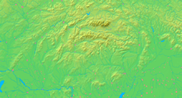
Location of Čremošné in Slovakia
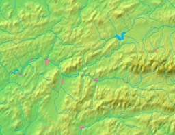
Location of Čremošné in the Žilina Region
Statistics: MOŠ/MIS

Čremošné is a village and municipality in Turčianske Teplice District in the Žilina Region of northern central Slovakia.

History

In historical records the village was first mentioned in 1340.

Geography

The municipality lies at an altitude of 650 metres and covers an area of 16.175km². It has a population of about 87 people.


Wikimedia Foundation. 2010.

Игры ⚽ Нужно сделать НИР?

Look at other dictionaries:

  • Čremošné — Wappen Karte …   Deutsch Wikipedia

  • Čremošné — (Village) Administration Pays  Slovaquie …   Wikipédia en Français

  • Čremošné-Tunnel — Offizieller Name Čremošniansky tunel Nutzung Eisenbahntunnel Verkehrsverbindung Bahnstrecke Banská Bystrica–Dolná Štubňa Länge 4.697 m Anzahl der Röhren …   Deutsch Wikipedia

  • Chata Čremošné — (Čremošné,Словакия) Категория отеля: Адрес: Cremosne 82, 03901 Čremošné, Словакия …   Каталог отелей

  • Bahnstrecke Zvolen-Vrútky — Zvolen–Vrútky Kursbuchstrecke (ZSSK): 170 Streckenlänge: 74,98 km Spurweite: 1435 mm (Normalspur) …   Deutsch Wikipedia

  • Bahnstrecke Zvolen–Vrútky — Zvolen–Vrútky Kursbuchstrecke (ZSSK): 170 Streckenlänge: 74,98 km Spurweite: 1435 mm (Normalspur) …   Deutsch Wikipedia

  • Kursbuchstrecke 170 (Slowakei) Zvolen–Vrútky — Zvolen–Vrútky Kursbuchstrecke (ZSSK): 170 Streckenlänge: 74,98 km Spurweite: 1435 mm (Normalspur) …   Deutsch Wikipedia

  • Bahnstrecke Banská Bystrica–Dolná Štubňa — Banská Bystrica–odbočka Dolná Štubňa Kursbuchstrecke (ZSSK): 170 Streckenlänge: 40,670 km Spurweite: 1435 mm (Normalspur) Legende …   Deutsch Wikipedia

  • Turčianske Teplice District — Geobox | Region name = Turčianske Teplice other name = category = District image caption = The Turiec Basin from Drieňok Mountain symbol = etymology = official name = motto = nickname = country = Slovakia country state = region = Žilina district …   Wikipedia

  • District de Turčianske Teplice — Turčianske Teplice Informations Pays …   Wikipédia en Français

Share the article and excerpts

Direct link
Do a right-click on the link above
and select “Copy Link”