- Turčianske Teplice
Geobox | Settlement
name = Turčianske Teplice
category = Town
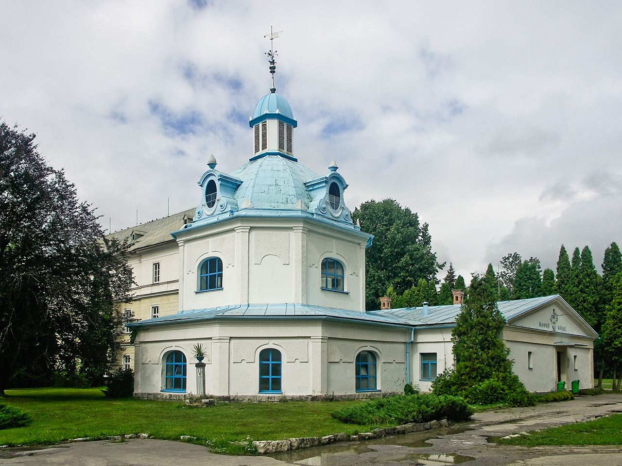
image_caption = Entrance to the spa in Turčianske Teplice
.png)
symbol = Turcianske Teplice COA.gif
symbol_type = Coat of arms
etymology =
official_name =
motto =
nickname =
country = Slovakia
country_
state =
region = Žilina
district = Turčianske Teplice
commune =
municipality =
part = Diviaky
part_fold = 1
part1 = Dolná Štubňa
part2 = Turčianský Michal
part3 = Turčianské Teplice
river = Turiec
location =
elevation = 495
lat_d = 48
lat_m = 51
lat_s = 32
lat_NS = N
long_d = 18
long_m = 51
long_s = 49
long_EW = E
coordinates_type = region:SK_type:city
highest =
highest_elevation =
highest_lat_d =
highest_long_d =
lowest =
lowest_elevation =
lowest_lat_d =
lowest_long_d =
area = 33.483
area_round = 3
population = 6941
population_date = 2005-12-31
population_density = auto
established = 1281
established_type = First mentioned
mayor = Michal Sygut
mayor_party =
timezone =
map_background = Slovakia - background map.png
map_locator = Slovakia
map1 = Žilina Region - outline map.svg
map1_size = 224
map1_background = Žilina Region - background map.png
map1_locator = Žilina Region
commons = Turčianske Teplice
statistics = [http://www.statistics.sk/mosmis/eng/prvav2.jsp?txtUroven430509&lstObec512729&Okruhzaklad MOŠ/MIS]
website = [http://eng.turciansketeplice.sk eng.turciansketeplice.sk]
footnotes =Turčianske Teplice ( _de. Bad Stuben; _hu. Stubnyafürdő) is a
town in centralSlovakia in theŽilina Region . It is about halfway between Martin andKremnica . As of2005 the town's population was 6,941. The town was the historic center of the Upper Turiec subregion within theTuriec region (comitatus), and now enjoys the status of a capital of theTurčianske Teplice District .History
The town is one of the oldest
spa town s inEurope , and was originally known as "Štubnianske Teplice". It was first mentioned in text dating from1281 when KingLadislaus IV of Hungary granted the lands surrounding the springs to a Count Peter. The spa became popular with royalty, including King Sigismund of Hungary and EmperorMaximilian I of Mexico . The recuperative abilities of the spa were first studied by the University of Halle medical student Jan Lisschoviny.Štubnianske Teplice was renamed Turčianske Teplice in
1946 . In1951 the town merged with the community of Vieska.Geography
Turčianske Teplice lies at an altitude of convert|520|m|ft|0 above sea level and covers an area of convert|33.483|km2|sqmi|1|lk=on. It lies in the Turiec Basin and is surrounded in proximity by the
Greater Fatra , Kremnica, Žiar andLesser Fatra mountain ranges.The divisions of the town include:
* Diviaky (1951 -1955 and1971 )
* Dolná Štubňa (incorporated in 1971)
* Turčiansky Michal (incorporated in 1971)
* Turčianske TepliceDemographics
According to the 2001
census , the town had 7,031 inhabitants. 97.98% of inhabitants wereSlovaks , 0.67% Czech and 0.37%Germans .cite web | title = Municipal Statistics | publisher = Statistical Office of the Slovak republic | url = http://www.statistics.sk/mosmis/eng/run.html | accessdate = 2008-01-31] The religious make-up was 48.09%Roman Catholics , 30.56%Lutherans , and 17.24% people with no religious affiliation.People
One of the famous personalities born in Turčianske Teplice is
Mikuláš Galanda , a modern painter,graphic designer andillustrator .References
External links
* [http://eng.turciansketeplice.sk Town website]
* [http://www.turcslk.sk Spa website]
.svg)


Wikimedia Foundation. 2010.