- Mosman Park, Western Australia
-
This article is about a suburb of Perth, Western Australia. For the local government area, see Town of Mosman Park.
Mosman Park
Perth, Western Australia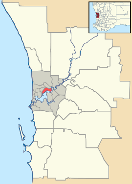
 Mosman Park
Population: 8,251 (2006 census)[1] Established: 1890s Postcode: 6012 Area: 4.3 km² (1.7 sq mi) Location: 14 km (9 mi) SW of Perth LGA: Town of Mosman Park State District: Cottesloe Federal Division: Curtin Suburbs around Mosman Park: Cottesloe Peppermint Grove Swan River Cottesloe Mosman Park Swan River North Fremantle East Fremantle Bicton Coordinates: 32°00′58″S 115°45′43″E / 32.016°S 115.762°E
Mosman Park is a western suburb of Perth, Western Australia on the north bank of the Swan River. Its Local Government Area is the Town of Mosman Park. "Mosman" is pronounced with an "z" (/z/), unlike the Sydney suburb of Mosman, which is pronounced with an "s" (/s/).
Contents
Geography
Mosman Park is bounded by the Indian Ocean and the Fremantle railway line to the west, a line south of Johnston Street to the north, and the Swan River to the east and south. Today, almost all of Mosman Park is residential, although significant parklands exist at Buckland Hill and along the river and coast.[2]
At the ABS 2001 census, Mosman Park had a population of 7,260 people living in 3,750 dwellings, about half of which were detached houses on separate lots. Several mansions are located within the suburb. The ABS identified property, business services and health as the main occupations.
Transport
Mosman Park is served by the Mosman Park and Victoria Street train stations. Various buses, including the CircleRoute, travel along Stirling Highway and through Mosman Park's eastern section.
Politics
Mosman Park is part of the federal division of Curtin. The federal seat is held by the conservative Liberal Party. It is regarded as a safe seat as it has been continually retained by the Liberal Party with the exception of former Liberal member Allan Rocher as an Independent politician between 1996 and 1998. For the parliament of Western Australia, the state electoral district of Cottesloe is also held by the Liberal Party.
See also
References
- ^ Australian Bureau of Statistics (25 October 2007). "Mosman Park (State Suburb)". 2006 Census QuickStats. http://www.censusdata.abs.gov.au/ABSNavigation/prenav/LocationSearch?collection=Census&period=2006&areacode=SSC51966&producttype=QuickStats&breadcrumb=PL&action=401. Retrieved 2008-10-05.
- ^ 2006 StreetSmart directory, Department of Lands and Surveys, Perth.
External links
Western suburbs of Perth, Western Australia City Beach · Claremont · Cottesloe · Crawley · Daglish · Dalkeith · Floreat · Jolimont · Karrakatta · Mosman Park · Mount Claremont · Nedlands · Peppermint Grove · Shenton Park · Subiaco · Swanbourne · Wembley · Wembley Downs · West Leederville
Categories:- Suburbs of Perth, Western Australia
- Perth, Western Australia geography stubs

Wikimedia Foundation. 2010.