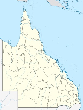
- Dimbulah, Queensland
-
Dimbulah
QueenslandPopulation: 381 (2006 Census)[1] Established: 1876 Postcode: 4872 Elevation: 407 m (1,335 ft) LGA: Tablelands Regional Council State District: Dalrymple Federal Division: Kennedy Mean max temp Mean min temp Annual rainfall 35 °C
95 °F10.5 °C
51 °F783.2 mm
30.8 inDimbulah is a town located in Far North Queensland, Australia, 114 kilometres from Cairns by road, on the Atherton Tableland. The town was established in 1876 to service the Tyrconnell Gold Mine, one of the richest mines on the Hodgkinson Gold Fields. The name "Dimbulah" is thought to have come from the local Indigenous Australian word for "long waterhole", referring to the Walsh River that runs nearby the town. At the 2006 census, Dimbulah had a population of 381.[1]
The area around Dimbulah was originally home to the Djankun and Kuku Djungan tribe. During the 1920s the Queensland government forcibly removed most of their children, forcing the tribe to scatter.
In the early 1900s the area received an influx of Italian migrants and in 1928 tobacco was introduced, becoming the area's major industry soon after. At its peak, there were 800 growers in the area, producing over 8,000 tonnes (60% of national yield) of tobacco a year.
Tobacco remained the dominant crop until recent years when government policy compelled its demise. Recent attempts at alternative crops such as tea trees, mangoes, sugar cane, coffee, lemons, limes, avocados, papaws, papayas, peanuts, soya beans, lychees, and cash crops (pumpkins, melons, etc.) have met with mixed success.
Local residents enjoy a tropical climate with hot, wet summers and dry, mild winters. There are many sporting clubs including swimming, tennis, horse and pony, lawn bowls, Rhee Taekwon-Do, and soccer. At the time of writing[when?], the town's retail facilities include a bank, post office, chemist, cafe, therapeutic massage, real estate, opp shop, butcher, two salons, clothing store, hardware store, community bank, grocery store, convenience store and petrol station. Community groups include the Dimbulah Community Centre, Lions Club, QCWA, chamber of commerce, museum association,Library, Friulani, Trevisani, and several faith-based groups.
Education
- Dimbulah Limited Hours Child Care, Age range 15 months - 5 years
- Dimbulah Kindergarten, Age range 3–5 years
- Dimbulah P-10 State School (founded September 1914), Age range 5–15 years
- St Anthony's Parish School (Catholic - founded January 1966) [2]
External links
- University of Queensland: Queensland Places: Dimbulah
- Dimbulah State School
- St Anthony's Parish School, Dimbulah
- Peace Art by students of St Anthony's School.
- Djankum Tribe in Tindale's Catalogue of Australian Aboriginal Tribes
References
- ^ a b Australian Bureau of Statistics (25 October 2007). "Dimbulah (L) (Urban Centre/Locality)". 2006 Census QuickStats. http://www.censusdata.abs.gov.au/ABSNavigation/prenav/LocationSearch?collection=Census&period=2006&areacode=UCL317400&producttype=QuickStats&breadcrumb=PL&action=401. Retrieved 7 May 2011.
- ^ http://www2.sta.qld.edu.au/index.php?vP=3
Atherton Tableland Schools Attractions Curtain Fig Tree | Davies Creek | Lake Tinaroo | Lake Eacham | Lake Barrine | Malanda Falls | Millaa Millaa Falls | Mount Hypipamee Crater | Mount Quincan | Seven Sisters | Windy HillTowns Local Government Areas TablelandsCoordinates: 17°08′56″S 145°06′38″E / 17.14889°S 145.11056°E
Categories:- Towns in Queensland
- Far North Queensland
- Australian Aboriginal placenames
Wikimedia Foundation. 2010.

